Enable Location

We need your location to show you interesting places around you

Discover nearby places

Find interesting locations and hidden gems around you

Precise directions

Get accurate directions and distances to places

Your location is never shared with other users. It's only used when you tap the location button.

Sandridge Park

Log in to your account

Start exploring — it's free

Trusted by 62,058 travelers worldwide

Continue with Google
Continue with Apple
or

We will send you a code to connect

By continuing, you accept our Terms and Conditions and our Privacy Policy

Check your inbox

We've sent a pincode in your inbox. Please enter the code below.

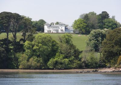
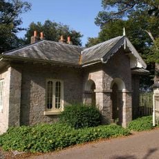
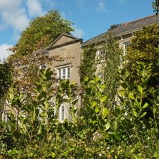
Sandridge Park, Country house in Stoke Gabriel, Great Britain.

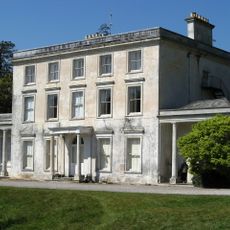
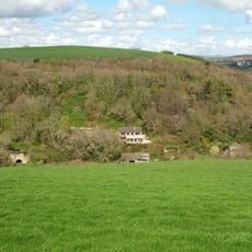
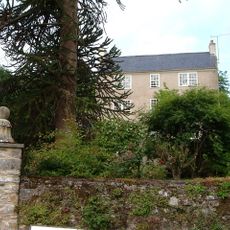
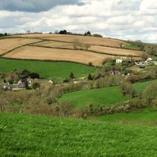
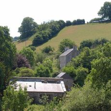
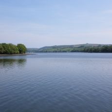
Sandridge Park is an Italianate country house situated on elevated ground at the head of the River Dart estuary, featuring stone loggias and wrought iron balconies. The mansion overlooks the river landscape and is set within grounds enhanced by pergola structures.

Celebrated architect John Nash designed this Grade II* listed building in 1805 for Elizabeth Baring, the Dowager Lady Ashburton, fulfilling her late husband's vision. The mansion represents an important moment in English country house design during the early 1800s.

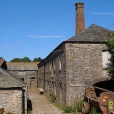
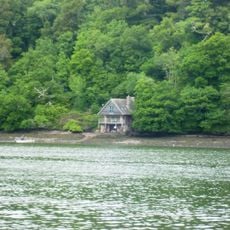
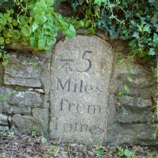
The estate holds connections to seafaring through the birthplace of Captain John Davis at nearby Sandridge Barton and the maritime traditions of the Gilbert family. Visitors can sense how the location and architecture reflect the area's naval heritage today.

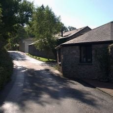
The property has undergone extensive restoration that preserved original materials and added pergola structures to the landscape. Visitors should expect uneven terrain and steps as the house sits on elevated ground surrounded by planted areas.

The mansion demonstrates the shift from William Gilpin's picturesque aesthetic to Nash's Italianate interpretation in early 19th-century England. This change in style reflects the evolving design preferences of the period.

The community of curious travelers

AroundUs brings together thousands of curated places, local tips, and hidden gems, enriched daily by 60,000 contributors worldwide.

Start exploring
Location
GPS coordinates
50.39710,-3.60540
Latest update
December 12, 2025 17:42
Around this place
Greenway
United Kingdom

Greenway

2.2 km
Church of St George
United Kingdom

Church of St George

1.4 km
Church of St Gabriel and St Mary
United Kingdom

Church of St Gabriel and St Mary

1.3 km
The Ferry Boat Inn
United Kingdom

The Ferry Boat Inn

1.8 km
Pords Bridge
United Kingdom

Pords Bridge

1.1 km
Smugglers Cottage
United Kingdom

Smugglers Cottage

1.9 km
Sage Cottage  The Hays
United Kingdom

Sage Cottage The Hays

1.7 km
Lodge, Gatepiers And Railings Approximately 330 Metres North East Of Greenway House
United Kingdom

Lodge, Gatepiers And Railings Approximately 330 Metres North East Of Greenway House

2 km
Cottage, Store And Limekiln Immediately West South West Of Dinah's Side
United Kingdom

Cottage, Store And Limekiln Immediately West South West Of Dinah's Side

1.3 km
Lodge Cottage
United Kingdom

Lodge Cottage

1.4 km
Waddeton Boat House
United Kingdom

Waddeton Boat House

1.5 km
Farm Buildings Immediately East Of Greenway Farmhouse
United Kingdom

Farm Buildings Immediately East Of Greenway Farmhouse

2.2 km
Milestone At Sx 8846 5627
United Kingdom

Milestone At Sx 8846 5627

2.5 km
Ferry Cottage
United Kingdom

Ferry Cottage

1.9 km
Front Garden Boundary Walls And Gate Piers To East Of Bramble Torre House
United Kingdom

Front Garden Boundary Walls And Gate Piers To East Of Bramble Torre House

1.7 km
Snail House
United Kingdom

Snail House

1.9 km
Wayside Cottage Including Adjoining Barn To North
United Kingdom

Wayside Cottage Including Adjoining Barn To North

1.4 km
Bathhouse And Adjoining Boathouse Metres South East Of Greenway House
United Kingdom

Bathhouse And Adjoining Boathouse Metres South East Of Greenway House

2.4 km
Highclere
United Kingdom

Highclere

1.4 km
Beacon mound at Fire Beacon Hill, 250m north west of Bosomzeal
United Kingdom

Beacon mound at Fire Beacon Hill, 250m north west of Bosomzeal

2.7 km
Bramble Torre House
United Kingdom

Bramble Torre House

1.8 km
West, East And North Ranges Of Farm Buildings To West Farmyard At Lower Yalberton Farm
United Kingdom

West, East And North Ranges Of Farm Buildings To West Farmyard At Lower Yalberton Farm

2.2 km
Sandridge Boathouse
United Kingdom

Sandridge Boathouse

590 m
Ferry View
United Kingdom

Ferry View

1.7 km
Stoke Gabriel House
United Kingdom

Stoke Gabriel House

1.6 km
Milestone, Waddeton Road, opp. East Farm. 300m W of Waddeton Court
United Kingdom

Milestone, Waddeton Road, opp. East Farm. 300m W of Waddeton Court

1.1 km
Dart Estuary Marine Conservation Zone
United Kingdom

Dart Estuary Marine Conservation Zone

1.2 km
Milestone, Lembury Road, 20m SE of turn to Stoke
United Kingdom

Milestone, Lembury Road, 20m SE of turn to Stoke

2.4 km
Show the full map
« Sandridge Park - Country house in Stoke Gabriel, Great Britain » is provided by Around Us (aroundus.com). Images and texts are derived from Wikimedia project under a Creative Commons license. You are allowed to copy, distribute, and modify copies of this page, under the conditions set by the license, as long as this note is clearly visible.

Discover hidden gems everywhere you go!

From secret cafés to breathtaking viewpoints, skip the crowded tourist spots and find places that match your style. Our app makes it easy with voice search, smart filtering, route optimization, and insider tips from travelers worldwide. Download now for the complete mobile experience.

Around Us App Screenshot

A unique approach to discovering new places

Le Figaro

All the places worth exploring

France Info

A tailor-made excursion in just a few clicks

20 Minutes

Around Us
Travel Guide & Maps
Download

Send to your phone

QR Code
1

Open the camera app on your mobile.

2

Point at the QR code with your camera. A notification will appear.

3

Tap the notification to open the link.