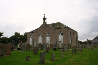
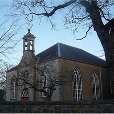
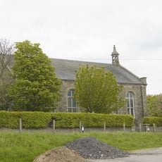
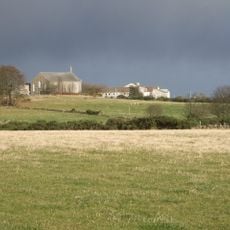
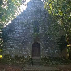
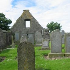
Kirkton of Skene, Category B listed church building in Skene, Scotland.
Kirkton of Skene is a Category B listed church building located in the parish of Skene in Aberdeenshire. The structure displays traditional Scottish architecture and local granite construction that characterize rural church buildings from this period.
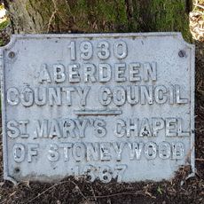
The church was built as part of Aberdeen's Presbytery development during Scotland's ecclesiastical expansion across rural parishes. It marks centuries of continuous religious practice in the Aberdeenshire region.
This church serves as a gathering place where the local community meets for worship and social occasions throughout the year. The building holds meaning for residents who maintain bonds with their parish through regular attendance and shared traditions.
The church is accessible by regional transport from Aberdeen and has parking available for visitors. Since it remains an active place of worship, it is helpful to check opening times before visiting.
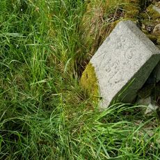
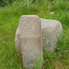
The building holds Category B listed status under Scottish law, which means any alterations to its structure require special permissions. This protection ensures that the architectural character of the building is maintained for future generations.
Location: Aberdeenshire
Location: Skene
Part of: Presbytery of Aberdeen
GPS coordinates: 57.15930,-2.32749
Latest update: December 14, 2025 14:24
Drum Castle
7.2 km
Dunecht House
5.2 km
Loch of Skene
1.8 km
Cullerlie stone circle
3.8 km
Garlogie Mills, Museum Of Power
3 km
Echt Parish Church
6.7 km
Skene House
4.1 km
Culter House
7.6 km
Westhill Library
3.1 km
Newhills Parish Church
7.5 km
Newhills House
7.3 km
South Fornet, stone circle 250m NW of
3.9 km
Drum Castle, Chapel
7.2 km
Boundary Marker 40, Kirkhill Farm, Aberdeen,
7.5 km
Boundary Marker 34, Greenwelltree, Aberdeen
6 km
Boundary Marker 31, Wynford, Aberdeen,
4.1 km
Boundary Marker 36, Greenwelltree, Aberdeen
6.2 km
Boundary Marker 32, Tulloch, Aberdeen
5.1 km
Newhills, Old Parish Church, Burial-ground
7.1 km
Kingswells, Consumption Dykes
6 km
Boundary Marker 33, Tulloch, Aberdeen
5.3 km
Boundary Marker 35, Greenwelltree, Aberdeen
6.1 km
Boundary Marker 30, Wynford Farm, Aberdeen,
3.9 km
Boundary Marker 37, East Wall, Steading, Ashtown, Aberdeen
6.5 km
Boundary Marker 39, Ashtown, Aberdeen
6.9 km
Boundary Marker 38, Ashtown, Aberdeen
6.8 km
Drum Castle, Walled Garden
7 km
Commemorative plaque to St Mary's Chapel
7.2 kmVisited this place? Tap the stars to rate it and share your experience / photos with the community! Try now! You can cancel it anytime.
Discover hidden gems everywhere you go!
From secret cafés to breathtaking viewpoints, skip the crowded tourist spots and find places that match your style. Our app makes it easy with voice search, smart filtering, route optimization, and insider tips from travelers worldwide. Download now for the complete mobile experience.
A unique approach to discovering new places❞
— Le Figaro
All the places worth exploring❞
— France Info
A tailor-made excursion in just a few clicks❞
— 20 Minutes