Chest opened
+${chestReward.xp} XP
Explorer
NOUVEAU ×${chestReward.collectible.quantity}
tapez pour fermer
Chest locked

Open chests in the app

Around Us is built for your phone — chests unlock when you walk, explore and capture nearby places.

Enable Location

We need your location to show you interesting places around you

Discover nearby places

Find interesting locations and hidden gems around you

Precise directions

Get accurate directions and distances to places

Your location is never shared with other users. It's only used when you tap the location button.

Log in to your account

Start exploring — it's free

Trusted by 72,878 travelers worldwide

Continue with Google
Continue with Apple
or

We will send you a code to connect

By continuing, you accept our Terms and Conditions and our Privacy Policy

Check your inbox

We've sent a pincode in your inbox. Please enter the code below.

Simonside Hills
Discussion Reviews Photo
3.7k Popularity

Simonside Hills, Hill chain in Northumberland, England

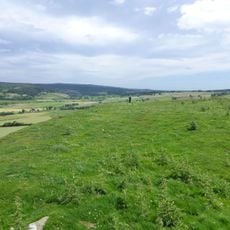
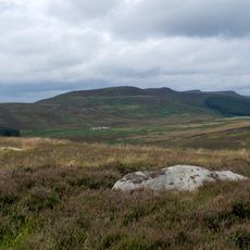
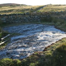
Simonside Hills is a sandstone ridge located near Rothbury in Northumberland, with peaks ranging from 300 to 440 meters in elevation and featuring rocky outcrops along the crest. The chain consists of several connected high points that hikers can reach via established paths offering views across the surrounding terrain.

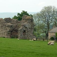
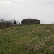
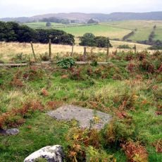
Bronze Age inhabitants left cup rings and burial sites on the hills, while an Iron Age hillfort at Lordenshaws indicates long-term human settlement in the region. These archaeological remains show that people lived in this landscape over thousands of years.

The name Simonside comes from Simundessete, recorded in the 13th century, and reflects connections to Germanic traditions. Today the hills serve mainly as a destination where walkers move through the landscape and take in views, with the old naming history visible only in written records.

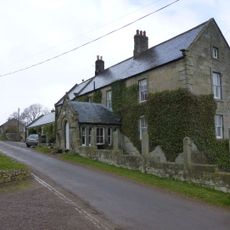
Access to the hills is mainly via the Lordenshaw car park, from which marked trails lead to various high points. The walks vary in difficulty and offer views to the Cheviot Hills and the North Sea on clear days.

Local folklore tells of the Duergar, supernatural beings from Norse mythology, said to roam the hills at night carrying lanterns and leading travelers astray. These stories remain woven into the region's oral traditions and add a mysterious layer to the landscape.

The community of curious travelers

AroundUs brings together thousands of curated places, local tips, and hidden gems, enriched daily by 60,000 contributors worldwide.

Start exploring
Location
GPS coordinates
55.28100,-1.96200
Latest update
December 11, 2025 18:10
Around this place
Roman Catholic Church of All Saints
United Kingdom

Roman Catholic Church of All Saints

3.7 km
Turks Head Inn
United Kingdom

Turks Head Inn

4.5 km
Whitton Tower
United Kingdom

Whitton Tower

4 km
Monument To First Lord Armstrong At South West Of Detached Graveyard
United Kingdom

Monument To First Lord Armstrong At South West Of Detached Graveyard

4.4 km
5, Market Place
United Kingdom

5, Market Place

4.5 km
Rothbury Library
United Kingdom

Rothbury Library

4.3 km
Monument To Walter Mavin At South East Of Detached Graveyard
United Kingdom

Monument To Walter Mavin At South East Of Detached Graveyard

4.5 km
Rothbury
United Kingdom

Rothbury

4.3 km
Sharpe's Folly
United Kingdom

Sharpe's Folly

4.1 km
Tosson Burgh
United Kingdom

Tosson Burgh

1.9 km
Highfield And Adjacent Cottage To East
United Kingdom

Highfield And Adjacent Cottage To East

4.3 km
Ogle House
United Kingdom

Ogle House

4.4 km
Milestone Circa 1 Mile South Of Rothbury
United Kingdom

Milestone Circa 1 Mile South Of Rothbury

4.4 km
West End House
United Kingdom

West End House

4.4 km
Tosson Tower
United Kingdom

Tosson Tower

2 km
Round cairn on Garleigh Hill, 790m north east of Lordenshaw
United Kingdom

Round cairn on Garleigh Hill, 790m north east of Lordenshaw

3.6 km
Milestone Circa A Quarter Of A Mile West Of Holling Hill
United Kingdom

Milestone Circa A Quarter Of A Mile West Of Holling Hill

4.2 km
Conway House (Premises Of Rg Bolam And Son)
United Kingdom

Conway House (Premises Of Rg Bolam And Son)

4.5 km
House Belonging To Mrs Armstrong  The Old Surgery
United Kingdom

House Belonging To Mrs Armstrong The Old Surgery

4.4 km
Whitton Pant Circa 40 Yards North Of Whitton Tower
United Kingdom

Whitton Pant Circa 40 Yards North Of Whitton Tower

4 km
Orchard Guest House
United Kingdom

Orchard Guest House

4.4 km
Milestone Circa A Quarter Of A Mile East Of Lordenshaw
United Kingdom

Milestone Circa A Quarter Of A Mile East Of Lordenshaw

3.8 km
Cup and ring marked rock and adjacent stone setting, 820m east of Whittondean Farm
United Kingdom

Cup and ring marked rock and adjacent stone setting, 820m east of Whittondean Farm

4.1 km
Pill Box At Nu 035 012
United Kingdom

Pill Box At Nu 035 012

2.7 km
Tosson Tower Farmhouse
United Kingdom

Tosson Tower Farmhouse

2.1 km
Cup and ring marked rock, 940m south-west of Wagtail Farm
United Kingdom

Cup and ring marked rock, 940m south-west of Wagtail Farm

4.4 km
East Newtown Farmhouse
United Kingdom

East Newtown Farmhouse

2.5 km
Former Congregational Church, Now Church Hall
United Kingdom

Former Congregational Church, Now Church Hall

4.3 km
Show the full map
Reviews
Share your experience

No review yet

Discussions
Start a discussion...

No discussion yet

« Simonside Hills - Hill chain in Northumberland, England » is provided by Around Us (aroundus.com). Images and texts are derived from Wikimedia project under a Creative Commons license. You are allowed to copy, distribute, and modify copies of this page, under the conditions set by the license, as long as this note is clearly visible.

Discover hidden gems everywhere you go!

From secret cafés to breathtaking viewpoints, skip the crowded tourist spots and find places that match your style. Our app makes it easy with voice search, smart filtering, route optimization, and insider tips from travelers worldwide. Download now for the complete mobile experience.

Around Us App Screenshot

A unique approach to discovering new places

Le Figaro

All the places worth exploring

France Info

A tailor-made excursion in just a few clicks

20 Minutes

Around Us
Travel Guide & Maps
Download

Send to your phone

QR Code
1

Open the camera app on your mobile.

2

Point at the QR code with your camera. A notification will appear.

3

Tap the notification to open the link.