Sheepwash Urban Park

Log in to your account

AroundUs is a community-driven map of interesting places, built by curious explorers like you. It grows with every review, story, and photo you share.
Connect to save your favorite spots, contribute locations, and create personalized routes.
Continue with Google
Continue with Apple
Continue with X
Continue with Facebook
Continue with email
By continuing, you accept our Terms and Conditions and our Privacy Policy
Create an account

Sheepwash Urban Park

Add to collection
Map
Suggest a change
Share

Sheepwash Urban Park, Local Nature Reserve in Tividale, West Midlands, England

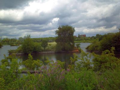
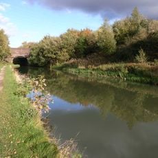
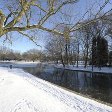
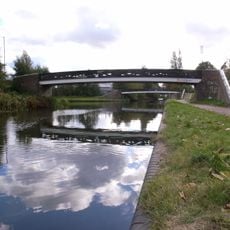
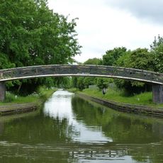
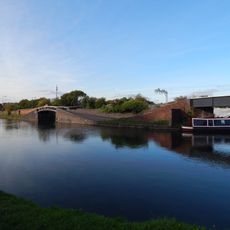
Sheepwash Urban Park is a nature reserve in Tividale featuring lakes, wetlands, grasslands, and wooded areas. These diverse habitats are connected by the Oldbury Arm of the River Tame, creating a varied landscape throughout the site.

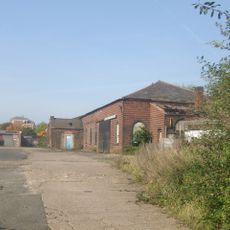
The site was originally industrial with brick factories and waste facilities before transforming into a nature reserve during major redevelopment in the 1980s. This conversion marked a significant shift in how the land was used and valued by the community.

The park serves as a learning hub where schools conduct field studies to understand the local ecosystem. Visitors can observe how the space functions as an outdoor classroom for nature education.

The park can be entered from Sheepwash Lane, Johns Lane, and Philip Road, giving visitors multiple starting points to explore. These entrances make it easy to plan different routes through the reserve depending on your interests.

Since 1985, birdwatchers have identified over 160 bird species here, including Black-necked Grebes and Oystercatchers. This rich variety of species makes the park a notable stopover for migrating birds.

GPS coordinates: 52.52270,-2.03950

Latest update: December 14, 2025 16:45

Photos
Around this place
Black Country Living Museum
United Kingdom

Black Country Living Museum

2.5 km
Black Country Living Museum
United Kingdom

Black Country Living Museum

2.4 km
Oak House, West Bromwich
United Kingdom

Oak House, West Bromwich

2.5 km
Ridgacre Branch
United Kingdom

Ridgacre Branch

2.3 km
Church of St. Andrew, West Bromwich
United Kingdom

Church of St. Andrew, West Bromwich

2.3 km
The Boat Gauging House, Tipton Canal Basin (Off Factory Road) Birmingham Canal Birmingham Level
United Kingdom

The Boat Gauging House, Tipton Canal Basin (Off Factory Road) Birmingham Canal Birmingham Level

2.5 km
Victoria Park
United Kingdom

Victoria Park

1.6 km
Oak House Museum
United Kingdom

Oak House Museum

2.5 km
Church of St Martin and St Paul
United Kingdom

Church of St Martin and St Paul

2.1 km
Church of St Peter
United Kingdom

Church of St Peter

719 m
Church of St John
United Kingdom

Church of St John

2.4 km
Farley Clock Tower
United Kingdom

Farley Clock Tower

2.4 km
St Paul
United Kingdom

St Paul

1.8 km
St Mark
United Kingdom

St Mark

2.3 km
Glebefields Library
United Kingdom

Glebefields Library

2.3 km
The Fountain Inn Public House
United Kingdom

The Fountain Inn Public House

2.2 km
Former Tipton Library
United Kingdom

Former Tipton Library

1.3 km
The Big House
United Kingdom

The Big House

2.5 km
Footbridge To North Of Junction With Tame Valley Canal, East Of Bayleys Lane Walsall Canal
United Kingdom

Footbridge To North Of Junction With Tame Valley Canal, East Of Bayleys Lane Walsall Canal

2 km
Towpath Bridge Over Netherton Tunnel Branch At Junction With New Main Line (Approximately 400 Metres East Of Dudley Port) Birmingham Canal Birmingham Level, Tividale
United Kingdom

Towpath Bridge Over Netherton Tunnel Branch At Junction With New Main Line (Approximately 400 Metres East Of Dudley Port) Birmingham Canal Birmingham Level, Tividale

263 m
Towpath Bridge Over Entrance To Canal Basin (Approximately 150 Metres West Of Watery Lane) Birmingham Canal Birmingham Level
United Kingdom

Towpath Bridge Over Entrance To Canal Basin (Approximately 150 Metres West Of Watery Lane) Birmingham Canal Birmingham Level

1.8 km
Hempole Lane Bridge, Eagles Lane Walsall Canal
United Kingdom

Hempole Lane Bridge, Eagles Lane Walsall Canal

1.3 km
Footbridge To South Of Junction With Tame Valley Canal, East Of Bayleys Lane Walsall Canal
United Kingdom

Footbridge To South Of Junction With Tame Valley Canal, East Of Bayleys Lane Walsall Canal

1.9 km
Bottom Lock And Attached Cantilever Footbridge, Factory Locks (Approximately 50 Meters North Of Furnace Parade) Birmingham Canal Birmingham Level
United Kingdom

Bottom Lock And Attached Cantilever Footbridge, Factory Locks (Approximately 50 Meters North Of Furnace Parade) Birmingham Canal Birmingham Level

2.3 km
Holyhead House
United Kingdom

Holyhead House

2.4 km
Sandwell Council House
United Kingdom

Sandwell Council House

2.5 km
Pillar Box At The Black Country Museum
United Kingdom

Pillar Box At The Black Country Museum

2.5 km
Milestone, Dudley Street, Guns village, by No. 28
United Kingdom

Milestone, Dudley Street, Guns village, by No. 28

2.2 km
Show the full map
Reviews

Visited this place? Tap the stars to rate it and share your experience / photos with the community! Try now! You can cancel it anytime.

« Sheepwash Urban Park - Local Nature Reserve in Tividale, West Midlands, England » is provided by Around Us (aroundus.com). Images and texts are derived from Wikimedia project under a Creative Commons license. You are allowed to copy, distribute, and modify copies of this page, under the conditions set by the license, as long as this note is clearly visible.

Discover hidden gems everywhere you go!

From secret cafés to breathtaking viewpoints, skip the crowded tourist spots and find places that match your style. Our app makes it easy with voice search, smart filtering, route optimization, and insider tips from travelers worldwide. Download now for the complete mobile experience.

Around Us App Screenshot

A unique approach to discovering new places

Le Figaro

All the places worth exploring

France Info

A tailor-made excursion in just a few clicks

20 Minutes