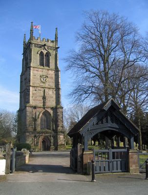
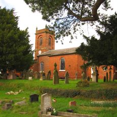
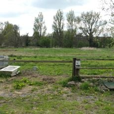
Wybunbury Tower, Gothic church tower in Wybunbury, England
Wybunbury Tower is a Gothic sandstone structure standing about 29.3 meters high, featuring a deeply recessed west entrance, three-light windows, and decorative niches. These niches hold carved bishop and Trinity figures that showcase the artistic care taken in its design.
This tower was built in the 15th century as a parish church structure. In 1832, engineer James Trubshaw carried out an innovative underground excavation to stabilize its tilt, marking a turning point in how such problems were solved.
Six bells cast by John Rudhall in 1791 still ring here for local gatherings and ceremonies, representing a long tradition of bell-ringing in this community. The sound of these bells marks important moments in the lives of residents and visitors.
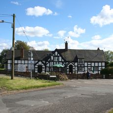
The tower welcomes visitors interested in exploring the building and its history. Guided visits organized by the Wybunbury Tower Preservation Trust allow you to learn about the Gothic features and the engineering methods used to stabilize the structure.
The stabilization technique pioneered here in 1832 later served as the foundation for correcting the lean of the Tower of Pisa in the 1990s. This connection shows how a local engineering solution became an internationally recognized method.
Location: Wybunbury
Architectural style: English Gothic architecture
Height: 29.3 m
GPS coordinates: 53.04520,-2.44880
Latest update: December 14, 2025 11:21
Doddington Hall
3.5 km
Delves Hall
3 km
St John's Church, Doddington
3.6 km
Church of St Mary the Virgin, Wistaston
4.2 km
Stapeley House
3 km
All Saints' Church, Weston, Cheshire
4 km
St Chad's Church, Wybunbury (new)
376 m
Moated site 300m SE of St Chad's Church
347 m
White Lion Inn
4 km
The Swan Inn
78 m
Thatchers
871 m
The Cliffe
715 m
Signpost
3.7 km
Wybunbury War Memorial
369 m
Yewtree Cottage
3.8 km
Bank House
3.3 km
Lea Hall
1.7 km
Hall Bank moated site, Wybunbury
264 m
Milepost, Oakes Corner
3.2 km
Milepost, Walgherton
988 m
Milepost, SW of Huntsback Farm; S of Wistaton road
3.8 km
Milepost, Crewe Road; midway between Broughton Lane and Laidon Avenue jcts
4.1 km
Milepost, near Batherton Boundary
3.3 km
Milepost, opp. Greenfields
2.7 km
Milepost, London Road at SJ6657751790
3.9 km
Milepost, S of Stapeley House
2.9 km
Milepost, Howbeck Farm
1.8 km
Milepost, High Street, nr Shavington village school
2.2 kmVisited this place? Tap the stars to rate it and share your experience / photos with the community! Try now! You can cancel it anytime.
Discover hidden gems everywhere you go!
From secret cafés to breathtaking viewpoints, skip the crowded tourist spots and find places that match your style. Our app makes it easy with voice search, smart filtering, route optimization, and insider tips from travelers worldwide. Download now for the complete mobile experience.
A unique approach to discovering new places❞
— Le Figaro
All the places worth exploring❞
— France Info
A tailor-made excursion in just a few clicks❞
— 20 Minutes