Chest opened
+${chestReward.xp} XP
Explorer
NOUVEAU ×${chestReward.collectible.quantity}
tapez pour fermer
Chest locked

Open chests in the app

Around Us is built for your phone — chests unlock when you walk, explore and capture nearby places.

Enable Location

We need your location to show you interesting places around you

Discover nearby places

Find interesting locations and hidden gems around you

Precise directions

Get accurate directions and distances to places

Your location is never shared with other users. It's only used when you tap the location button.

Log in to your account

Start exploring — it's free

Trusted by 72,892 travelers worldwide

Continue with Google
Continue with Apple
or

We will send you a code to connect

By continuing, you accept our Terms and Conditions and our Privacy Policy

Check your inbox

We've sent a pincode in your inbox. Please enter the code below.

Discussion Reviews Photo
1.3k Popularity

Slit Woods, Nature reserve in County Durham, England.

Slit Woods is a woodland site covering around 14 hectares alongside Middlehope Burn in County Durham. The trees consist mainly of ash and wych elm, while the forest floor supports a varied layer of herbs and wildflowers including bellflower and globeflower.

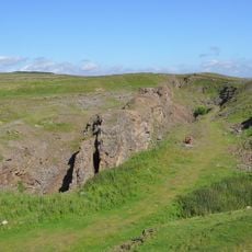
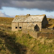
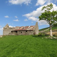
The site gained protected status in 1976 to safeguard its natural features. This designation came after centuries of mining activity, as lead extraction at operations like Slitt Mine and Middlehope Mine had shaped the landscape for generations.

The woodland supports several plant species that are relatively uncommon in the wider region, making it a place where walkers can encounter plants they might not see elsewhere. This concentration of rare flora draws interest from those who enjoy observing the diversity of native vegetation.

The woodland has several walking paths where visitors can move through the landscape and observe the plant life. The best time to visit is spring through summer, when most wildflowers bloom and the paths are easy to walk.

Former mining waste heaps have evolved into specialized grasslands where plants like spring sandwort thrive in metal-rich soil. This unexpected link between industrial past and present botanical interest makes the site particularly notable.

The community of curious travelers

AroundUs brings together thousands of curated places, local tips, and hidden gems, enriched daily by 60,000 contributors worldwide.

Start exploring
GPS coordinates
54.74640,-2.14667
Latest update
December 14, 2025 17:43
Around this place
West Rigg Open Cutting
United Kingdom

West Rigg Open Cutting

508 m
Westgate Methodist Chapel
United Kingdom

Westgate Methodist Chapel

1 km
Church of St John the Baptist
United Kingdom

Church of St John the Baptist

2.4 km
Milepost About 120 Metres East Of Park House Farmhouse
United Kingdom

Milepost About 120 Metres East Of Park House Farmhouse

2.2 km
John Wesley Monument
United Kingdom

John Wesley Monument

3.5 km
Weardale Museum And High House Chapel
United Kingdom

Weardale Museum And High House Chapel

3.4 km
Bridge Over River Wear
United Kingdom

Bridge Over River Wear

4 km
Coronation Bridge Over River Wear
United Kingdom

Coronation Bridge Over River Wear

3.4 km
The 'Golden Lion'
United Kingdom

The 'Golden Lion'

2.4 km
High House Chapel And Former Minister's House
United Kingdom

High House Chapel And Former Minister's House

3.4 km
High Crooked Well
United Kingdom

High Crooked Well

396 m
St John's Chapel, War Memorial
United Kingdom

St John's Chapel, War Memorial

2.4 km
Ludwell Farmhouse
United Kingdom

Ludwell Farmhouse

3.8 km
Westernhope Burn East Farmhouse
United Kingdom

Westernhope Burn East Farmhouse

3.1 km
Barn Range South Of Ludwell Farmhouse
United Kingdom

Barn Range South Of Ludwell Farmhouse

3.8 km
Hackword Tomb About 2 Metres East Of East End Of Church Of St John
United Kingdom

Hackword Tomb About 2 Metres East Of East End Of Church Of St John

2.4 km
Rancho Del Rio
United Kingdom

Rancho Del Rio

3.3 km
Guidepost At Junction Of A689 And Causeway Road
United Kingdom

Guidepost At Junction Of A689 And Causeway Road

4 km
Pound At West End Of Village
United Kingdom

Pound At West End Of Village

4 km
Scarsike Head Guide Post On North Side Of Road Junction One Metre West Of Wall
United Kingdom

Scarsike Head Guide Post On North Side Of Road Junction One Metre West Of Wall

2.3 km
Weavers Workshop At Junction Of A689 And Causeway Road
United Kingdom

Weavers Workshop At Junction Of A689 And Causeway Road

4 km
Former House And Byre, With Loose Boxes, South Of Ludwell Farmhouse Barn
United Kingdom

Former House And Byre, With Loose Boxes, South Of Ludwell Farmhouse Barn

3.8 km
Emerson Tomb About 15 Metres East Of Church Of St John, Near South Wall Of Churchyard
United Kingdom

Emerson Tomb About 15 Metres East Of Church Of St John, Near South Wall Of Churchyard

2.4 km
Somerville Tomb About 5 Metres South Of Chancel Of Church Of St John
United Kingdom

Somerville Tomb About 5 Metres South Of Chancel Of Church Of St John

2.4 km
High Smailsburn Farmhouse
United Kingdom

High Smailsburn Farmhouse

3.9 km
Haswick's Bridge Over River Wear
United Kingdom

Haswick's Bridge Over River Wear

1.1 km
New Close Farmhouse With Stable, Byre And Lofts
United Kingdom

New Close Farmhouse With Stable, Byre And Lofts

2.5 km
Westernhopeburn West Farmhouse and adjoining outbuilding
United Kingdom

Westernhopeburn West Farmhouse and adjoining outbuilding

3.1 km
Show the full map
Reviews
Share your experience

No review yet

Discussions
Start a discussion...

No discussion yet

« Slit Woods - Nature reserve in County Durham, England » is provided by Around Us (aroundus.com). Images and texts are derived from Wikimedia project under a Creative Commons license. You are allowed to copy, distribute, and modify copies of this page, under the conditions set by the license, as long as this note is clearly visible.

Discover hidden gems everywhere you go!

From secret cafés to breathtaking viewpoints, skip the crowded tourist spots and find places that match your style. Our app makes it easy with voice search, smart filtering, route optimization, and insider tips from travelers worldwide. Download now for the complete mobile experience.

Around Us App Screenshot

A unique approach to discovering new places

Le Figaro

All the places worth exploring

France Info

A tailor-made excursion in just a few clicks

20 Minutes

Around Us
Travel Guide & Maps
Download

Send to your phone

QR Code
1

Open the camera app on your mobile.

2

Point at the QR code with your camera. A notification will appear.

3

Tap the notification to open the link.