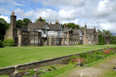
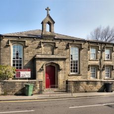
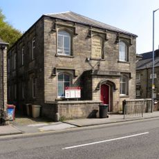
Smithills Hall, Medieval manor house in Bolton, England
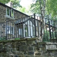
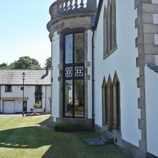
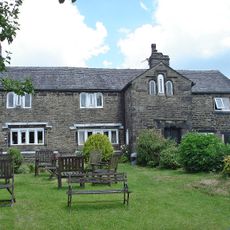
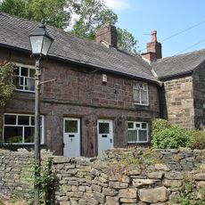
Smithills Hall is a country house in Bolton that blends architectural styles from different time periods, showing how it changed and grew over centuries. The building combines timber frames with stone walls and features an open courtyard surrounded by three connected ranges that tell the story of its evolution.
Construction began in the early 1300s as a timber-framed manor, and over the centuries it was gradually rebuilt with stone for greater strength and stability. Each generation of owners added their own improvements, creating the layers visible in the building today.
The courtyard served as the social hub of daily life for the families who lived here, shaping how the estate was used and experienced. Walking through the rooms, you can see how people ate, slept, and spent their time across the centuries.
The house is open to visitors on most days of the week, and admission is free for everyone. It is helpful to check the exact opening times before your visit, as hours may change with the seasons.
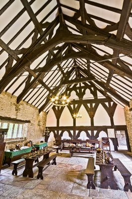
The north wing contains the great hall with original medieval wooden beams still showing details from the 1300s. This remarkable room displays the craftsmanship and building techniques that workers used when it was first constructed.
Location: Bolton
Website: https://friendsofsmithillshall.co.uk
GPS coordinates: 53.60250,-2.45550
Latest update: December 8, 2025 19:44
St Thomas' Church, Halliwell
1.4 km
Church of St Peter
1.4 km
Church of St Paul
929 m
Moss Bank Park
987 m
Numbers 645 And 647 And The Bay Mare Public House
1.5 km
The Finishers Arms (Number 487) And Numbers 489-493
1.5 km
Fox And Stork Public House
847 m
Victoria Row Numbers 2-16 St Pauls Place
947 m
Falcon Mill
1.1 km
1-9, Birley Street
1.6 km
St Pauls School (South Of Church)
968 m
6-9, Hill Top
888 m
591 And 593, Halliwell Road
803 m
Chimney At Junction With Moss Lane
718 m
1-6, Hoyle Street
1.4 km
St Pauls School (North Of Church)
906 m
Bosco House
855 m
Bryan Hey Farmhouse
1.2 km
1 and 2, Hill Top
879 m
54, 56 And 58, Harvey Street
930 m
3, 4 And 5, Hill Top
857 m
Farm Buildings At Harricroft Farm
342 m
Thornleigh House
842 m
653-661, Blackburn Road
1.5 km
Milestone, Smithills Dean Road, by No. 93 - about 1/4 N from the A58 Ring Road Moss Bank Way
327 m
Albert Row Numbers 1-11 St Pauls Place
918 m
Milestone, Colliers Row Road - 200m W of the cross roads with Smithills Dean Road, Scout Road and Coal Pit Road
1.4 km
Milestone, Sharples, just N of Arundel Street
1.3 kmVisited this place? Tap the stars to rate it and share your experience / photos with the community! Try now! You can cancel it anytime.
Discover hidden gems everywhere you go!
From secret cafés to breathtaking viewpoints, skip the crowded tourist spots and find places that match your style. Our app makes it easy with voice search, smart filtering, route optimization, and insider tips from travelers worldwide. Download now for the complete mobile experience.
A unique approach to discovering new places❞
— Le Figaro
All the places worth exploring❞
— France Info
A tailor-made excursion in just a few clicks❞
— 20 Minutes