Enable Location

We need your location to show you interesting places around you

Discover nearby places

Find interesting locations and hidden gems around you

Precise directions

Get accurate directions and distances to places

Your location is never shared with other users. It's only used when you tap the location button.

Sussex Ouse Valley Way

Log in to your account

Start exploring — it's free

Trusted by 64,096 travelers worldwide

Continue with Google
Continue with Apple
or

We will send you a code to connect

By continuing, you accept our Terms and Conditions and our Privacy Policy

Check your inbox

We've sent a pincode in your inbox. Please enter the code below.

Sussex Ouse Valley Way
Discussion Reviews 1 Photos
1.2k Popularity

Sussex Ouse Valley Way, long-distance footpath in East and West Sussex, England

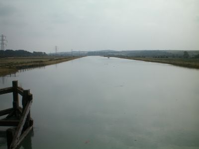
The Sussex Ouse Valley Way is a long-distance trail stretching about 42 miles across South East England, starting from Lower Beeding and ending at the coast near Seaford Bay, while following the River Ouse. The route moves through varied landscapes including the wooded hills of the High Weald, the open farmland of the Low Weald, and the gentle slopes of the South Downs before reaching the seaside.

The trail was designed by Terry Owen and created through a project involving local groups and councils that took more than two years, supported by organizations like the Sussex Ouse Restoration Trust. The route passes historical sites including Furnace Pond, a large pond connected to the region's past iron-making industry, and Barcombe Mills, which reflect the area's connection to water and mill work.

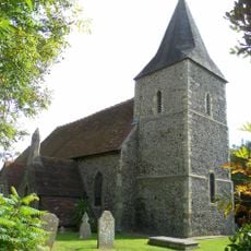
The trail passes through small villages such as Slaugham, Handcross, Lindfield, and Newick, where you can observe the daily rhythm of rural life. These settlements retain a quiet character and show how people work and live within the Sussex landscape.

The trail is divided into six sections, making it easier to walk in stages, and is marked on Ordnance Survey maps with a blue and grey disc symbol showing a viaduct and river. Several hostels and small inns are located within a few kilometers of the path, offering places to rest overnight if you want to split the walk across multiple days.

Occasional steam whistles from the nearby Bluebell Line, a heritage railway, pierce the quiet while walking through Lindfield and Newick, adding a nostalgic touch to the journey. This unexpected sound element connects the modern walking experience with railway history and creates moments of surprise on otherwise quiet country roads.

The community of curious travelers

AroundUs brings together thousands of curated places, local tips, and hidden gems, enriched daily by 60,000 contributors worldwide.

Start exploring
GPS coordinates
50.78350,0.05725
Latest update
February 9, 2026 07:45
Reviews
Share your experience

No review yet

Discussions
Start a discussion...

No discussion yet

« Sussex Ouse Valley Way - long-distance footpath in East and West Sussex, England » is provided by Around Us (aroundus.com). Images and texts are derived from Wikimedia project under a Creative Commons license. You are allowed to copy, distribute, and modify copies of this page, under the conditions set by the license, as long as this note is clearly visible.

Discover hidden gems everywhere you go!

From secret cafés to breathtaking viewpoints, skip the crowded tourist spots and find places that match your style. Our app makes it easy with voice search, smart filtering, route optimization, and insider tips from travelers worldwide. Download now for the complete mobile experience.

Around Us App Screenshot

A unique approach to discovering new places

Le Figaro

All the places worth exploring

France Info

A tailor-made excursion in just a few clicks

20 Minutes

Around Us
Travel Guide & Maps
Download

Send to your phone

QR Code
1

Open the camera app on your mobile.

2

Point at the QR code with your camera. A notification will appear.

3

Tap the notification to open the link.