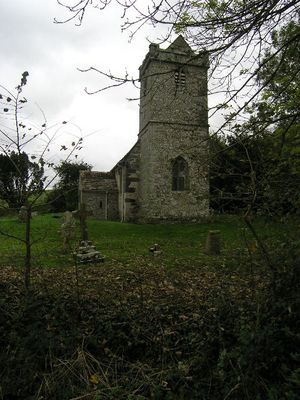
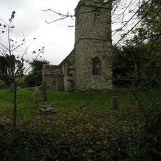
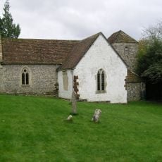
Tarrant Abbey, Medieval Cistercian nunnery ruins in Tarrant Crawford, England
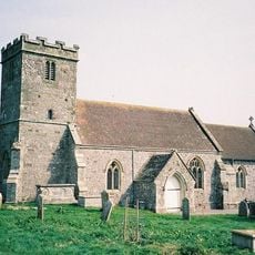
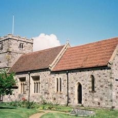
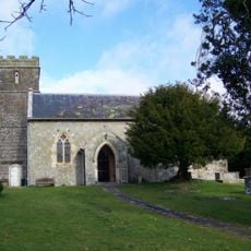
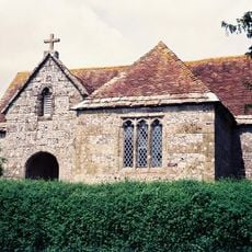
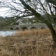
Tarrant Abbey is a Cistercian nunnery in Tarrant Crawford in Dorset, of which mainly buried foundations remain today. A medieval barn survives at Abbey Farm, standing beside the River Tarrant.
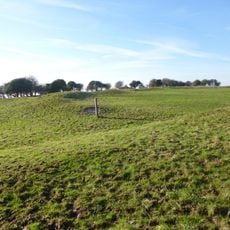
The site was founded in 1186 by Ralph de Kahaines and became one of England's most prosperous nunneries before being dissolved in 1539. This gave it a lifespan of roughly 350 years as an active religious community.
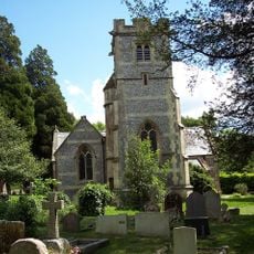
The nearby St Mary's Church holds remarkable wall paintings from the 14th century that depict scenes from the life of Saint Margaret across several panels. These artworks reflect the artistic importance of the area during the medieval period.
The site sits at Abbey Farm and is reached via walking paths through the Dorset countryside. The grounds are generally open to visitors, though wear appropriate footwear as the terrain can become muddy after rain.
Queen Joan, sister of King Henry III, is said to be buried in the abbey graveyard, reportedly in a golden coffin following her death during a visit. This connection to a member of the royal family sets the site apart from many other religious ruins.
Location: Tarrant Crawford
Inception: 12 century
Part of: Tarrant Abbey, site of, and tithe barn at Abbey Farm
GPS coordinates: 50.83140,-2.12228
Latest update: December 14, 2025 13:08
Buzbury Rings
2.4 km
St Mary the Virgin, Tarrant Crawford
816 m
Church of All Saints
1.1 km
Church of All Saints
2.9 km
Church of St Mary
1.5 km
Parish Church of Saint Bartholomew
2.9 km
Church of St Mary, Tarrant Rushton
3.4 km
Church of St John
826 m
Church of St Mary
2.9 km
Church of St Mary
4 km
Milestone Approximately 700 Metres South East Of Church Of St Mary
1.4 km
The War Memorial
3 km
22 And 24, East Street
3.9 km
26, East Street
3.9 km
Stour House
3.9 km
Crawford Bridge
1.6 km
Tarrant Keyneston War Memorial
1.7 km
Tarrant Crawford Cross
1.2 km
Milestone
3.2 km
2 And 4, East Street
3.9 km
1 and 3, East Street
3.9 km
The Manor House
3.1 km
Rawston Farmhouse
3.9 km
Milestone Approximately 10 Metres West Of No 26
960 m
Eastway House
3.9 km
Milestone
2.7 km
Milestone, half mile W of Badbury Rings;
3.6 km
Milestone, 300m E of Spetisbury; 30m W of layby
2.1 kmVisited this place? Tap the stars to rate it and share your experience / photos with the community! Try now! You can cancel it anytime.
Discover hidden gems everywhere you go!
From secret cafés to breathtaking viewpoints, skip the crowded tourist spots and find places that match your style. Our app makes it easy with voice search, smart filtering, route optimization, and insider tips from travelers worldwide. Download now for the complete mobile experience.
A unique approach to discovering new places❞
— Le Figaro
All the places worth exploring❞
— France Info
A tailor-made excursion in just a few clicks❞
— 20 Minutes