Thynghowe, Viking assembly site in Sherwood Forest, England.
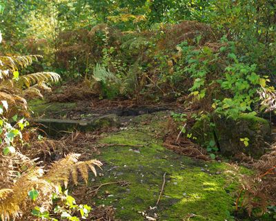
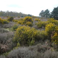
Thynghowe is an archaeological site sitting at the summit of Hanger Hill, where three ancient parish boundaries meet within Sherwood Forest in Nottinghamshire. The location features a preserved assembly mound integrated with walking trails and woodland that shape the natural landscape where these borders converge.
Local historians Stuart Reddish and Lynda Mallett rediscovered this lost assembly place in 2005. The rediscovery led to its inclusion in the English Historic England Archive and reconnected the site with the region's medieval past.
The name Thynghowe comes from Old Norse words, with 'thyng' meaning assembly and 'howe' referring to a mound, showing Norse influence in medieval England. Visitors can trace this linguistic heritage directly at the site, where the place name reflects its original purpose and cultural roots.
Visitors can reach this location via walking trails in the Birklands area of Sherwood Forest, where signage marks the way to the mound. The site sits within the larger forest area, making it a good addition to a woodland walk if you are already exploring the region.
Three parish boundaries met at this location, and the assembly mound marked a natural point where these divisions converged. This design allowed communities from neighboring areas to gather on neutral ground and settle disputes.
The community of curious travelers
AroundUs brings together thousands of curated places, local tips, and hidden gems, enriched daily by 60,000 contributors worldwide.