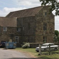
Upsall Castle, Medieval castle ruins in North Yorkshire, England
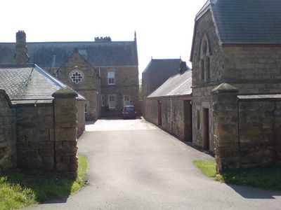
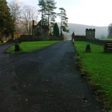
Upsall Castle is a ruined medieval fortress in North Yorkshire with sections of the southeast Kitchen Tower still standing and foundations visible beneath ground. The remains of the southern and western walls can be seen partially underground, showing the original layout of the structure.
The site began as a fortified structure around 1130 linked to an early Norman landowner. A quadrangular castle with four sides was later built on the same spot, developing over many decades into a more substantial fortress.
The site features stonework with mason marks that reveal details about medieval construction methods and the craftspeople who built here. Walking through the ruins helps visitors understand how such structures were made in that era.
The site is difficult to access and sits on private land, so visitors should check availability beforehand. The ruins are exposed to the elements with minimal facilities or signage to guide you through the remains.
Local stories tell of gold discoveries that people have supposedly made while digging at the site over the years. These tales have become part of the castle's folklore and hint at hidden valuables buried in the ground.
GPS coordinates: 54.27666,-1.30482
Latest update: December 8, 2025 21:08
The World of James Herriot
5.5 km
Church of St Mary
5.4 km
The Three Tuns
5.5 km
Holy Trinity Church, Boltby
3.7 km
Church of St Felix
2.7 km
Church of St Wilfrid
4.1 km
Church of St Michael and All Angels
3.1 km
Church of St Wilfrid
1.5 km
Church of St Mary
4.2 km
Church of St Leonard
4 km
Church of All Saints
5.3 km
Thirsk Museum
5.5 km
Market Clock By The Post Office
5.5 km
Bridge Over Gurtoff Beck
3.8 km
Thirsk Library
5.4 km
Village Cross
3.4 km
Kepwick Hall With Attached Service Wing And Coach House
4.5 km
Thirsk Hall
5.4 km
Mile Post Opposite Number 15
5.3 km
Lime kilns 400m south west of Furlands
3.7 km
Manor Farmhouse and Attached Stable Block
5.3 km
Boundary Stone On East Side Of Junction With Cophill Lane
2.5 km
Nevison House
2.1 km
Mile Post Outside Burniston
4.8 km
Group Of Font And Two Cross Bases With Shafts Approximately 5 Metres To South West Of Porch Of Church Of St Wilfrid
1.5 km
Wayside cross 600m east of Gallow Hill, known as Friar's Cross
4.5 km
Leake Hall
4.1 km
Milestone, Northallerton Road, outside Spa House
4.7 kmVisited this place? Tap the stars to rate it and share your experience / photos with the community! Try now! You can cancel it anytime.
Discover hidden gems everywhere you go!
From secret cafés to breathtaking viewpoints, skip the crowded tourist spots and find places that match your style. Our app makes it easy with voice search, smart filtering, route optimization, and insider tips from travelers worldwide. Download now for the complete mobile experience.
A unique approach to discovering new places❞
— Le Figaro
All the places worth exploring❞
— France Info
A tailor-made excursion in just a few clicks❞
— 20 Minutes