Water End Swallow Holes, Geological site in Welham Green, United Kingdom
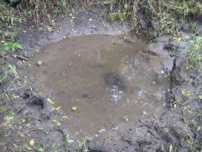
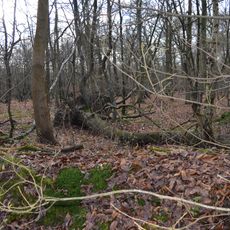
Water End Swallow Holes is a geological site in Welham Green comprising fifteen natural sinkholes formed within the chalk bedrock across approximately 11.3 hectares. These depressions developed through the natural drainage of groundwater in this water-permeable landscape.
The site received protection as a Site of Special Scientific Interest in 1986 due to its geological and biological value. The chalk sinkholes themselves formed through natural hydrological processes that have operated over many centuries.
These limestone formations serve as an educational resource for scientists and researchers studying the natural drainage systems of southeastern England.
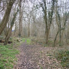
Access to the site is provided via Station Road and is managed by Welwyn Hatfield District Council. Visitors should wear sturdy footwear as the ground is uneven and can become slippery in wet conditions.
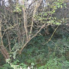
The area contains Reed Sweet-grass populations in its deeper water sections alongside a willow carr swamp system. These two distinct habitat types coexist in close proximity and support different ecological communities.
GPS coordinates: 51.72390,-0.22064
Latest update: December 13, 2025 17:08
Wyllyotts Manor
3.6 km
The White Hart Public House
3.1 km
The Black Horse Public House
2.9 km
Castle Lime Works Quarry
1.7 km
Redwell Wood
2.5 km
Oxleys Wood
3 km
Church of St John the Evangelist
2.8 km
The Woodman Inn
172 m
Church of St Giles
3.2 km
Church of King Charles and the Martyr
3.1 km
Church of St Mary the Virgin
883 m
United Reformed Church Brookmans Park
1.4 km
Main Gates,Octagonal Lodge,Walls,East Lodge And Service Gates To North Mymms Park
766 m
Gaussen Tomb In Churchyard Of Church Of St Mary The Virgin
848 m
Mural Located In Former Lee Valley Water Company Offices And Free-Standing Sculpture On West Side Of Entrance Drive
3.5 km
The Old Maypole Public House
196 m
The Folly Arch
2.8 km
London Coal Duty Marker On District Boundary At Tl 2570 0240
3.3 km
Milestone About 50 Metres East Of Ridge Hill Stud
3.2 km
Potters Bar Museum
3.6 km
North Mymms Park With Adjoining Garden Walls And Ha Ha
1.2 km
Tomb On South Side Of Chancel Of Church Of St Mary The Virgin
850 m
Milestone About 300 Metres South West Of Redwell Wood Farm House
3.2 km
Barn About 60 Metres North West Of Coursers Farm House
2.6 km
Milestone About 30 Metres North Of Little Heath Farm
3.6 km
Milestone, Great North Road, S of Kentish Lane
3 km
Milestone, Bell Bar, adjacent to garage (was Hatfield)
2.5 km
Milestone, Great N Road, near Buttfield Cottage
3 kmVisited this place? Tap the stars to rate it and share your experience / photos with the community! Try now! You can cancel it anytime.
Discover hidden gems everywhere you go!
From secret cafés to breathtaking viewpoints, skip the crowded tourist spots and find places that match your style. Our app makes it easy with voice search, smart filtering, route optimization, and insider tips from travelers worldwide. Download now for the complete mobile experience.
A unique approach to discovering new places❞
— Le Figaro
All the places worth exploring❞
— France Info
A tailor-made excursion in just a few clicks❞
— 20 Minutes