Enable Location

We need your location to show you interesting places around you

Discover nearby places

Find interesting locations and hidden gems around you

Precise directions

Get accurate directions and distances to places

Your location is never shared with other users. It's only used when you tap the location button.

White Ladies Priory

Log in to your account

Start exploring — it's free

Trusted by 63,380 travelers worldwide

Continue with Google
Continue with Apple
or

We will send you a code to connect

By continuing, you accept our Terms and Conditions and our Privacy Policy

Check your inbox

We've sent a pincode in your inbox. Please enter the code below.

White Ladies Priory
Discussion Reviews 1 Photos
6.5k Popularity

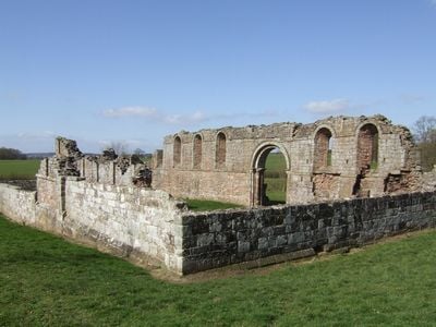
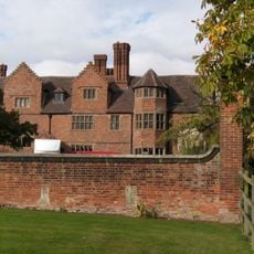
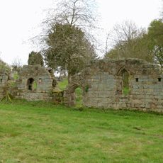
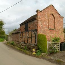
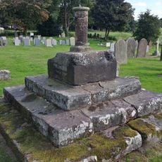
White Ladies Priory, Augustinian priory ruins in Boscobel, England

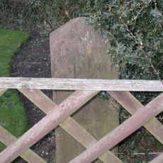
White Ladies Priory consists of stone ruins from an Augustinian convent with walls that survive to the present day. The remains include parts of the church building with medieval architectural details and carved grave markers from the medieval period.

The priory was founded as a religious community and operated for several centuries before being dissolved in the 16th century. Later it gained brief significance when it served as a shelter during a notable moment in English history.

The white robes worn by the Augustinian nuns who lived here gave the priory its name and shaped how people understood the community. These religious women maintained their way of life at the site for centuries.

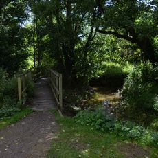
You can reach the site by walking along a public path that stays open during daylight hours. Parking space is available nearby, and there is no need to book ahead or pay an entrance fee.

The buildings were placed on the north side of the church rather than in the expected location, which was done to stay near a water source. This practical choice shows how the community adapted their layout to match local conditions.

The community of curious travelers

AroundUs brings together thousands of curated places, local tips, and hidden gems, enriched daily by 60,000 contributors worldwide.

Start exploring
Location
Inception
12 century
GPS coordinates
52.66570,-2.25840
Latest update
January 25, 2026 19:18
Around this place
Royal Oak
United Kingdom

Royal Oak

1.2 km
Weston Park
United Kingdom

Weston Park

3.6 km
Boscobel House
United Kingdom

Boscobel House

1.3 km
Tong Castle
United Kingdom

Tong Castle

3 km
Church of St Bartholomew
United Kingdom

Church of St Bartholomew

3.1 km
Black Ladies Priory
United Kingdom

Black Ladies Priory

2.7 km
Donington and Albrighton
United Kingdom

Donington and Albrighton

3.5 km
Church of St Cuthbert
United Kingdom

Church of St Cuthbert

3.4 km
Church of St Mary Magdalene
United Kingdom

Church of St Mary Magdalene

3.6 km
Church of St John
United Kingdom

Church of St John

2.2 km
Remains Of Almshouses Approximately 20 Metres To West Of Nave Of Church Of St Bartholomew
United Kingdom

Remains Of Almshouses Approximately 20 Metres To West Of Nave Of Church Of St Bartholomew

3.1 km
Former North Gates And Gatepiers To Tong Castle And Flanking Retaining Walls And Bollards, Approximately 30 Metres To South West Of The Old Post Office
United Kingdom

Former North Gates And Gatepiers To Tong Castle And Flanking Retaining Walls And Bollards, Approximately 30 Metres To South West Of The Old Post Office

3 km
The Grecian Temple at Chillington Hall
United Kingdom

The Grecian Temple at Chillington Hall

3.6 km
St Peter
United Kingdom

St Peter

3.5 km
The Old Post Office
United Kingdom

The Old Post Office

2.9 km
Meeson Hall
United Kingdom

Meeson Hall

3.7 km
Station Road railway bridge, Albrighton
United Kingdom

Station Road railway bridge, Albrighton

3.1 km
Outbuilding Approximately 20 Metres To North Of The Old Post Office
United Kingdom

Outbuilding Approximately 20 Metres To North Of The Old Post Office

2.9 km
Milestone in the grounds of Acorn Cottage
United Kingdom

Milestone in the grounds of Acorn Cottage

1.9 km
Albrighton War Memorial
United Kingdom

Albrighton War Memorial

3.6 km
Obelisk Milestone Approximately 10 Metres To East Of The Bell Inn
United Kingdom

Obelisk Milestone Approximately 10 Metres To East Of The Bell Inn

3.5 km
Tong House
United Kingdom

Tong House

2.9 km
1-4, Newport Road
United Kingdom

1-4, Newport Road

2.9 km
The Red House
United Kingdom

The Red House

2.9 km
Church Farmhouse
United Kingdom

Church Farmhouse

3 km
Churchyard cross base and sundial approximately 5 metres to south of South Chapel of Church of St Bartholomew
United Kingdom

Churchyard cross base and sundial approximately 5 metres to south of South Chapel of Church of St Bartholomew

3.1 km
Bridge At Sj 813104
United Kingdom

Bridge At Sj 813104

3.1 km
Churchyard cross, St Mary Magdalene's Church
United Kingdom

Churchyard cross, St Mary Magdalene's Church

3.6 km
Show the full map
Reviews
Share your experience

No review yet

Discussions
Start a discussion...

No discussion yet

« White Ladies Priory - Augustinian priory ruins in Boscobel, England » is provided by Around Us (aroundus.com). Images and texts are derived from Wikimedia project under a Creative Commons license. You are allowed to copy, distribute, and modify copies of this page, under the conditions set by the license, as long as this note is clearly visible.

Discover hidden gems everywhere you go!

From secret cafés to breathtaking viewpoints, skip the crowded tourist spots and find places that match your style. Our app makes it easy with voice search, smart filtering, route optimization, and insider tips from travelers worldwide. Download now for the complete mobile experience.

Around Us App Screenshot

A unique approach to discovering new places

Le Figaro

All the places worth exploring

France Info

A tailor-made excursion in just a few clicks

20 Minutes

Around Us
Travel Guide & Maps
Download

Send to your phone

QR Code
1

Open the camera app on your mobile.

2

Point at the QR code with your camera. A notification will appear.

3

Tap the notification to open the link.