Chest opened
+${chestReward.xp} XP
Explorer
NOUVEAU ×${chestReward.collectible.quantity}
tapez pour fermer
Chest locked

Open chests in the app

Around Us is built for your phone — chests unlock when you walk, explore and capture nearby places.

Enable Location

We need your location to show you interesting places around you

Discover nearby places

Find interesting locations and hidden gems around you

Precise directions

Get accurate directions and distances to places

Your location is never shared with other users. It's only used when you tap the location button.

Log in to your account

Start exploring — it's free

Trusted by 72,905 travelers worldwide

Continue with Google
Continue with Apple
or

We will send you a code to connect

By continuing, you accept our Terms and Conditions and our Privacy Policy

Check your inbox

We've sent a pincode in your inbox. Please enter the code below.

West Craven
Discussion Reviews Photo
2.4k Popularity

West Craven, Rural district in Lancashire, England.

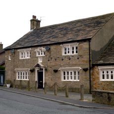
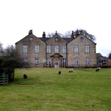
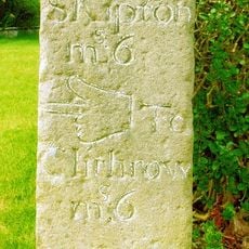
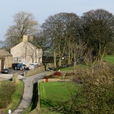
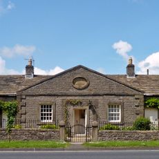
West Craven is a rural district in Lancashire in northern England that spreads across green hills and land divided by stone walls. Several small towns and villages are linked by winding country roads that form a scattered network of communities.

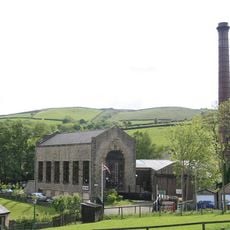
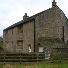
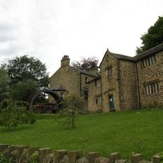
The region was originally farmland but became a textile manufacturing center during the Industrial Revolution as mills were built along waterways. This industrial period left a lasting mark on the landscape and shaped the identity of many towns.

Weekly markets in the towns here showcase handmade goods, farm products, and traditional Lancashire foods made by local producers. These markets reflect how deeply the communities remain connected to their land and craft traditions.

Regular bus services through the Pennine Rider network connect towns here with larger cities like Leeds and Manchester. Those driving should be prepared for narrow, winding roads, especially in the hillier areas.

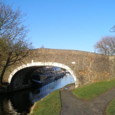
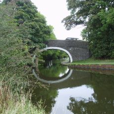
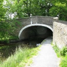
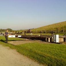
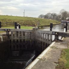
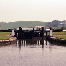
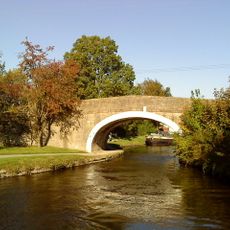
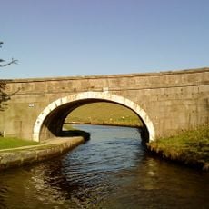
The Leeds and Liverpool Canal runs through the region and is used by original locks and bridges from the 1700s that still work. These well-maintained canal structures offer an unexpected link to an earlier transportation era.

The community of curious travelers

AroundUs brings together thousands of curated places, local tips, and hidden gems, enriched daily by 60,000 contributors worldwide.

Start exploring
GPS coordinates
53.92400,-2.18600
Latest update
December 13, 2025 11:43
Around this place
Bancroft Shed
United Kingdom

Bancroft Shed

1.5 km
Church of St Mary le Ghyll, Barnoldswick
United Kingdom

Church of St Mary le Ghyll, Barnoldswick

1.5 km
St Michael's Church, Bracewell
United Kingdom

St Michael's Church, Bracewell

1.8 km
Church of St Mary
United Kingdom

Church of St Mary

2.4 km
Leeds And Liverpool Canal Cockshott Bridge
United Kingdom

Leeds And Liverpool Canal Cockshott Bridge

1.5 km
Anchor Inn
United Kingdom

Anchor Inn

2.4 km
Bancroft Mill Engine Museum
United Kingdom

Bancroft Mill Engine Museum

1.5 km
Independent Methodist Church Including Steps And Railings To Street
United Kingdom

Independent Methodist Church Including Steps And Railings To Street

1.1 km
Leeds And Liverpool Canal, South Field Bridge
United Kingdom

Leeds And Liverpool Canal, South Field Bridge

2.5 km
Church Well
United Kingdom

Church Well

2.4 km
Fosters Arms Public House
United Kingdom

Fosters Arms Public House

555 m
Leeds And Liverpool Canal Salterforth Bridge Number 151
United Kingdom

Leeds And Liverpool Canal Salterforth Bridge Number 151

2.4 km
Coates Hall
United Kingdom

Coates Hall

590 m
Thornton-in-Craven War Memorial
United Kingdom

Thornton-in-Craven War Memorial

2.4 km
Leeds And Liverpool Canal Lock Number 42
United Kingdom

Leeds And Liverpool Canal Lock Number 42

1.4 km
Gill Hall
United Kingdom

Gill Hall

1.6 km
Leeds And Liverpool Canal Lock Number 44
United Kingdom

Leeds And Liverpool Canal Lock Number 44

1.1 km
Leeds And Liverpool Canal Lock Number 43
United Kingdom

Leeds And Liverpool Canal Lock Number 43

1.3 km
Milestone In South East Corner Of Garden At 245 (Lane End Farmhouse)
United Kingdom

Milestone In South East Corner Of Garden At 245 (Lane End Farmhouse)

553 m
K6 Telephone Kiosk
United Kingdom

K6 Telephone Kiosk

2.9 km
Leeds And Liverpool Canal Coates Lane Or Greenfield Bridge Number 156
United Kingdom

Leeds And Liverpool Canal Coates Lane Or Greenfield Bridge Number 156

970 m
Hopwood House
United Kingdom

Hopwood House

1.8 km
Greenberfield Farmhouse
United Kingdom

Greenberfield Farmhouse

862 m
Leeds And Liverpool Canal Canal Bridge Number 157
United Kingdom

Leeds And Liverpool Canal Canal Bridge Number 157

1.2 km
The Almshouses
United Kingdom

The Almshouses

2.6 km
The Grammar School
United Kingdom

The Grammar School

2.9 km
Stocks
United Kingdom

Stocks

2.9 km
Milestone, ExYW Salterforth Lane on ancient lane
United Kingdom

Milestone, ExYW Salterforth Lane on ancient lane

2.1 km
Show the full map
Reviews
Share your experience

No review yet

Discussions
Start a discussion...

No discussion yet

« West Craven - Rural district in Lancashire, England » is provided by Around Us (aroundus.com). Images and texts are derived from Wikimedia project under a Creative Commons license. You are allowed to copy, distribute, and modify copies of this page, under the conditions set by the license, as long as this note is clearly visible.

Discover hidden gems everywhere you go!

From secret cafés to breathtaking viewpoints, skip the crowded tourist spots and find places that match your style. Our app makes it easy with voice search, smart filtering, route optimization, and insider tips from travelers worldwide. Download now for the complete mobile experience.

Around Us App Screenshot

A unique approach to discovering new places

Le Figaro

All the places worth exploring

France Info

A tailor-made excursion in just a few clicks

20 Minutes

Around Us
Travel Guide & Maps
Download

Send to your phone

QR Code
1

Open the camera app on your mobile.

2

Point at the QR code with your camera. A notification will appear.

3

Tap the notification to open the link.