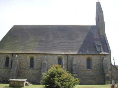
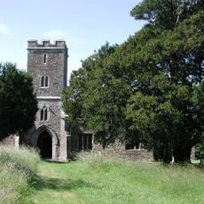
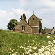
Witham Charterhouse, Carthusian monastery ruins in Witham Friary, England
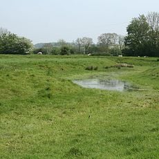
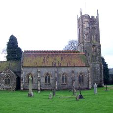
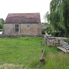
Witham Charterhouse is a Carthusian monastery ruin in Somerset, England, situated within what was once the Royal Forest of Selwood. Excavations have revealed rectilinear earthworks, buttressed wall foundations, glazed roof tiles, and patterns from medieval floor construction.
King Henry II founded the monastery in 1178 as penance for the murder of Archbishop Thomas Becket. This establishment marked the beginning of the Carthusian order's presence in England.
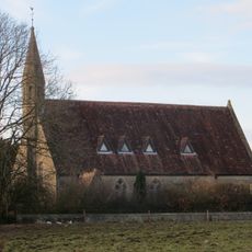
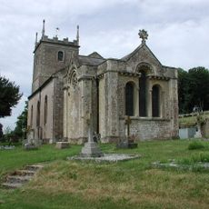
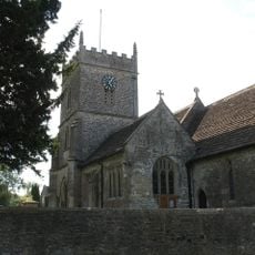
The parish church at Witham Friary incorporates elements from the medieval lay brothers' chapel. This continuity shows how the site remains connected to its religious past through everyday worship.
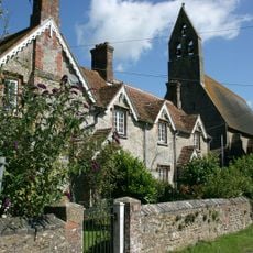
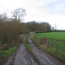
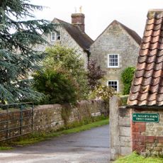
The site features visible earthworks and foundations that you can walk around to explore. Stone fragments from the original buildings are built into nearby local structures and can be seen from outside.
This was England's first Carthusian foundation, with Saint Hugh of Avalon taking charge as prior from 1180 onward. This early start gave the site importance as the birthplace of an order that later spread throughout the country.
Location: Witham Friary
Inception: 12 century
GPS coordinates: 51.16310,-2.36600
Latest update: December 14, 2025 11:24
Marston House
4.9 km
Holwell Quarries
4.9 km
Church of St Mary, Witham Friary
621 m
Cloford Quarry
4.8 km
Former Church of St Michael
3.5 km
Church of St Leonard, Marston Bigot
4.6 km
Postlebury Wood
2.6 km
Church of St Mary
3.9 km
Church of Saint John the Baptist, South Brewham
5 km
Marston Moat
4 km
Church of St Mary, Wanstrow
3.7 km
Church of St Mary Magdalene
3.4 km
Church of St Mary
4.7 km
St Algars Farmhouse
4.5 km
Milestone At Ngr St 7886 4196
4.6 km
Milestone On Druley Hill, At Ngr St 7422 3729
3.2 km
Former Village Reading Room
592 m
Rockfield House And Service Buildings
5.2 km
County Boundary Post On Road Bridge At Junction To Horningsham
4.7 km
Milestone At Ngr St 7799 4317
4.4 km
Milestone On Boundary Wall Of Horseshoe Farmhouse
3.9 km
Milestone, SW of village, just N of road jct
4.2 km
Milestone, Burt's Hill, S of village
3.5 km
Milestone, 400m NE of Wanstrow, near Chancellor's Farm
3.5 km
Milestone, S of Cloford, NE of Wanstrow
3.5 km
Milestone, half mile S of Nunney Village, near Nunney Catch
4.1 km
Milestone, N of Trudoxhill
4.7 km
Milestone, W of Nunney Catch, NW of Cloford
5 kmVisited this place? Tap the stars to rate it and share your experience / photos with the community! Try now! You can cancel it anytime.
Discover hidden gems everywhere you go!
From secret cafés to breathtaking viewpoints, skip the crowded tourist spots and find places that match your style. Our app makes it easy with voice search, smart filtering, route optimization, and insider tips from travelers worldwide. Download now for the complete mobile experience.
A unique approach to discovering new places❞
— Le Figaro
All the places worth exploring❞
— France Info
A tailor-made excursion in just a few clicks❞
— 20 Minutes