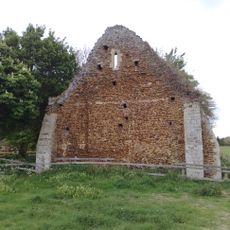
Wormegay Castle, Medieval castle in Norfolk, England.
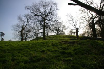
Wormegay Castle is a ruined Norman stronghold in Norfolk consisting of a raised earthen mound surrounded by deep defensive ditches. The site features the characteristic layout of a motte-and-bailey fortress with an elevated outer courtyard.
Hermer de Ferrers built this fortress after the Norman Conquest in the 11th century as an administrative hub for East Anglia. The family maintained control of the site until the mid-12th century.
The castle structure demonstrates the Norman influence on English architecture, serving as the central point for feudal properties across East Anglia.
The site is now an archaeological monument open to view from the ground level. Visitors should wear sturdy footwear since the terrain is uneven and the landscape remains largely natural.
This fortress guarded a crucial causeway across the Fens and served as a strategic outpost for the region's Norman overlords. Its commanding position made it an essential part of the territory's early medieval power structure.
Location: Norfolk
GPS coordinates: 52.67790,0.45220
Latest update: December 9, 2025 20:20
Pentney Priory
4.3 km
Blackborough Priory
2.8 km
Church of Ss Peter and Paul
3.8 km
Church of St Botolph
1 km
Church of All Saints
3.6 km
Church of St Michael
1.6 km
Church of St Mary the Virgin
3.7 km
Church of All Saints
4.3 km
Church of St Andrew
3.7 km
Church of St Mary
4.3 km
Colts Hall
3.5 km
Crown Public House
4.2 km
Gatehouse at Pentney Priory
4.2 km
Watlington War Memorial
3.8 km
Middleton War Memorial
4.3 km
Wormegay War Memorial
525 m
Shouldham War Memorial
3.6 km
North Runcton War Memorial
4.4 km
Shouldham Thorpe War Memorial
3.7 km
Medieval settlement remains immediately west of All Saints' Church
3.5 km
Remains Of Benedictine Priory At Tf 673 140
2.7 km
Former National School And Boundary Wall
3.4 km
Village cross, 30m south of Cross Hill Farm
527 m
Milestone, Main Rd, N of jct with Gravelhill Lane
4.1 km
Milestone, between 40/// & 40// speed signs
1.4 km
Milestone, c.20yds south of Bridge House
2.8 km
Milestone, trees; front of multi-branched oak
2.1 km
Milestone, Lynn Rd, 140yds N of School Rd
4 kmVisited this place? Tap the stars to rate it and share your experience / photos with the community! Try now! You can cancel it anytime.
Discover hidden gems everywhere you go!
From secret cafés to breathtaking viewpoints, skip the crowded tourist spots and find places that match your style. Our app makes it easy with voice search, smart filtering, route optimization, and insider tips from travelers worldwide. Download now for the complete mobile experience.
A unique approach to discovering new places❞
— Le Figaro
All the places worth exploring❞
— France Info
A tailor-made excursion in just a few clicks❞
— 20 Minutes