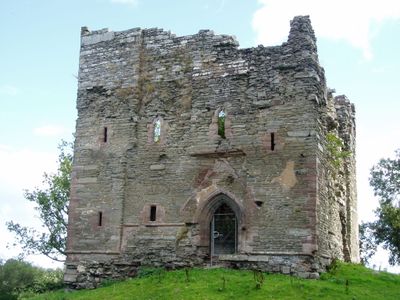
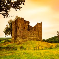
Hopton Castle, Medieval castle ruins in Hopton, Shropshire, England
Hopton Castle is a ruined medieval castle in rural Shropshire, England, made up of a still-standing stone tower with three floors and very thick walls. Surrounding the tower, the earthworks of the original fortification are still clearly visible on the ground.
The castle was built in the 12th century as a Norman fortification to control the surrounding land. In 1644, during the English Civil War, it was destroyed after a prolonged siege and was never rebuilt.
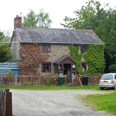
The name Hopton comes from the family that owned and gave its name to the surrounding settlement during the medieval period. Visitors can still see how the tower would have dominated the village, making the presence of local power very visible.
The site is open to visitors at no cost and has information panels dotted around to explain what you are looking at. Sturdy shoes are a good idea, as the ground is uneven and the slopes of the earthworks can be steep in places.
Excavations at the site revealed that the tower had a sophisticated latrine system with water channels built directly into its walls, which was very advanced for its time. This detail shows that those who lived here paid careful attention to sanitation in a period when it was far from common.
The community of curious travelers
AroundUs brings together thousands of curated places, local tips, and hidden gems, enriched daily by 60,000 contributors worldwide.