Downes, Crediton, English country house in Crediton Hamlets, United Kingdom.
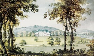
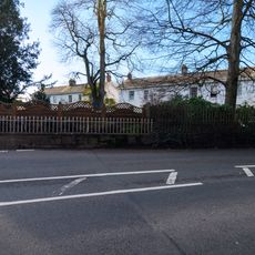
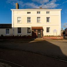
The Palladian-style mansion features red brick construction, a slate roof, and symmetrical design with a central staircase and end stacks.
The Gould family purchased the Downes estate in 1692, with Moses Gould initiating a significant period of ownership that lasted several generations.
The estate reflects the living standards of English gentry, incorporating architectural elements that demonstrate the social hierarchy of 18th-century Devon.
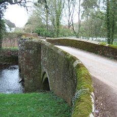
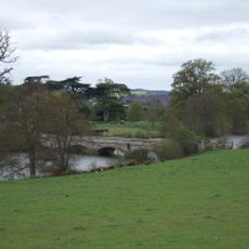
The estate spans 1,400 acres, including Home Farm, Fordton Barton, Uton Barton, Dunscombe Farm, and additional parkland areas.
Near the mansion lies a Roman villa site, identified through crop marks revealing a rectangular enclosure with a winged-corridor structure.
Location: Crediton Hamlets
GPS coordinates: 50.78600,-3.63060
Latest update: March 7, 2025 21:38
Fordton Bridge
1.4 km
Bridge Over Lake, Approximately 35 Metres North Of South Lodge
1.4 km
Post Office
1.3 km
The Limes
1.4 km
Numbers 16 To 20 (Consecutive) And Number 22
1.2 km
Crediton Signal Box
1.3 km
Fairpark And Attached Garden And Yard Walls
1.3 km
Waiting Rooms Immediately East Of Crediton Railway Station Main Range
1.2 km
Taw Vale Terrace Rear Yard And Garden Walls And Adjoining Stable Block
1.2 km
Gate Posts, Gates And Iron Railings Approximately 3 Metres South Of South Lodge
1.1 km
Waiting Rooms Immediately South West Of Crediton Station Main Range
1.2 km
Taw Vale Taw Vale Terrace Rear Yard And Garden Walls And Adjoining Stable Blocks
1.2 km
14, East Street
1.4 km
9, 10 And 10A, East Street
1.3 km
15, East Street
1.4 km
8A And 8B, East Street
1.3 km
30 and 31 Exeter Road and attached railings and walls
1.3 km
Footbridge Immediately West Of Crediton Railway Station Main Range
1.3 km
12 And 13, East Street
1.3 km
Winswood Winswood Cottage Winswood Spinney
1.4 km
Dartmoor Railway Inn And Attached Ranges Round Stable Yard The
1.2 km
3, Mill Street
1.3 km
Hillbrow Including Garden Wall To The West
1.3 km
Crediton Railway Station Main Range
1.2 km
Cob Boundary Wall Between Number 32 (Not Included) And Four Mills Lane
1.3 km
Culver House And Attached Front Yard Wall
1.3 km
East Perimeter Wall, Railings And Gateway To Taw Vale Terrace
1.2 km
Milestone, SE of town, 30m W of Wellparks, 400m E of Shell Garage
779 mReviews
Visited this place? Tap the stars to rate it and share your experience / photos with the community! Try now! You can cancel it anytime.
Discover hidden gems everywhere you go!
From secret cafés to breathtaking viewpoints, skip the crowded tourist spots and find places that match your style. Our app makes it easy with voice search, smart filtering, route optimization, and insider tips from travelers worldwide. Download now for the complete mobile experience.
A unique approach to discovering new places❞
— Le Figaro
All the places worth exploring❞
— France Info
A tailor-made excursion in just a few clicks❞
— 20 Minutes