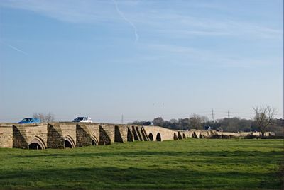
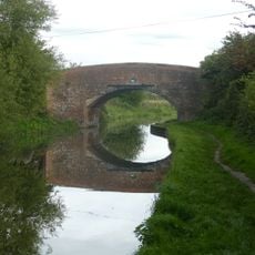
Swarkestone Bridge, Medieval road bridge and archaeological site in Swarkestone, England.
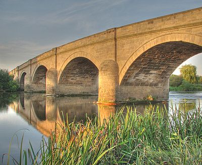
Swarkestone Bridge spans the River Trent with 17 arches and stretches for about a mile across the landscape. This stone structure rises above the water with irregular openings and also crosses several smaller waterways that feed the main river.
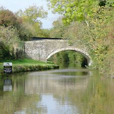
The bridge was built in stone in the 13th century from local sandstone, replacing an earlier wooden crossing. It has undergone repairs over time, but several of its original medieval arches remain standing.
The bridge served as a crossing point during the English Civil War, when opposing forces clashed here in battle. Today, the worn stones still carry traces of this turbulent period in English history.
Visitors can cross by car or on foot, though only lightweight vehicles are permitted due to weight restrictions. Walking across gives the best view of the entire structure and the countryside stretching below.
Several of the oldest arches date from the late 13th century and have never been substantially altered since. This remarkable age makes certain sections of the bridge a direct link to medieval stone construction techniques.
Location: Swarkestone
GPS coordinates: 52.85288,-1.45356
Latest update: December 7, 2025 20:47
Swarkestone Hall Pavilion
589 m
Church of St Wilfrid
1.6 km
Church of St Michael
1.4 km
St James’ Church, Swarkestone
312 m
Church of St Peter
2.2 km
Railway Bridge Over The River Trent
2.2 km
Church House
3.1 km
Swarkestone Lows round barrow cemetery and part of an aggregate field system 300m north west of The Lowes Farm
1 km
Ingleby Toft
2.4 km
Trent And Mersey Canal Lowes Bridge
683 m
Trent and Mersey Canal Swarkestone Lock and Bridge
702 m
Trent And Mersey Canal Sarson's Bridge
2.2 km
Crewe And Harpur Arms
89 m
Barrow upon Trent War Memorial at Twyford Road, Barrow-upon-Trent
1.7 km
Pair Of Gate Piers To North West Of Swarkestone Hall At Sk 372 287
357 m
Swarkestone Hall Farmhouse
569 m
Crofton House
3.1 km
Kings Newton House And Attached Gates And Outbuildings
3.2 km
58, Main Street
3.1 km
Chantry House
3 km
Trent And Mersey Canal, Canal Milepost At Sk 392 274
2.6 km
Trent And Mersey Canal, Canal Milepost At Swarkestone Stop Sk 368 291
598 m
Village Cross
3.2 km
Hardinge Arms
3 km
Trent And Mersey Canal, Canal Milepost To South Of Massey's Bridge At Sk 381 284
1.2 km
Lowes Farmhouse And Attached Farm Buildings
957 m
Cross House
3.2 km
Milepost, N of Cuttle Bridge
822 mVisited this place? Tap the stars to rate it and share your experience / photos with the community! Try now! You can cancel it anytime.
Discover hidden gems everywhere you go!
From secret cafés to breathtaking viewpoints, skip the crowded tourist spots and find places that match your style. Our app makes it easy with voice search, smart filtering, route optimization, and insider tips from travelers worldwide. Download now for the complete mobile experience.
A unique approach to discovering new places❞
— Le Figaro
All the places worth exploring❞
— France Info
A tailor-made excursion in just a few clicks❞
— 20 Minutes