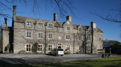
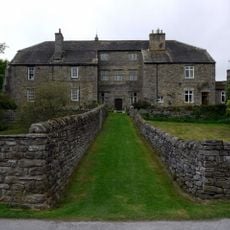
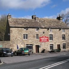
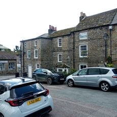
Horsley Hall, Country house hotel in Stanhope, England
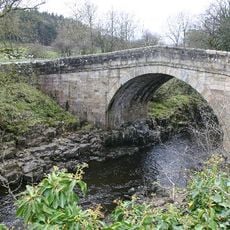
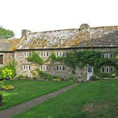
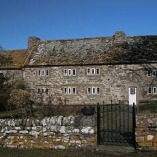
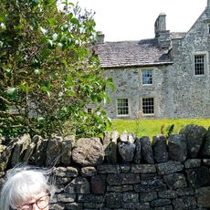
Horsley Hall is a country house standing near the River Wear with three floors and eight bays showing architectural features from different periods of construction. The building displays design elements that were added over several centuries.
The manor house originated in the 17th century and was expanded and modified throughout the 1800s by the Hildyard family. Several family members held the position of High Sheriff of Durham.
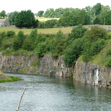
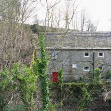
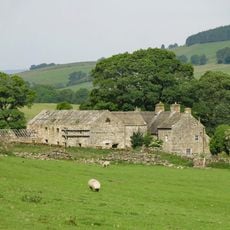
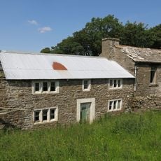
The house served for generations as the center of a farming operation and limestone quarrying site that supplied ore for steel production during World War II. This economic activity shaped the surrounding land and communities for many years.
The building sits in Durham countryside and functions today as a hotel for visitors. Parking and access to the grounds are available, though the remote location requires some travel to reach.
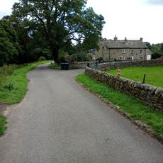
The estate encompasses farmlands and pastures that stretch for miles along the riverside, creating a generous rural property. These extensive grounds form a substantial holding within the river valley.
Location: Stanhope
GPS coordinates: 54.73912,-2.05590
Latest update: December 14, 2025 16:42
Greenfoot Quarry
2 km
All Saints
1.3 km
Eastgate War Memorial
1.3 km
Memorial Fountain At Junction With Road To Ford
2.9 km
Stanhope Castle
3.2 km
Bridge Over Rookhope Burn
1.3 km
Stanhope Hall
2.7 km
The Cross Keys Public House
1.4 km
Number 1 And Houses Adjoining In Butts Head, The Butts
3.3 km
Stanhope Bridge
2.2 km
Barn Range South Of Ludwell Farmhouse
2.2 km
Eastgate Mill
1.4 km
Westernhope Burn East Farmhouse
3 km
Ludwell Farmhouse
2.2 km
Numbers 1 - 4 Consecutive And Stables Attached
3.2 km
Stanhope Market Cross
3.3 km
Premises Formerly Occupied By J And G Archibald Limited
3.3 km
Shield Ash Farmhouse
2.1 km
Castle Wall Including Market Lodge, Gateway And Bus Shelter
3.3 km
North Lodge And Wall To Stanhope Castle (Castle Lodge)
3.2 km
Market cross, 35m and 50m south of St Thomas' Church
3.3 km
Former House And Byre, With Loose Boxes, South Of Ludwell Farmhouse Barn
2.2 km
Unthank Mill, Houses And Cow House Attached
3 km
Westernhopeburn West Farmhouse and adjoining outbuilding
3 km
Unthank Hall
2.8 km
Former Farmhouse To West Of Snowhope Close Farmhouse
1.6 km
200m W of jct B6275
2.5 km
Hare Law
1.1 kmVisited this place? Tap the stars to rate it and share your experience / photos with the community! Try now! You can cancel it anytime.
Discover hidden gems everywhere you go!
From secret cafés to breathtaking viewpoints, skip the crowded tourist spots and find places that match your style. Our app makes it easy with voice search, smart filtering, route optimization, and insider tips from travelers worldwide. Download now for the complete mobile experience.
A unique approach to discovering new places❞
— Le Figaro
All the places worth exploring❞
— France Info
A tailor-made excursion in just a few clicks❞
— 20 Minutes