Holmhills Community Park

Log in to your account

AroundUs is a community-driven map of interesting places, built by curious explorers like you. It grows with every review, story, and photo you share.
Connect to save your favorite spots, contribute locations, and create personalized routes.
Continue with Google
Continue with Apple
Continue with X
Continue with Facebook
Continue with email
By continuing, you accept our Terms and Conditions and our Privacy Policy
Create an account

Holmhills Community Park

Add to collection
Map
Suggest a change
Share

Holmhills Community Park, Neighborhood park in Cambuslang, Scotland

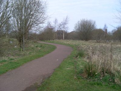
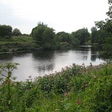
Holmhills Community Park is a green space in Cambuslang that combines wooded sections, wildflower meadows, and a pond connected by walking pathways. Different parts of the park include open sports fields, offering visitors a variety of landscapes within one location.

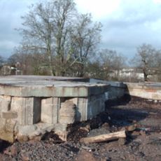
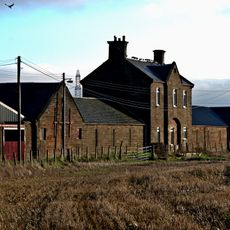
This site was once farmland used for raising cattle and growing grain before being converted into a public park during the 1960s. The change from agricultural use to a community green space marked a shift in how the area was developed.

Local schools use the park for health and outdoor education programs, showing how important this green space is for the community. You can see families and students exploring nature as part of their regular activities.

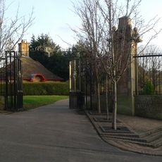
You can enter the park from several points along Greenlees Road, Western Road, Langlea Road, and Grenville Drive. Plan time to explore different sections, as the pathways connect various parts of the park for easy movement.

The park is regularly surveyed to track wildlife like herons and foxes living in their natural surroundings. This ongoing observation shows how nature thrives within a community space.

Location: South Lanarkshire

GPS coordinates: 55.81148,-4.17410

Latest update: December 14, 2025 18:03

Photos
Around this place
Cuningar Loop
United Kingdom

Cuningar Loop

3.6 km
Castlemilk House
United Kingdom

Castlemilk House

2.9 km
Gilbertfield Castle
United Kingdom

Gilbertfield Castle

1.7 km
Rutherglen Town Hall
United Kingdom

Rutherglen Town Hall

3.2 km
Auchenshuggle Bridge
United Kingdom

Auchenshuggle Bridge

2.7 km
Bogany Flats
United Kingdom

Bogany Flats

3.5 km
Mains Castle
United Kingdom

Mains Castle

3.8 km
Glasgow, Rutherglen, Main Street, St Columbkille's Roman Catholic Church
United Kingdom

Glasgow, Rutherglen, Main Street, St Columbkille's Roman Catholic Church

3.1 km
591 Tollcross Road, Tollcross House
United Kingdom

591 Tollcross Road, Tollcross House

3.9 km
Rutherglen, Main Street, Rutherglen Old Parish Church, Rutherglen Tower And Fragments Of Old Church
United Kingdom

Rutherglen, Main Street, Rutherglen Old Parish Church, Rutherglen Tower And Fragments Of Old Church

3.2 km
Castlemilk, 201 Ardencraig Road, St Martin's R.c. Church
United Kingdom

Castlemilk, 201 Ardencraig Road, St Martin's R.c. Church

3.1 km
Cambuslang, Cairns Road, Cambuslang Old Parish Church
United Kingdom

Cambuslang, Cairns Road, Cambuslang Old Parish Church

745 m
Dalmarnock railway bridge
United Kingdom

Dalmarnock railway bridge

3.7 km
Stonelaw Road, Stonelaw Parish Church
United Kingdom

Stonelaw Road, Stonelaw Parish Church

2.5 km
Dalmarnock Bridge
United Kingdom

Dalmarnock Bridge

3.6 km
Cambuslang, 37 Greenlees Road, Cambuslang Literary Institute
United Kingdom

Cambuslang, 37 Greenlees Road, Cambuslang Literary Institute

701 m
Rutherglen, Main Street, Old Parish Church, Dr Gorman's Statue
United Kingdom

Rutherglen, Main Street, Old Parish Church, Dr Gorman's Statue

3.2 km
Rutherglen, Main Street, St Columbkille's Roman Catholic Church, Presbytery
United Kingdom

Rutherglen, Main Street, St Columbkille's Roman Catholic Church, Presbytery

3.1 km
Rutherglen, 18 Farmeloan Road, Rutherglen East Church
United Kingdom

Rutherglen, 18 Farmeloan Road, Rutherglen East Church

2.9 km
Cambuslang, Western Golf Course, Dovecot
United Kingdom

Cambuslang, Western Golf Course, Dovecot

1.4 km
Mercat Cross, Main Street, Rutherglen, Glasgow
United Kingdom

Mercat Cross, Main Street, Rutherglen, Glasgow

3.1 km
Dalmarnock first railway bridge
United Kingdom

Dalmarnock first railway bridge

3.7 km
Rutherglen, Overtoun Park, Queen Victoria Jubilee Fountain
United Kingdom

Rutherglen, Overtoun Park, Queen Victoria Jubilee Fountain

2.7 km
Flemington Farm
United Kingdom

Flemington Farm

3.1 km
Cambuslang, Greenlees Road, Tabernacle Street
United Kingdom

Cambuslang, Greenlees Road, Tabernacle Street

837 m
Melrose Avenue, Stonelaw High School
United Kingdom

Melrose Avenue, Stonelaw High School

2.7 km
Mill Street, Overtoun Park, Gateway
United Kingdom

Mill Street, Overtoun Park, Gateway

2.9 km
Winter Gardens Nursery
United Kingdom

Winter Gardens Nursery

4 km
Show the full map
Reviews

Visited this place? Tap the stars to rate it and share your experience / photos with the community! Try now! You can cancel it anytime.

« Holmhills Community Park - Neighborhood park in Cambuslang, Scotland » is provided by Around Us (aroundus.com). Images and texts are derived from Wikimedia project under a Creative Commons license. You are allowed to copy, distribute, and modify copies of this page, under the conditions set by the license, as long as this note is clearly visible.

Discover hidden gems everywhere you go!

From secret cafés to breathtaking viewpoints, skip the crowded tourist spots and find places that match your style. Our app makes it easy with voice search, smart filtering, route optimization, and insider tips from travelers worldwide. Download now for the complete mobile experience.

Around Us App Screenshot

A unique approach to discovering new places

Le Figaro

All the places worth exploring

France Info

A tailor-made excursion in just a few clicks

20 Minutes