Enable Location

We need your location to show you interesting places around you

Discover nearby places

Find interesting locations and hidden gems around you

Precise directions

Get accurate directions and distances to places

Your location is never shared with other users. It's only used when you tap the location button.

Rotherfield Park

Log in to your account

Start exploring — it's free

Trusted by 63,919 travelers worldwide

Continue with Google
Continue with Apple
or

We will send you a code to connect

By continuing, you accept our Terms and Conditions and our Privacy Policy

Check your inbox

We've sent a pincode in your inbox. Please enter the code below.

Discussion Reviews 1 Photos
4.8k Popularity

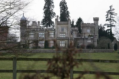
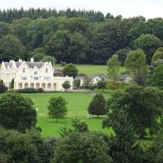
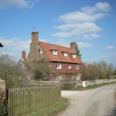
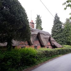
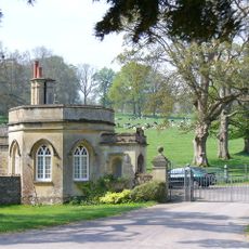
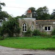
Rotherfield Park, Grade I listed country house in East Tisted, England

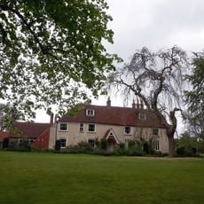
Rotherfield Park is a country house built between 1815 and 1821 with Tudor-Gothic styling that includes towers and crenellated battlements throughout its structure. The estate sits at an elevated location and features historic glasshouses in its gardens where peaches, apricots, and vines were grown.

The site was first recorded in 1015 as Hrytherafeld, meaning open pasture for cattle. It evolved into a medieval hunting park by the 16th century before the current house took its final form in the early 1800s.

The house appeared in the 1994 film Four Weddings and a Funeral, where it served as a Scottish castle for a key scene. This film connection has made it recognizable to audiences interested in cinema history, though the production itself is now decades past.

The estate is not open for regular visits but opens occasionally during National Gardens Scheme events held throughout the year. Visitors should check ahead for specific opening dates, as these are limited and happen only at particular times.

The elevated location at approximately 600 meters protects the historic fruit and vine crops from late spring frosts, which is crucial for growing delicate varieties. This natural advantage allowed earlier occupants to successfully cultivate peaches and other tender fruits in this part of England.

The community of curious travelers

AroundUs brings together thousands of curated places, local tips, and hidden gems, enriched daily by 60,000 contributors worldwide.

Start exploring
Location
GPS coordinates
51.08580,-1.00940
Latest update
December 10, 2025 20:03
Around this place
Farringdon Church Of England Primary School And Village Hall
United Kingdom

Farringdon Church Of England Primary School And Village Hall

3.5 km
Church of St Peter ad Vincula, Colemore
United Kingdom

Church of St Peter ad Vincula, Colemore

1.9 km
Pelham Place
United Kingdom

Pelham Place

1.3 km
Church of All Saints
United Kingdom

Church of All Saints

3.6 km
Church of St James
United Kingdom

Church of St James

649 m
Church of St Mary
United Kingdom

Church of St Mary

3 km
Table Tomb 2 Metres South Of The Church Tower
United Kingdom

Table Tomb 2 Metres South Of The Church Tower

3.6 km
Lower Woodside Farmhouse
United Kingdom

Lower Woodside Farmhouse

3.6 km
Upper Woodside Farm Cottage
United Kingdom

Upper Woodside Farm Cottage

3.5 km
Barn House
United Kingdom

Barn House

3 km
Newton Valence War Memorial
United Kingdom

Newton Valence War Memorial

2.9 km
Angerton
United Kingdom

Angerton

3.5 km
Cruck Cottage
United Kingdom

Cruck Cottage

3.5 km
Table Tomb 4 Metres South Of The Church Tower
United Kingdom

Table Tomb 4 Metres South Of The Church Tower

3.6 km
Barn 100 Metres South-West Of Manor House Farmhouse
United Kingdom

Barn 100 Metres South-West Of Manor House Farmhouse

3.5 km
Front Lodge
United Kingdom

Front Lodge

564 m
Cartshed 60 Metres South Of Manor House Farmhouse
United Kingdom

Cartshed 60 Metres South Of Manor House Farmhouse

3.6 km
The Drift
United Kingdom

The Drift

3.4 km
Churchyard Cross 10 Metres South Of The Church
United Kingdom

Churchyard Cross 10 Metres South Of The Church

3.6 km
Manor House Farmhouse
United Kingdom

Manor House Farmhouse

3.6 km
Lower Lodge
United Kingdom

Lower Lodge

1.2 km
Granary 50 Metres South Of Manor House Farmhouse
United Kingdom

Granary 50 Metres South Of Manor House Farmhouse

3.6 km
Milestone, Old Lodge
United Kingdom

Milestone, Old Lodge

3 km
Milestone, Winchester Road, Greenways Farm, just E of jct with Lapwing Way
United Kingdom

Milestone, Winchester Road, Greenways Farm, just E of jct with Lapwing Way

4.1 km
Milestone, Winchester Road, Four Marks
United Kingdom

Milestone, Winchester Road, Four Marks

3.8 km
Milestone, Lower Farringdon (July 15 reported moved 50m to grass in front of new brick garage)
United Kingdom

Milestone, Lower Farringdon (July 15 reported moved 50m to grass in front of new brick garage)

3.1 km
Milestone, Pelham Place
United Kingdom

Milestone, Pelham Place

1.7 km
Milestone, opp. a row of houses
United Kingdom

Milestone, opp. a row of houses

638 m
Show the full map
Reviews
Share your experience

No review yet

Discussions
Start a discussion...

No discussion yet

« Rotherfield Park - Grade I listed country house in East Tisted, England » is provided by Around Us (aroundus.com). Images and texts are derived from Wikimedia project under a Creative Commons license. You are allowed to copy, distribute, and modify copies of this page, under the conditions set by the license, as long as this note is clearly visible.

Discover hidden gems everywhere you go!

From secret cafés to breathtaking viewpoints, skip the crowded tourist spots and find places that match your style. Our app makes it easy with voice search, smart filtering, route optimization, and insider tips from travelers worldwide. Download now for the complete mobile experience.

Around Us App Screenshot

A unique approach to discovering new places

Le Figaro

All the places worth exploring

France Info

A tailor-made excursion in just a few clicks

20 Minutes

Around Us
Travel Guide & Maps
Download

Send to your phone

QR Code
1

Open the camera app on your mobile.

2

Point at the QR code with your camera. A notification will appear.

3

Tap the notification to open the link.