·

Enable Location

We need your location to show you interesting places around you

Discover nearby places

Find interesting locations and hidden gems around you

Precise directions

Get accurate directions and distances to places

Your location is never shared with other users. It's only used when you tap the location button.

Buarth-y-Gaer

Log in to your account

Start exploring — it's free

Trusted by 62,717 travelers worldwide

Continue with Google
Continue with Apple
or

We will send you a code to connect

By continuing, you accept our Terms and Conditions and our Privacy Policy

Check your inbox

We've sent a pincode in your inbox. Please enter the code below.

Buarth-y-Gaer

Buarth-y-Gaer, archaeological site in United Kingdom

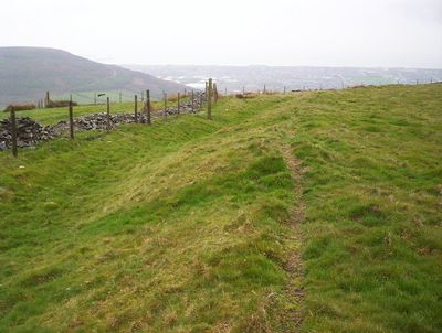
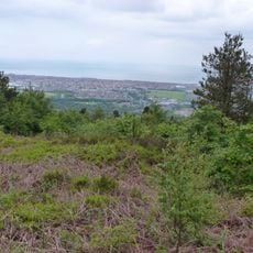
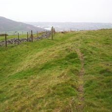
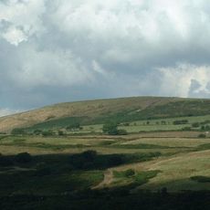
Buarth-y-Gaer is an archaeological site on a hilltop in South Wales, surrounded by earthen banks and a ditch that circle the summit. The enclosure covers roughly one and a quarter acres and sits about 300 meters above sea level, overlooking the Neath estuary and the town of Briton Ferry.

The site was built during the Iron Age, a period before written records, though exact dating remains under study. Inside the enclosure lies a Bronze Age burial mound that predates the hillfort itself, showing the long span of human activity at this location.

The name means 'Mountain of the Fort', yet the site appears to have served more as a gathering place than a military stronghold for its ancient inhabitants. People used this hilltop location to watch over the surrounding land and protect their community.

The site is easy to walk around and explore, with gentle grassy slopes that present no major difficulties for visitors. No modern buildings are nearby, so it remains quiet and pastoral, ideal for a peaceful walk while you study the historical remains and earthworks.

The site has been partly damaged by quarrying activity in the past, a reminder of how modern actions can affect ancient history. Yet the remaining earthworks and burial mound still tell a story spanning thousands of years and linking past inhabitants to visitors today.

The community of curious travelers

AroundUs brings together thousands of curated places, local tips, and hidden gems, enriched daily by 60,000 contributors worldwide.

Start exploring
GPS coordinates
51.62760,-3.78490
Latest update
February 9, 2026 07:43
« Buarth-y-Gaer - archaeological site in United Kingdom » is provided by Around Us (aroundus.com). Images and texts are derived from Wikimedia project under a Creative Commons license. You are allowed to copy, distribute, and modify copies of this page, under the conditions set by the license, as long as this note is clearly visible.

Discover hidden gems everywhere you go!

From secret cafés to breathtaking viewpoints, skip the crowded tourist spots and find places that match your style. Our app makes it easy with voice search, smart filtering, route optimization, and insider tips from travelers worldwide. Download now for the complete mobile experience.

Around Us App Screenshot

A unique approach to discovering new places

Le Figaro

All the places worth exploring

France Info

A tailor-made excursion in just a few clicks

20 Minutes

Around Us
Travel Guide & Maps
Download

Send to your phone

QR Code
1

Open the camera app on your mobile.

2

Point at the QR code with your camera. A notification will appear.

3

Tap the notification to open the link.