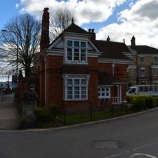
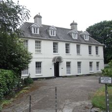
Acland, Landkey, Grade I listed building in Landkey, England
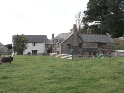
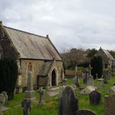
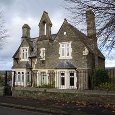
Acland is a large country house in Landkey featuring Tudor elements, including a wooden porch from 1591 and a private chapel on the grounds. The building preserves its original layout, though its main hall was altered later, and the rooms show how a wealthy family lived across many generations.
The house was founded in 1155 and served as the main home of the Acland family for nearly 800 years. The family once controlled about 40,000 acres across Devon until their connection to the estate ended in 1945.
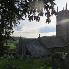
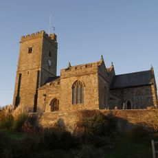
The chapel on the grounds holds memorials to the Acland family, who shaped the region over many centuries. Visitors can still sense the connection between this house and the local area through the family's long presence here.
The estate sits about 3 miles from Barnstaple in North Devon and is protected as a Grade I listed building. Visitors should note that this is a historic structure, and access to certain areas may vary depending on conservation needs.
The great hall was once altered when Hugh Acland had a ceiling inserted, which lowered the room's height. This change reveals how a family adapted their living spaces over time while keeping the original Tudor structure intact.
Location: Landkey
GPS coordinates: 51.07490,-4.00818
Latest update: December 14, 2025 11:40
Rock Park
3.2 km
Holy Trinity Church, Barnstaple
3.2 km
Church of St John the Baptist, Barnstaple
2.7 km
Church of St Gregory
1.7 km
Church of St Paul, Landkey
1.4 km
East Cemetery Chapel
2.8 km
Railings On North Side Of Rock Park
3.2 km
Milestone At Ss 5665 3206 Approximately 4 Metres North Of Park Lane
2.8 km
West Cemetery Chapel
2.9 km
Barnstaple War Memorial Including Posts and Chains
3.3 km
Landkey War Memorial
1.4 km
Salem Almshouses
3.3 km
Bowl barrow at Codden Beacon
3.2 km
Cemetery Lodge
2.8 km
1, Union Place
3.2 km
Milestone, Budd's Wood, 500m W of Chelfham viaduct, on riverside road
3.3 km
Milestone At Ss 5735 3331
2.2 km
Rock Park Lodge
3.1 km
Balustrade And Lamp Post To Rock Park Lodge
3.1 km
2, Union Place
3.2 km
Lamp Post At Junction Of New Road And Park Terrace
3.1 km
Pill House
3.2 km
Union Terrace
3.2 km
Milestone, Landkey Road, opp. Clinton Road, by "Brieryfields"
2.6 km
20, Litchdon Street
3.3 km
Milestone, 30m W of turn to Hayne
3.2 km
Milestone, S of Riversmead, half mile N of Snapper, on riverside road
2.6 km
Milestone, Goodleigh Road, E end of Goodleigh village
1.9 kmVisited this place? Tap the stars to rate it and share your experience / photos with the community! Try now! You can cancel it anytime.
Discover hidden gems everywhere you go!
From secret cafés to breathtaking viewpoints, skip the crowded tourist spots and find places that match your style. Our app makes it easy with voice search, smart filtering, route optimization, and insider tips from travelers worldwide. Download now for the complete mobile experience.
A unique approach to discovering new places❞
— Le Figaro
All the places worth exploring❞
— France Info
A tailor-made excursion in just a few clicks❞
— 20 Minutes