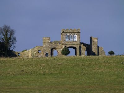
The Observatory, Folly observatory in Longhoughton, England
The Observatory is a square-plan tower built from rough-faced stone with refined ashlar details, standing on hollow-chamfered arches at the cliff top. The single interior room contains three large round-arched windows per wall, framing views toward Alnwick Castle and the North Sea.
Robert Adam designed this building between 1754 and 1770 for the first Duke of Northumberland, and it is now Grade I listed. It forms part of the architectural improvements Adam created across the duke's estate during that period.
This building was part of a series of viewpoints the first Duke of Northumberland created across the estate to enjoy his surrounding lands. These structures reveal how wealthy landowners of that era surveyed and appreciated their properties.
The location on a cliff top provides open views of the surroundings, but reaching it requires walking across uneven ground from Longhoughton. Access to the tower itself is limited, as the building is best appreciated from outside.
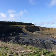
The cliff is named after 'heugh', a local Northumberland term for steep hills without water streams running through them. This linguistic detail reveals how place names preserve ancient geographic distinctions rooted in the region's language.
The community of curious travelers
AroundUs brings together thousands of curated places, local tips, and hidden gems, enriched daily by 60,000 contributors worldwide.