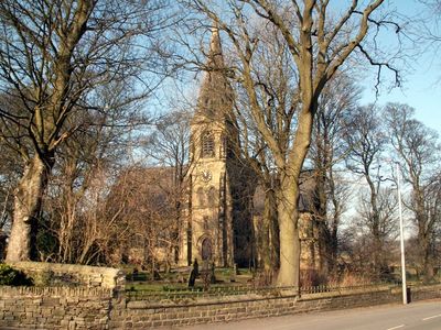
Church of St Thomas, Thurstonland, Gothic Revival church in Thurstonland, England
The Church of St Thomas is a Gothic Revival religious building with a three-level tower topped by a stone spire. Its windows display pointed arch shapes and geometric patterns including leaf-like cusps and four-lobed designs typical of the style.
The building was constructed in 1870 by local craftsmen under the direction of architects James Mallinson and William Swinden Barber. Nicholas North, Leonard North, and Joah Swallow were responsible for executing the construction work.
The church maintains burial records from 1862 to 1958, including graves of 2,000 patients from Kirkburton's Storthes Hall Hospital between 1904 and 1991.
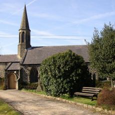
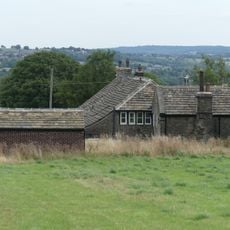
The building sits on Marsh Hall Lane and serves as a place for regular worship services and community gatherings throughout the week. Visitors should plan their visit respectfully, bearing in mind that it remains an active place of worship with scheduled services.
The interior features a distinctive roof construction system with angled timber supports that creates visual depth across the ceiling. The baptismal font from 1871 rests on four elegant marble columns, forming a surprising base for this ritual object.
Location: Kirkburton
Inception: 1870
Architectural style: Gothic Revival
Website: http://achurchnearyou.com/thurstonland-st-thomas
GPS coordinates: 53.59316,-1.75056
Latest update: December 12, 2025 12:04
Church of St George
1.5 km
Low Fold Farm The Post Office (The Village)
353 m
Brockholes War Memorial
1.3 km
Old Milestone
739 m
Marsh Hall Farmhouse and barn
446 m
Brockholes Village Hall
1.4 km
Lumb House Farmhouse
801 m
Old Guide Post At Junction With Wood Lane
1.4 km
Barn 10 yards to east of Number 9 Upper Fold Farmhouse
312 m
Dairy 100 yards to west of Blake House
561 m
West Royd Farmhouse
1.6 km
Ward Boundary Stone In Front Of No 24
1.5 km
72, The Village
275 m
5 Miles Post, 300 Yards North Of Junction With Calf Hill Road
1.8 km
54, The Village
296 m
Old Guide Post At Junction With Ing Head Lane
727 m
4, The Village
390 m
50 and 52, The Village
298 m
Old Guide Post At Junction With Stores Hall Road
1.6 km
Marsh Hall
447 m
Principal barn 50 yards to south west of Upper Fold Farmhouse
346 m
Barn 100 yards to north of Blake House
586 m
Small former barn now adjoining Number 5 Upper Fold Farmhouse
330 m
Upper Fold Farmhouse
321 m
Moor View Farmhouse
1.6 km
60, The Village
288 m
4.5 Mile Post Opposite Junction Of Brockholes Lane
1.5 km
Guidestone, Stocksmoor, Cross Lane
1.4 kmVisited this place? Tap the stars to rate it and share your experience / photos with the community! Try now! You can cancel it anytime.
Discover hidden gems everywhere you go!
From secret cafés to breathtaking viewpoints, skip the crowded tourist spots and find places that match your style. Our app makes it easy with voice search, smart filtering, route optimization, and insider tips from travelers worldwide. Download now for the complete mobile experience.
A unique approach to discovering new places❞
— Le Figaro
All the places worth exploring❞
— France Info
A tailor-made excursion in just a few clicks❞
— 20 Minutes