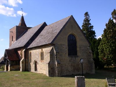
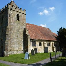
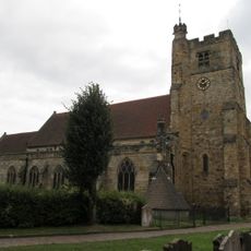
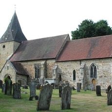
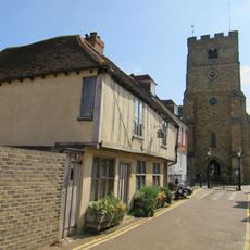
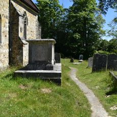
Church of All Saints, Grade I listed church in Capel, United Kingdom
The Church of All Saints is a medieval stone building with a square bell tower and a tiled roof covering the central nave and side aisles. The structure features timber-framed windows and a straightforward design typical of religious buildings from this period.
Construction started around 1450, making it one of the oldest religious buildings in the Kent region. The structure has survived and been maintained through the centuries as a lasting example of medieval church building.
The wooden pews and stone memorials inside show how people have gathered and remembered their dead here for generations. These objects tell the story of a community's faith and connection to the place.
The building is open during the week for visitors wanting to explore the interior and architecture at their own pace. Sunday services take place regularly, so plan a visit outside these times if you prefer to walk around undisturbed.
The bell tower contains three bells cast in different centuries, with the oldest made during King Henry VII's reign. These bells mark the long life of the building and show how it has continued to serve its community across generations.
Location: Capel
Inception: 15 century
Website: http://tudeley.org
GPS coordinates: 51.18490,0.31884
Latest update: December 8, 2025 19:56
Tonbridge Castle
3.4 km
Somerhill House
1.3 km
Church of St Thomas à Becket, Capel
1.8 km
Church of St Peter and St Paul
3.3 km
The Rose And Crown Hotel
3.3 km
Old Church of St Peter
2.5 km
Ye Olde Chequers Inn
3.3 km
Milking Parlour And Cider House Immediately South Of Park Farmhouse
708 m
The Man Of Kent Public House
3.2 km
Lake Bridge
2.3 km
Fairthorne House
2.4 km
The Red House
3.3 km
145 And 147, High Street
3.3 km
The Hermitage
3.1 km
Minerva House Minerva House Annexe
3.3 km
139, High Street
3.3 km
Little Hawkwell Farmhouse
3 km
Park Farmhouse
692 m
15, Bordyke
3.2 km
Tyger's Head
3.3 km
Downingbury Farm Barn
3.2 km
Downingbury Farmhouse
3.3 km
Tonbridge War Memorial
3.3 km
Terrace Walls Around The South And East Sides Of Somerhill Including The Sunken Lake Approximately 5 Metres North Of The Somerhill Stable Yard
1.3 km
Church Farmhouse Including Bakehouse Approximately 1.5 Metres to the East
59 m
Anonymous Chest Tomb Approximately 1.5 Metres South Of The Nave Of The Old Church Of St Peter
2.5 km
Oasthouse Approximately 5 Metres East Of Tatlingbury Farmhouse
1.7 km
Milestone, Penbury Road, at jct with A21, in cul de sac of old road
2.3 kmVisited this place? Tap the stars to rate it and share your experience / photos with the community! Try now! You can cancel it anytime.
Discover hidden gems everywhere you go!
From secret cafés to breathtaking viewpoints, skip the crowded tourist spots and find places that match your style. Our app makes it easy with voice search, smart filtering, route optimization, and insider tips from travelers worldwide. Download now for the complete mobile experience.
A unique approach to discovering new places❞
— Le Figaro
All the places worth exploring❞
— France Info
A tailor-made excursion in just a few clicks❞
— 20 Minutes