Buntingsdale Hall, Country house in Sutton upon Tern, England
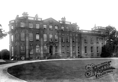
Buntingsdale Hall is a three-story country residence built of red brick with Georgian architectural details including fluted pilasters and a Corinthian stone doorcase. Sandstone dressings adorn the facade, and the property contains garden retaining walls, a kitchen garden, walled enclosure, boathouse, and fishpond beside the nearby River Tern.
Construction began in 1719 for Bulkeley Mackworth, with architect John Prince replaced by Francis Smith of Warwick during the project, completed in 1721. This change in leadership influenced the final Georgian design and execution of the building.
The Mackworth family insignia and crest appear on the rainwater heads, serving as visible markers of ownership. The initials 'BM' and the date '1721' inscribed here connect the building to its original patrons.
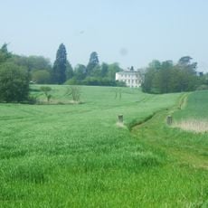
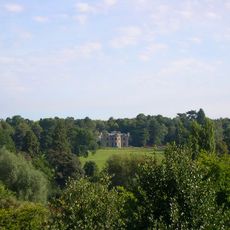
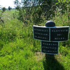
The property sits north of the River Tern with multiple garden areas and water features to explore on the grounds. Visiting works best from outside views since the hall remains private, and the surrounding landscape offers pleasant walks along the river and through the gardens.
From 1943 to 1972 the building served as Royal Air Force 22 Group headquarters, operating as a military center during and after World War II. The only significant update during those decades was a kitchen renovation in 1969.
Location: Sutton upon Tern
Inception: 1721
GPS coordinates: 52.88920,-2.51457
Latest update: December 12, 2025 14:22
Styche Hall
3.3 km
Pell Wall Hall
2.6 km
Market Drayton Methodist Church
2.2 km
Church of Saint Mary
2.6 km
Wollerton Old Hall Garden
4.3 km
Church of Saint Margaret
3.1 km
Church of St Peter
4.9 km
Star Hotel
2.7 km
Market Drayton Memorial Cross
2.7 km
Milepost Approximately 165 Metres To South East Of Lostford House Farmhouse
3.3 km
Clod Hall
4.6 km
The Sandbrook Vaults
2.6 km
Milestone Approximately 40 Metres To West Of Warran Farmhouse
1.7 km
Shropshire Union Canal Bridge Number 58
4 km
Wollerton Old Hall
4.2 km
Shropshire Union Canal Direction Post About 115 Metres South East Of Bridge Number 59
3.9 km
Milepost approximately 25 metres to south west of Fordhill Cottages
864 m
The Butter Market
2.6 km
Milepost Approximately 15 Metres To South West Of Stone Stone House
4.5 km
Shropshire Union Canal Milepost Circa 160 Metres South Of Bridge Number 61 At Sj 685 335
3.3 km
Milestone Approximately Twenty Metres To South West Of Number 5, Sweet Appletree
4.1 km
27, Shropshire Street
2.6 km
The Red House
2.5 km
Milestone Approximately 210 Metres To South East Of The Four Crosses Inn
5.6 km
Milepost Approximately 170 Metres To South Of Bridge Number 67
5.6 km
Milepost Approximately 1040 Metres To South Of Bridge Number 66
4.1 km
Milestone, S Bletchley
3 km
Milestone, Stafford Street; opp. no 33, outside Netto
2.8 kmVisited this place? Tap the stars to rate it and share your experience / photos with the community! Try now! You can cancel it anytime.
Discover hidden gems everywhere you go!
From secret cafés to breathtaking viewpoints, skip the crowded tourist spots and find places that match your style. Our app makes it easy with voice search, smart filtering, route optimization, and insider tips from travelers worldwide. Download now for the complete mobile experience.
A unique approach to discovering new places❞
— Le Figaro
All the places worth exploring❞
— France Info
A tailor-made excursion in just a few clicks❞
— 20 Minutes