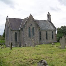
Cow Cave, Limestone cave and archaeological site in Chudleigh, England
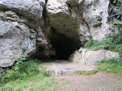
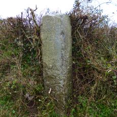
Cow Cave is a limestone cave system in Chudleigh with an arched entrance measuring about 4.5 meters high and 5 meters wide. The passages lead deeper into the rock, revealing layered deposits that tell the story of different periods over many thousands of years.
Humans made use of this cave during the Stone Age, with evidence showing occupation and activity from that distant time. Over subsequent millennia, natural deposits accumulated and preserved remains of animals that lived in and around the site.
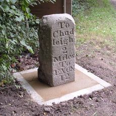
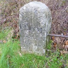
The name likely comes from cattle that once sheltered in the opening, though locals have used the designation for centuries. Walking through the passages today, you can sense the long human connection to this underground space.
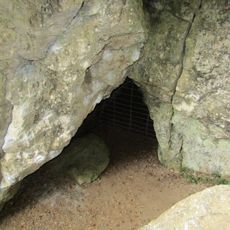
Entry requires special permission in advance, as a gate controls access to protect the delicate archaeological deposits inside. Wear sturdy shoes and bring a light source, since the passages can be slippery and dim even with the entrance open.
The site holds animal remains from ages when the climate was far colder and different beasts roamed the landscape. These bones and teeth offer clues about what Britain's environment looked like long before people settled here.
Location: Chudleigh
GPS coordinates: 50.59670,-3.60543
Latest update: December 14, 2025 14:41
Ugbrooke
1.2 km
Pixie's Hole
72 m
Hams Barton
2.2 km
The Town Hall
1 km
Church of St Paul
2.3 km
Church of St Mary and St Martin
780 m
Direction Post At Junction Of The Roads To Bovey Tracey And Ashburton, About 40M North-East Of St Paul's Church
2.3 km
Chudleigh War Memorial
975 m
The Bishop Lacy Public House
804 m
Milestone 13m NW of Fern Cottage
358 m
The Old Coaching House
873 m
Clay Cutters Arms
2.3 km
Longthorn Cottage
2.4 km
War Memorial Gateway to the North East of the Church of St. Paul
2.3 km
Chudleigh Bridge
752 m
Forsterville Lodge
2.5 km
Old Fairfield
656 m
Forsterville Cottages
2.5 km
Bridgeland Bridge
899 m
K6 Telephone Kiosks Outside Town Hall
1 km
7, Fore Street
938 m
Milestone At Sx 852 764
2.6 km
Lower Dunscombe Farmhouse
2.1 km
The Wheel
902 m
The Old House
734 m
The Obelisk
980 m
Direction Post At North-East Corner Of Huish Crossroads
2.6 km
Milestone, Stokelake, 30m from road bridge of River Teign at jct with B3193
787 mVisited this place? Tap the stars to rate it and share your experience / photos with the community! Try now! You can cancel it anytime.
Discover hidden gems everywhere you go!
From secret cafés to breathtaking viewpoints, skip the crowded tourist spots and find places that match your style. Our app makes it easy with voice search, smart filtering, route optimization, and insider tips from travelers worldwide. Download now for the complete mobile experience.
A unique approach to discovering new places❞
— Le Figaro
All the places worth exploring❞
— France Info
A tailor-made excursion in just a few clicks❞
— 20 Minutes