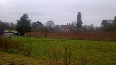
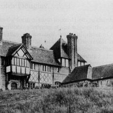
Iscoyd Park, Grade II* listed country house in Bronington, United Kingdom
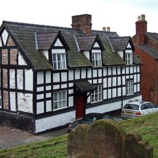
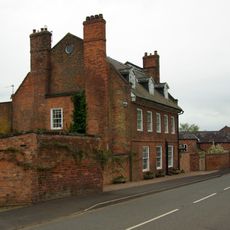
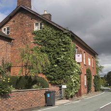
Iscoyd Park is a three-storey redbrick Georgian country house in Bronington featuring a slate roof and period architecture. The property sits within landscaped grounds that include multiple lakes and original service buildings scattered across the estate.
The estate came into William Hanmer's hands in 1737 and later passed to Philip Lake Godsal in 1843, beginning a lengthy family tenure. These ownership shifts shaped the property's evolution and the various changes made to it over generations.
The mansion maintains an extensive collection of family heirlooms, original artworks, and period furniture throughout its nine bedroom suites and reception rooms.
The estate now operates as an event venue with accommodation available and requires advance booking for visits and special occasions. Visitors should contact ahead to arrange their plans and confirm when they can view the grounds and buildings.
During World War II, American military forces converted the estate's parkland into a field hospital for their forces. The wartime alterations to the grounds remain visible in the property's layout today.
Location: Bronington
Elevation above the sea: 87.6 m
Part of: Iscoed Estate
GPS coordinates: 52.97280,-2.73932
Latest update: December 12, 2025 16:42
St Alkmund's Church
3.7 km
St Chad's Chapel, Tushingham
4.9 km
St Chad's Church, Tushingham
4.8 km
The Gelli
4.4 km
Churton Memorial Fountain
4.1 km
Church of the Holy Trinity
3.1 km
Church Of St Chad, Hanmer
5.5 km
St Mary's Church
1.1 km
Hanmer Churchyard Cross
5.5 km
Milestone Adjoining North East Front Of Number 46 (Victoria Hotel)
3.7 km
Church View
5.5 km
Bronington war memorial
2.9 km
Whitchurch War Memorial
4.2 km
Guide Post
3.7 km
Willeymoor Lock
4.4 km
Whitchurch Heritage Centre
3.8 km
Milestone Adjoining Number 3 A
3.8 km
Pan Castle
2.7 km
Guidepost
5.1 km
Pearl Farmhouse
4.7 km
The Bolling, with garden wall to left
5.5 km
Hanmer Arms
5.4 km
Guidepost
3.2 km
Milepost, S of Quoisley Lock on canal
5.4 km
Milepost, Sandhole Farm; 100m S of power lines
3.5 km
Milepost, S of Hill Top Farm
2.6 km
Milepost, N of B5395 jct, Grindley Brook, S of Willey Moor jct
2.2 km
Milepost, N of Bell o' th' Hill, opp. Church of St Chad, Tushingham
4.8 kmVisited this place? Tap the stars to rate it and share your experience / photos with the community! Try now! You can cancel it anytime.
Discover hidden gems everywhere you go!
From secret cafés to breathtaking viewpoints, skip the crowded tourist spots and find places that match your style. Our app makes it easy with voice search, smart filtering, route optimization, and insider tips from travelers worldwide. Download now for the complete mobile experience.
A unique approach to discovering new places❞
— Le Figaro
All the places worth exploring❞
— France Info
A tailor-made excursion in just a few clicks❞
— 20 Minutes