Enable Location

We need your location to show you interesting places around you

Discover nearby places

Find interesting locations and hidden gems around you

Precise directions

Get accurate directions and distances to places

Your location is never shared with other users. It's only used when you tap the location button.

Five Mile House

Log in to your account

Start exploring — it's free

Trusted by 62,957 travelers worldwide

Continue with Google
Continue with Apple
or

We will send you a code to connect

By continuing, you accept our Terms and Conditions and our Privacy Policy

Check your inbox

We've sent a pincode in your inbox. Please enter the code below.

Five Mile House
Discussion Reviews 1 Photos
1.3k Popularity

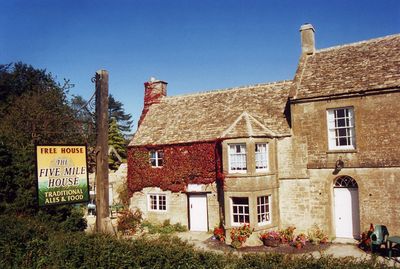
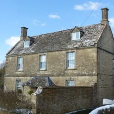
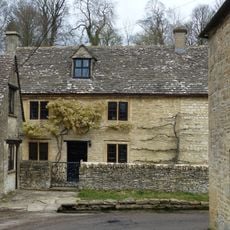
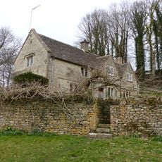
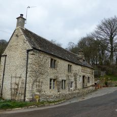
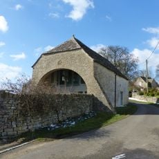
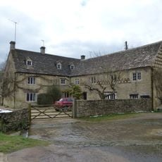
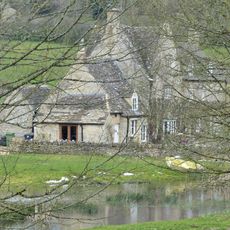
Five Mile House, Historical pub and Grade II listed building in Duntisbourne Abbots, England.

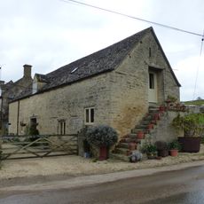
Five Mile House is a 17th-century building situated along the ancient Roman road Ermin Street, featuring traditional elements such as open fireplaces, bare wood floors, and simple wooden seating. After closing in 2015, the former pub was converted into residential accommodation.

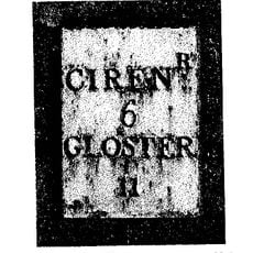
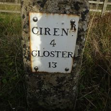
The building dates to the 17th century and stood at a strategic location along the Roman road Ermin Street. According to records from 1891, it was known at that time as the Old Inn.

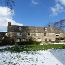
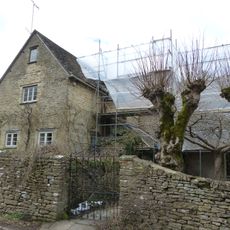
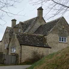
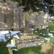
This property served as a gathering place for locals over many decades, particularly during the Ruck family's stewardship from the 1930s through the 1990s. Such establishments anchored community life in rural English villages.

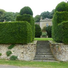
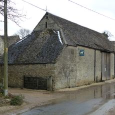
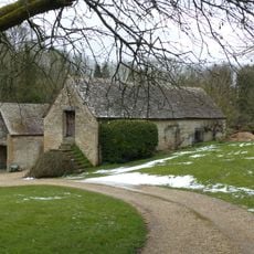
The property is visible from outside but is no longer open to visitors, as it now serves as a residence. The location on Gloucester Road in Duntisbourne Abbots is straightforward to find, though access is limited to viewing the exterior and surroundings from a distance.

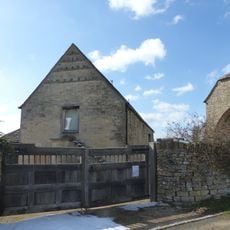
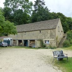
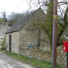
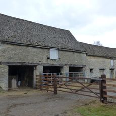
The property contains remnants of an old smithy in its garden, linking to the transportation history of the former Roman road. These surviving traces show how the location once served an important role in local trade routes.

The community of curious travelers

AroundUs brings together thousands of curated places, local tips, and hidden gems, enriched daily by 60,000 contributors worldwide.

Start exploring
Address
Gloucester Road, Duntisbourne Abbots, Cirencester, Gloucestershire, GL7 7JR
GPS coordinates
51.78025,-2.03306
Latest update
December 14, 2025 17:41
Around this place
Church of St Bartholomew
United Kingdom

Church of St Bartholomew

1.3 km
Davenport House
United Kingdom

Davenport House

1.4 km
Church of St Peter
United Kingdom

Church of St Peter

1.4 km
Unidentified monument in the churchyard approximately 2m south of porch to Church Of St Bartholomew
United Kingdom

Unidentified monument in the churchyard approximately 2m south of porch to Church Of St Bartholomew

1.3 km
Unidentified monument in the churchyard approximately 4.5m south of chancel to Church of St Bartholomew
United Kingdom

Unidentified monument in the churchyard approximately 4.5m south of chancel to Church of St Bartholomew

1.3 km
High Cottages
United Kingdom

High Cottages

1.8 km
Turner's
United Kingdom

Turner's

1.5 km
Whitehead's Well
United Kingdom

Whitehead's Well

1.4 km
Moor Wood
United Kingdom

Moor Wood

2.6 km
Barn approximately 3m north west of Croft Farmhouse
United Kingdom

Barn approximately 3m north west of Croft Farmhouse

1.4 km
Manor Farmhouse
United Kingdom

Manor Farmhouse

1.3 km
Milestone
United Kingdom

Milestone

1.4 km
Alice's House
United Kingdom

Alice's House

1.5 km
Open-fronted store west of the stables, Moor Wood
United Kingdom

Open-fronted store west of the stables, Moor Wood

2.5 km
Barn approximately 8 metres south of Duntisbourne Leer Farmhouse
United Kingdom

Barn approximately 8 metres south of Duntisbourne Leer Farmhouse

1.5 km
Barn and garages approximately 10m north of Croft Farmhouse
United Kingdom

Barn and garages approximately 10m north of Croft Farmhouse

1.4 km
Barn to south of Manor Farmhouse
United Kingdom

Barn to south of Manor Farmhouse

2.6 km
Trustams Mead
United Kingdom

Trustams Mead

1.5 km
Stables to south east of Manor Farmhouse
United Kingdom

Stables to south east of Manor Farmhouse

2.5 km
Duntisbourne Leer Farmhouse
United Kingdom

Duntisbourne Leer Farmhouse

1.5 km
Milestone
United Kingdom

Milestone

238 m
Well Hill
United Kingdom

Well Hill

1.5 km
Cartshed and granary with attached cowhouse across road and to south east of Manor Farmhouse
United Kingdom

Cartshed and granary with attached cowhouse across road and to south east of Manor Farmhouse

2.6 km
Footbridge to east of ford
United Kingdom

Footbridge to east of ford

2.6 km
Manor Farmhouse
United Kingdom

Manor Farmhouse

2.5 km
Churchyard cross in St Bartholomew's churchyard
United Kingdom

Churchyard cross in St Bartholomew's churchyard

1.3 km
Stables approximately 18 metres south east of Duntisbourne Leer Farmhouse
United Kingdom

Stables approximately 18 metres south east of Duntisbourne Leer Farmhouse

1.5 km
Milestone, N of Dartley farm (southbound carriageway)
United Kingdom

Milestone, N of Dartley farm (southbound carriageway)

1.8 km
Show the full map
Reviews
Share your experience

No review yet

Discussions
Start a discussion...

No discussion yet

« Five Mile House - Historical pub and Grade II listed building in Duntisbourne Abbots, England » is provided by Around Us (aroundus.com). Images and texts are derived from Wikimedia project under a Creative Commons license. You are allowed to copy, distribute, and modify copies of this page, under the conditions set by the license, as long as this note is clearly visible.

Discover hidden gems everywhere you go!

From secret cafés to breathtaking viewpoints, skip the crowded tourist spots and find places that match your style. Our app makes it easy with voice search, smart filtering, route optimization, and insider tips from travelers worldwide. Download now for the complete mobile experience.

Around Us App Screenshot

A unique approach to discovering new places

Le Figaro

All the places worth exploring

France Info

A tailor-made excursion in just a few clicks

20 Minutes

Around Us
Travel Guide & Maps
Download

Send to your phone

QR Code
1

Open the camera app on your mobile.

2

Point at the QR code with your camera. A notification will appear.

3

Tap the notification to open the link.