Enable Location

We need your location to show you interesting places around you

Discover nearby places

Find interesting locations and hidden gems around you

Precise directions

Get accurate directions and distances to places

Your location is never shared with other users. It's only used when you tap the location button.

Pawton Quoit

Log in to your account

Start exploring — it's free

Trusted by 61,619 travelers worldwide

Continue with Google
Continue with Apple
or

We will send you a code to connect

By continuing, you accept our Terms and Conditions and our Privacy Policy

Check your inbox

We've sent a pincode in your inbox. Please enter the code below.

Pawton Quoit

Pawton Quoit, Neolithic portal dolmen in Cornwall, United Kingdom

Description

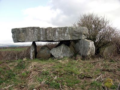
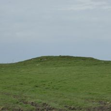
Pawton Quoit is a Neolithic burial chamber in Cornwall built from stone blocks arranged as a simple passage grave. The structure stands on a north-facing ridge near St Breock with three supporting stones holding up a massive capstone that has broken over time.

History

This burial site was constructed between 3500 and 2600 BC during the Neolithic period. Early maps from 1813 labeled it as 'Druid's Altar', reflecting how people reinterpreted the ancient structure through their own cultural lens.

Culture

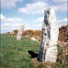
The site represents one of twenty portal dolmens discovered in Britain, with most concentrated in Cornwall and several found in Oxfordshire.

Practical

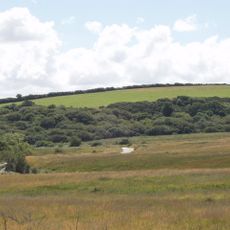
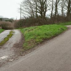
The site sits on an open ridge requiring a walk through country roads and fields to reach it from the nearest parking areas. The exposed location means weather can be changeable, so come prepared for wind and potential rain.

Did you know?

The capstone weighs roughly 14,400 kilograms, making it the heaviest of all similar monuments in the county. This massive stone has remained in place for thousands of years despite exposure to the elements on the open ridge.

GPS coordinates
50.49081,-4.86920
Latest update
December 14, 2025 17:02

AroundUs brings together thousands of curated places, local tips, and hidden gems, enriched daily by 60,000 contributors worldwide. Discover all places nearby (United Kingdom).

Around this place
Nine Maidens stone row
United Kingdom

Nine Maidens stone row

3.6 km
St Breock Downs Monolith
United Kingdom

St Breock Downs Monolith

1.3 km
Rosenannon Downs
United Kingdom

Rosenannon Downs

2.4 km
Town Hall
United Kingdom

Town Hall

3.6 km
Church of St Breock
United Kingdom

Church of St Breock

2.4 km
The Molesworth Arms Hotel
United Kingdom

The Molesworth Arms Hotel

3.6 km
Police Station
United Kingdom

Police Station

3.5 km
Regal Cinema
United Kingdom

Regal Cinema

3.6 km
1 and 2, Whiterock Terrace
United Kingdom

1 and 2, Whiterock Terrace

3.4 km
Milestone At Sw 935680
United Kingdom

Milestone At Sw 935680

3.4 km
Milestone 300 Metres To South West Of Whitecross
United Kingdom

Milestone 300 Metres To South West Of Whitecross

2.3 km
Tollgate House
United Kingdom

Tollgate House

3 km
The Conservative Club
United Kingdom

The Conservative Club

3.6 km
Wadebridge Bridge
United Kingdom

Wadebridge Bridge

3.8 km
Milestone 300 Metres To North East Of Trevear Farm
United Kingdom

Milestone 300 Metres To North East Of Trevear Farm

2.7 km
108, Egloshayle Road
United Kingdom

108, Egloshayle Road

4.1 km
Tredruston Farmhouse And Garden Wall To North
United Kingdom

Tredruston Farmhouse And Garden Wall To North

1.6 km
Bowl barrow 540m WSW of St Breock Downs Farm
United Kingdom

Bowl barrow 540m WSW of St Breock Downs Farm

1.7 km
Guide Post 1400 Metres To South Of Cannalidgey
United Kingdom

Guide Post 1400 Metres To South Of Cannalidgey

3.1 km
Medieval wayside cross at Whitecross, near Wadebridge
United Kingdom

Medieval wayside cross at Whitecross, near Wadebridge

2.4 km
Wayside cross in Egloshayle churchyard, 0.46m east of the church porch
United Kingdom

Wayside cross in Egloshayle churchyard, 0.46m east of the church porch

4.2 km
Milestone 250 Metres To South Of Hawksland
United Kingdom

Milestone 250 Metres To South Of Hawksland

1.8 km
Milestone 250 Metres To East Of St Issey
United Kingdom

Milestone 250 Metres To East Of St Issey

4.1 km
Milestone 250 Metres To South Of Hawksland
United Kingdom

Milestone 250 Metres To South Of Hawksland

1.8 km
2 Headstones Samuel King And Jane Peers And Tombchest Of William Norway 1 Metre To South Of West Tower Of Egloshayle Church
United Kingdom

2 Headstones Samuel King And Jane Peers And Tombchest Of William Norway 1 Metre To South Of West Tower Of Egloshayle Church

4.2 km
Walls And Steps To North East Of Whiterock Terrace
United Kingdom

Walls And Steps To North East Of Whiterock Terrace

3.4 km
Milestone 250 Metres To South West Of Halfway House
United Kingdom

Milestone 250 Metres To South West Of Halfway House

2.2 km
Milestone 300 Metres To South West Of Trevanson
United Kingdom

Milestone 300 Metres To South West Of Trevanson

3.1 km
Show the full map
« Pawton Quoit - Neolithic portal dolmen in Cornwall, United Kingdom » is provided by Around Us (aroundus.com). Images and texts are derived from Wikimedia project under a Creative Commons license. You are allowed to copy, distribute, and modify copies of this page, under the conditions set by the license, as long as this note is clearly visible.

Discover hidden gems everywhere you go!

From secret cafés to breathtaking viewpoints, skip the crowded tourist spots and find places that match your style. Our app makes it easy with voice search, smart filtering, route optimization, and insider tips from travelers worldwide. Download now for the complete mobile experience.

Around Us App Screenshot

A unique approach to discovering new places

Le Figaro

All the places worth exploring

France Info

A tailor-made excursion in just a few clicks

20 Minutes

Around Us
Travel Guide & Maps
Download

Send to your phone

QR Code
1

Open the camera app on your mobile.

2

Point at the QR code with your camera. A notification will appear.

3

Tap the notification to open the link.