Enable Location

We need your location to show you interesting places around you

Discover nearby places

Find interesting locations and hidden gems around you

Precise directions

Get accurate directions and distances to places

Your location is never shared with other users. It's only used when you tap the location button.

Harthill Hall

Log in to your account

Start exploring — it's free

Trusted by 62,557 travelers worldwide

Continue with Google
Continue with Apple
or

We will send you a code to connect

By continuing, you accept our Terms and Conditions and our Privacy Policy

Check your inbox

We've sent a pincode in your inbox. Please enter the code below.

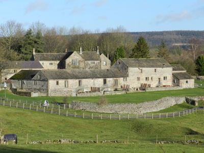
Harthill Hall, farmhouse in Harthill, Derbyshire Dales, Derbyshire, UK

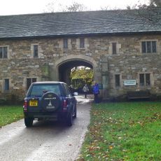
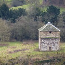
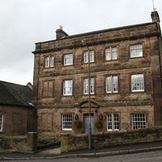
Harthill Hall is a 16th-century stone house in Harthill, Derbyshire, listed as Grade II, with roots dating back to the 13th century. The complex contains original features such as carved oak doors, heavy wooden beams, and flagstone floors that display the craftsmanship of past centuries.

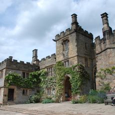
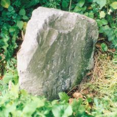
The site was founded in 1259 when Sir Richard de Hartle received permission to build a chapel and appoint a chaplain. The main building we see today was constructed in the 16th century, representing a later phase of development on this long-occupied land.

The hall takes its name from an early landowner, reflecting how medieval settlements grew around large estates and their families. Today it operates as a residential property where visitors experience how the buildings once served both household and agricultural purposes.

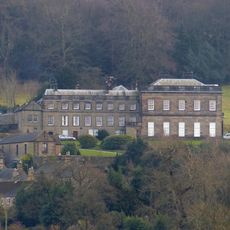
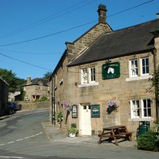
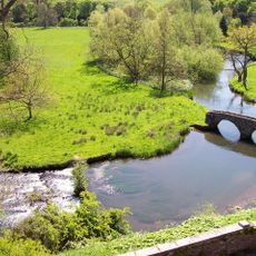
The estate sits just outside Bakewell and is easily reached via a country road, with convenient access to local pubs and cafes. It sits near the Peak District National Park, putting walking and cycling paths within reach from the property itself.

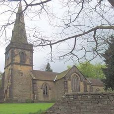
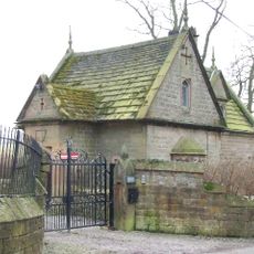
A 14th-century chapel stands on the grounds, older than the main house, showing this was a religious and community center for centuries. A restored knot garden employs traditional planting styles that recreate historical garden methods now largely lost elsewhere.

The community of curious travelers

AroundUs brings together thousands of curated places, local tips, and hidden gems, enriched daily by 60,000 contributors worldwide.

Start exploring
Location
GPS coordinates
53.17867,-1.65845
Latest update
February 9, 2026 07:45
Around this place
Haddon Hall
United Kingdom

Haddon Hall

1.8 km
Stanton Hall
United Kingdom

Stanton Hall

1.3 km
Holy Trinity Church, Stanton-in-Peak
United Kingdom

Holy Trinity Church, Stanton-in-Peak

1.3 km
All Saints’ Church, Youlgreave
United Kingdom

All Saints’ Church, Youlgreave

1.7 km
The Flying Childers Inn
United Kingdom

The Flying Childers Inn

1.2 km
Western gatepiers and gates to All Saints Churchyard
United Kingdom

Western gatepiers and gates to All Saints Churchyard

1.8 km
Mill Bridge
United Kingdom

Mill Bridge

726 m
Main bridge over River Wye at Haddon Hall
United Kingdom

Main bridge over River Wye at Haddon Hall

1.7 km
Coal Pit Bridge
United Kingdom

Coal Pit Bridge

1.6 km
Hawley Bridge 100 metres north north east of Harthill Lodge
United Kingdom

Hawley Bridge 100 metres north north east of Harthill Lodge

272 m
Footbridge over River Bradford 60 metres south west of Bedford House
United Kingdom

Footbridge over River Bradford 60 metres south west of Bedford House

1.7 km
Dorothy Vernon's Bridge over River Wye
United Kingdom

Dorothy Vernon's Bridge over River Wye

1.7 km
All Saints School and School House
United Kingdom

All Saints School and School House

1.7 km
Raper Lodge
United Kingdom

Raper Lodge

1.6 km
Milestone 15 Metres North Of Stoney Ley Lodge
United Kingdom

Milestone 15 Metres North Of Stoney Ley Lodge

1.1 km
Entrance Gatehouse to Haddon Hall
United Kingdom

Entrance Gatehouse to Haddon Hall

1.6 km
Rock House
United Kingdom

Rock House

836 m
Barn at Harthill Hall Farm
United Kingdom

Barn at Harthill Hall Farm

38 m
Milestone North Of Entrance To Haddon Barn
United Kingdom

Milestone North Of Entrance To Haddon Barn

1.6 km
Road bridge over River Bradford
United Kingdom

Road bridge over River Bradford

1.7 km
Pigeoncote 20 metres north west of entrance gatehouse to Haddon Hall
United Kingdom

Pigeoncote 20 metres north west of entrance gatehouse to Haddon Hall

1.7 km
Packhorse bridge over River Bradford 120 metres south east of Braemar House
United Kingdom

Packhorse bridge over River Bradford 120 metres south east of Braemar House

1.6 km
Ravenstor Close and attached garage
United Kingdom

Ravenstor Close and attached garage

1.3 km
Lathkill House Farmhouse
United Kingdom

Lathkill House Farmhouse

933 m
Sundial 10 metres south west of All Saints Church porch
United Kingdom

Sundial 10 metres south west of All Saints Church porch

1.7 km
Holly House
United Kingdom

Holly House

1.2 km
The Lodge
United Kingdom

The Lodge

844 m
Milestone, near Oxclose Wood, S of A6 jct
United Kingdom

Milestone, near Oxclose Wood, S of A6 jct

427 m
Show the full map
« Harthill Hall - farmhouse in Harthill, Derbyshire Dales, Derbyshire, UK » is provided by Around Us (aroundus.com). Images and texts are derived from Wikimedia project under a Creative Commons license. You are allowed to copy, distribute, and modify copies of this page, under the conditions set by the license, as long as this note is clearly visible.

Discover hidden gems everywhere you go!

From secret cafés to breathtaking viewpoints, skip the crowded tourist spots and find places that match your style. Our app makes it easy with voice search, smart filtering, route optimization, and insider tips from travelers worldwide. Download now for the complete mobile experience.

Around Us App Screenshot

A unique approach to discovering new places

Le Figaro

All the places worth exploring

France Info

A tailor-made excursion in just a few clicks

20 Minutes

Around Us
Travel Guide & Maps
Download

Send to your phone

QR Code
1

Open the camera app on your mobile.

2

Point at the QR code with your camera. A notification will appear.

3

Tap the notification to open the link.