Enable Location

We need your location to show you interesting places around you

Discover nearby places

Find interesting locations and hidden gems around you

Precise directions

Get accurate directions and distances to places

Your location is never shared with other users. It's only used when you tap the location button.

St Leonard's Church

Log in to your account

Start exploring — it's free

Trusted by 62,525 travelers worldwide

Continue with Google
Continue with Apple
or

We will send you a code to connect

By continuing, you accept our Terms and Conditions and our Privacy Policy

Check your inbox

We've sent a pincode in your inbox. Please enter the code below.

St Leonard's Church

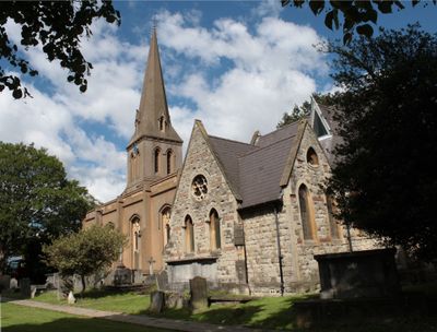
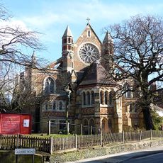
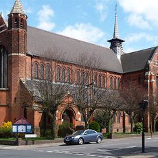
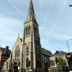
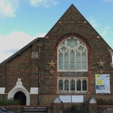
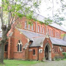
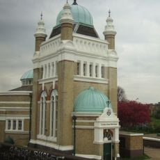
St Leonard's Church, Anglican parish church in Streatham, England

St Leonard's Church is an Anglican parish church in Streatham that features a 14th-century tower forming its base with a stone chancel added in 1863 designed by William Dyce. The building blends its medieval tower foundation with later additions that developed its overall shape and character over time.

The church was first documented in 1301, establishing itself as a long-standing center of community and spiritual life in the parish. In the 19th century, it underwent major reconstruction in 1830 under architect Joseph T. Parkinson, which reshaped its physical form.

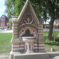
The Streatham Window displays symbols of St Leonard alongside the coats of arms from Winchester, Rochester, and Southwark dioceses that once covered this parish. The window tells the story of how the local community was religiously connected to these broader church centers.

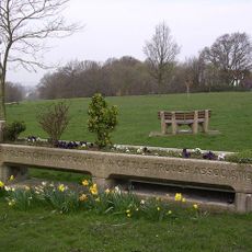
The church holds regular services and makes its community hall available for local events, with current information accessible through its website and YouTube channel. Visitors can check these digital resources to learn about opening times and what to expect during their visit.

In 1394, John Brabourne sought sanctuary in the church during a property dispute and required King Richard II to intervene for his release. The incident reveals how this location served as a refuge for people in danger during medieval times.

The community of curious travelers

AroundUs brings together thousands of curated places, local tips, and hidden gems, enriched daily by 60,000 contributors worldwide.

Start exploring
Inception
14 century
GPS coordinates
51.42954,-0.13160
Latest update
December 13, 2025 12:25
Around this place
Tooting Commons
United Kingdom

Tooting Commons

1.1 km
The Priory
United Kingdom

The Priory

1.2 km
Streatham Library
United Kingdom

Streatham Library

298 m
Streatham War Memorial
United Kingdom

Streatham War Memorial

708 m
Former Streatham Hill Theatre
United Kingdom

Former Streatham Hill Theatre

1.3 km
St Peter's Church
United Kingdom

St Peter's Church

1.2 km
Church of St Margaret
United Kingdom

Church of St Margaret

1.3 km
Roman Catholic Church of the English Martyrs
United Kingdom

Roman Catholic Church of the English Martyrs

74 m
Streatham Methodist Church
United Kingdom

Streatham Methodist Church

516 m
Mitcham Lane Baptist Church
United Kingdom

Mitcham Lane Baptist Church

1.4 km
Streatham United Reformed Church
United Kingdom

Streatham United Reformed Church

592 m
ABC Streatham
United Kingdom

ABC Streatham

873 m
Trinity Reformed Church
United Kingdom

Trinity Reformed Church

492 m
Parish Church of St Alban
United Kingdom

Parish Church of St Alban

937 m
Yew Tree Lodge
United Kingdom

Yew Tree Lodge

925 m
St Thomas with St Stephen
United Kingdom

St Thomas with St Stephen

1.4 km
Waterworks Pumping Station
United Kingdom

Waterworks Pumping Station

834 m
496, Streatham High Road Sw6
United Kingdom

496, Streatham High Road Sw6

1.1 km
Mill Building On South Side Of Factory Square, Ten Yards To West Of Number 496 Streatham High Road
United Kingdom

Mill Building On South Side Of Factory Square, Ten Yards To West Of Number 496 Streatham High Road

1.2 km
Dyce Drinking Fountain
United Kingdom

Dyce Drinking Fountain

139 m
Furzedown Lodge
United Kingdom

Furzedown Lodge

1.3 km
No. 269 Leigham Court Road And Associated Patios, Paved Surfaces And Walls
United Kingdom

No. 269 Leigham Court Road And Associated Patios, Paved Surfaces And Walls

1.3 km
Main Building Of Sunnyhill Junior Mixed And Infants School
United Kingdom

Main Building Of Sunnyhill Junior Mixed And Infants School

799 m
Gates, Gates Piers And Flanking Walls At Main Entrance To St Michael's Convent
United Kingdom

Gates, Gates Piers And Flanking Walls At Main Entrance To St Michael's Convent

1.3 km
Trough With Drinking Fountain
United Kingdom

Trough With Drinking Fountain

1.2 km
Leigham Lodge
United Kingdom

Leigham Lodge

800 m
Streatham Civilians War Memorial
United Kingdom

Streatham Civilians War Memorial

716 m
Milestone, Streatham High Road, in front of Kwik-fit garage
United Kingdom

Milestone, Streatham High Road, in front of Kwik-fit garage

475 m
Show the full map
« St Leonard's Church - Anglican parish church in Streatham, England » is provided by Around Us (aroundus.com). Images and texts are derived from Wikimedia project under a Creative Commons license. You are allowed to copy, distribute, and modify copies of this page, under the conditions set by the license, as long as this note is clearly visible.

Discover hidden gems everywhere you go!

From secret cafés to breathtaking viewpoints, skip the crowded tourist spots and find places that match your style. Our app makes it easy with voice search, smart filtering, route optimization, and insider tips from travelers worldwide. Download now for the complete mobile experience.

Around Us App Screenshot

A unique approach to discovering new places

Le Figaro

All the places worth exploring

France Info

A tailor-made excursion in just a few clicks

20 Minutes

Around Us
Travel Guide & Maps
Download

Send to your phone

QR Code
1

Open the camera app on your mobile.

2

Point at the QR code with your camera. A notification will appear.

3

Tap the notification to open the link.