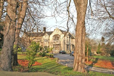
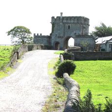
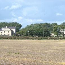
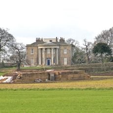
Monk Fryston Hall, Historic country house in Monk Fryston, England
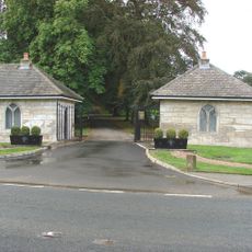
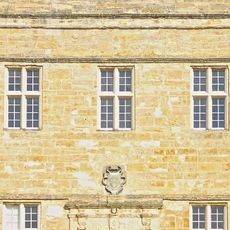
Monk Fryston Hall is a country house set within 66 acres of parkland in Yorkshire, England. The building features Magnesian Limestone construction and is covered with distinctive stone slate roofing throughout.
The house was founded in the 13th century for Selby Abbey and underwent major renovation in 1740. Further renovations followed in 1897 when new rooms were added.
The hall was built following Yorkshire traditions and displays regional craftsmanship methods that have been used since medieval times. The limestone walls and slate roofing reflect the area's characteristic building style.
The house sits near the A63 road and is easily accessible from the major motorways A1(M) and M62. Today it operates as a hotel, allowing visitors to experience the historic setting firsthand.
The building preserves elements from different building periods and shows how it changed over centuries. A 20th-century kitchen range was added to the original medieval structure.
Location: Monk Fryston
GPS coordinates: 53.76260,-1.23368
Latest update: December 14, 2025 14:42
Church of All Saints, Ledsham
5 km
Church of St Mary
4.1 km
Church of All Saints
4.1 km
Church of St Edward, Brotherton
4.8 km
Church of St Mary
2.1 km
Church of St Wilfrid
145 m
Milestone Approximately Ten Metres North Of Junction With Byram Park Road
4.7 km
Methodist Church
180 m
Sherburn-in-Elmet Library
4.1 km
Brotherton Tubular Bridge
5 km
Monk Fryston Lodge
1.8 km
Milestone Approximately 70 Metres South Of Junction With Back Lane
5.4 km
Ferrybridge "A" Power Station
5.7 km
Brotherton Railway Bridge
5 km
Milestone Approximately 0.2 Miles South Of Junction With Betteras Hill Road
1.7 km
Milestone Approximately Fifty Metres South Of Junction With Burton Salmon Lane
3.3 km
Ledston Lodge
5.7 km
Aire bridge
4.7 km
Milestone Approximately 0.4 Miles East Of Junction With A162
725 m
Steeton Hall Gatehouse
2.7 km
Steeton Hall
2.7 km
Gateforth Hall
5 km
Milestone Approximately 0.5 Miles East Of Junction With Lowfield Road
2.4 km
Milestone Approximately 0.4 Miles From Junction With Selby And Leeds Road (A63)
1.2 km
Milestone Approximately 0.1 Mile South Of Junction With Betteras Hill Road
1.5 km
Milestone, Milford Road N end of South Milford S of rly bridge
2.2 km
Milestone, Low Street, Sherburn opp Cliff Garage
3.8 km
Milestone, Church St, Brotherton
4.7 kmVisited this place? Tap the stars to rate it and share your experience / photos with the community! Try now! You can cancel it anytime.
Discover hidden gems everywhere you go!
From secret cafés to breathtaking viewpoints, skip the crowded tourist spots and find places that match your style. Our app makes it easy with voice search, smart filtering, route optimization, and insider tips from travelers worldwide. Download now for the complete mobile experience.
A unique approach to discovering new places❞
— Le Figaro
All the places worth exploring❞
— France Info
A tailor-made excursion in just a few clicks❞
— 20 Minutes