
High Wigsell, architectural structure in Salehurst and Robertsbridge, Rother, East Sussex, UK
Location: Salehurst and Robertsbridge
GPS coordinates: 51.00984,0.51285
Latest update: March 4, 2025 20:36
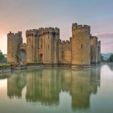
Bodiam Castle
2.3 km
The Seven Stars Inn
3.8 km
Bethel Strict Baptist Chapel, Robertsbridge
3.8 km
Robertsbridge United Reformed Church
3.8 km
Robertsbridge Abbey
2.6 km
Iridge Place
2.7 km
Bodiam Station
2.4 km
The Parish Church of St Giles
1.9 km
The Parish Church of St James
3.7 km
The Parish Church of St Mary
2.6 km
Church of St Laurence
3.2 km
Church of St Nicholas
2.8 km
The Curlew Inn
213 m
A quadrangular castle and its landscaped setting, an associated millpond, medieval crofts and cultivation earthworks, and a World War II pillbox at Bodiam
2.3 km
The Post Office
3.7 km
Great Wigsell
1 km
Old School House
1.9 km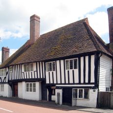
Monk's Cottage, Rother
3.4 km
Robertsbridge War Memorial Clock Tower
3.9 km
Abbey Ruins
2.7 km
The Oasthouses and Granary at Great Wigsell to the Northwest of the House
1 km
Large Barn at Great Wigsell to the Southeast of the House
969 m
Milestone Opposite Sandhurst Farm Shop
3.8 km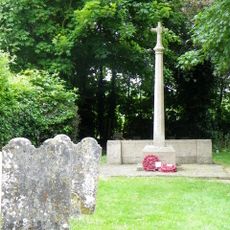
Ewhurst Green War Memorial
3.7 km
Bodiam Bridge
2.2 km
The Mill House
2 km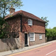
1, High Street
3.7 km
Milestone, Rye Road, E of "Clayhill"
3.9 kmReviews
Visited this place? Tap the stars to rate it and share your experience / photos with the community! Try now! You can cancel it anytime.
Discover hidden gems everywhere you go!
From secret cafés to breathtaking viewpoints, skip the crowded tourist spots and find places that match your style. Our app makes it easy with voice search, smart filtering, route optimization, and insider tips from travelers worldwide. Download now for the complete mobile experience.

A unique approach to discovering new places❞
— Le Figaro
All the places worth exploring❞
— France Info
A tailor-made excursion in just a few clicks❞
— 20 Minutes