
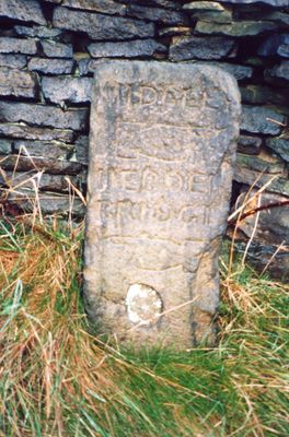
Guide Post At Se 015270 20 Metres To West Of Rough Bottom
Guide Post At Se 015270 20 Metres To West Of Rough Bottom, fingerpost in Hebden Royd, Calderdale, West Yorkshire, UK
Location: Hebden Royd
Inception: 18 century
GPS coordinates: 53.73974,-1.97758
Latest update: March 3, 2025 02:43
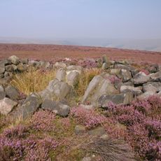
Cairn known as Millers Grave on Midgley Moor
1.4 km
Church of St Michael
1.1 km
Hawks Clough Bridge
1.1 km
Mytholmroyd Library
1.7 km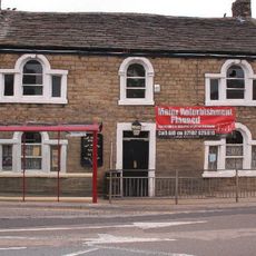
The Dusty Miller Public House And Attached Barn
1 km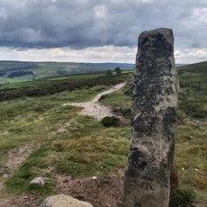
Cup marked boundary stone known as Churn Milk Joan on Crow Hill, Midgley Moor, 580m north of Foster Clough Bridge
756 m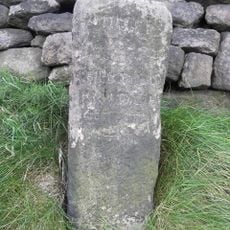
Guidestone, Wadsworth Lane jct Rowland Lane/Burlees Lane
1.5 km
Mytholmroyd War Memorial at Se 012260 50 Metres to East of the Dusty Miller Public House
1 km
Wadsworth Banks Farmhouse
280 m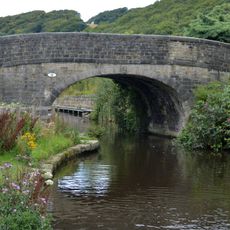
Rochdale Canal Redacre Bridge
921 m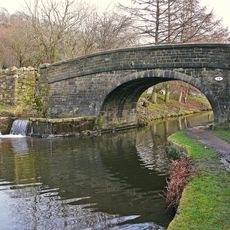
Rochdale Canal Broadbottom Bridge
1 km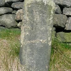
Guide Post At Se 000272 At Junction Of Burlees Lane
1.5 km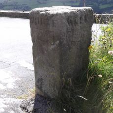
Guidestone, jct Wadsworth Lane/Height Rd/Nook Lane
980 m
Wadsworth Royd Farmhouse
386 m
The Part Of Mount Pleasant Mills To Rear Of Mount Pleasant House Occupied By Aj Dyter, Cabinet Maker And Firth Joiners
867 m
Milestone At Se 001265 To East Of Entrance To Falling Royd Lodge
1.5 km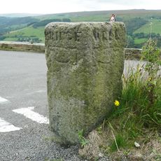
Guide Post At Se 006271 At Junction Of Wadsworth Lane
976 m
Redacre House
855 m
Milestone At Se 016260 At Junction Of White Lee Gardens
1 km
Numbers 1-6 Green End and attached barn
1.9 km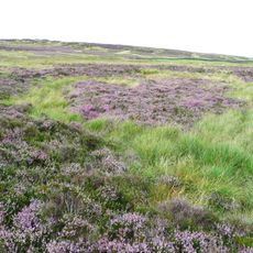
Enclosed Bronze Age urnfield 440m north west of Rough Bottom on Midgeley Moor
426 m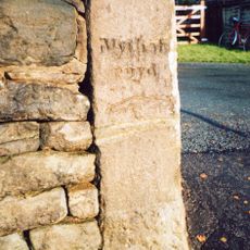
Guide Post At Se 026264 At Junction Of Height Road
1.3 km
Club Houses
1.9 km
Mytholmroyd Viaduct
1.2 km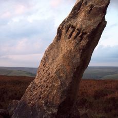
Greenwood Stone
1.5 km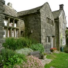
Broad Bottom Old Hall
906 m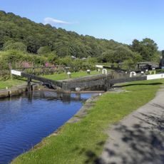
Rochdale Canal Lock Number 7 (Broadbottom) And Overflow Channel To North
1.1 km
22,24,26,34,36,38,40, 42, Sunny Bank
821 mReviews
Visited this place? Tap the stars to rate it and share your experience / photos with the community! Try now! You can cancel it anytime.
Discover hidden gems everywhere you go!
From secret cafés to breathtaking viewpoints, skip the crowded tourist spots and find places that match your style. Our app makes it easy with voice search, smart filtering, route optimization, and insider tips from travelers worldwide. Download now for the complete mobile experience.

A unique approach to discovering new places❞
— Le Figaro
All the places worth exploring❞
— France Info
A tailor-made excursion in just a few clicks❞
— 20 Minutes