Enable Location

We need your location to show you interesting places around you

Discover nearby places

Find interesting locations and hidden gems around you

Precise directions

Get accurate directions and distances to places

Your location is never shared with other users. It's only used when you tap the location button.

Scotch Plains

Log in to your account

Start exploring — it's free

Trusted by 62,414 travelers worldwide

Continue with Google
Continue with Apple
or

We will send you a code to connect

By continuing, you accept our Terms and Conditions and our Privacy Policy

Check your inbox

We've sent a pincode in your inbox. Please enter the code below.

Scotch Plains, Township in Union County, New Jersey

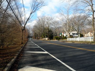
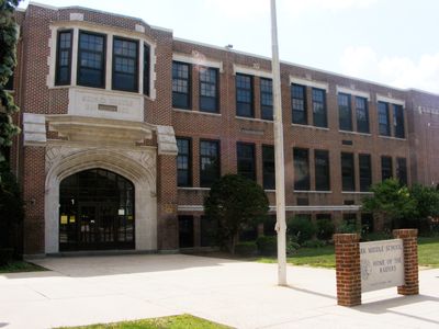
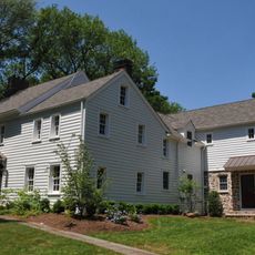
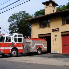
Scotch Plains is a residential township in Union County, New Jersey, situated within the New York metropolitan area and characterized by suburban neighborhoods and open green spaces. The community spreads across varied terrain with established residential areas interspersed with parks and natural areas.

Scottish Quakers established the early settlement here in the late 1600s, forming the foundation of a religious and agricultural community. The area experienced rapid growth during the 19th century as suburban development expanded from nearby New York City.

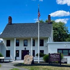
The Shady Rest Golf and Country Club was the first country club for African-American members in the nation, employing John Shippen as its golf professional. The club represents an important milestone in breaking down racial barriers within recreational spaces.

The township connects to New York City via NJ Transit's Raritan Valley Line and multiple bus routes serving the region. Having a car is practical for getting around, as neighborhoods and attractions spread across different areas.

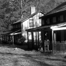
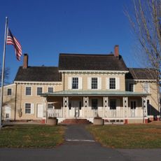
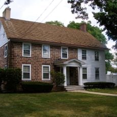
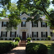
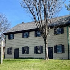
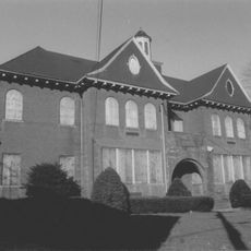
The Aunt Betty Frazee House marks locations where residents encountered British forces during the Revolutionary War. This structure serves as a physical reminder of the community's connection to the fight for independence.

The community of curious travelers

AroundUs brings together thousands of curated places, local tips, and hidden gems, enriched daily by 60,000 contributors worldwide.

Start exploring
Location
Elevation above the sea
66 m
Shares border with
Watchung, Westfield, Fanwood, Plainfield, Mountainside, Berkeley Heights, Clark, Edison, South Plainfield
GPS coordinates
40.65538,-74.38987
Latest update
December 19, 2025 22:40
Around this place
Feltville Historic District
United States of America

Feltville Historic District

2.9 km
United States of America

Bowcraft Amusement Park

1.1 km
Shady Rest Golf and Country Club
United States of America

Shady Rest Golf and Country Club

1.5 km
Homestead Farm at Oak Ridge
United States of America

Homestead Farm at Oak Ridge

6.7 km
United States of America

Oak Ridge Park

6.3 km
United States of America

William Miller Sperry Observatory

5.8 km
Cedar Brook Park
United States of America

Cedar Brook Park

6.2 km
Deacon Andrew Hetfield House
United States of America

Deacon Andrew Hetfield House

3.3 km
Miller-Cory House
United States of America

Miller-Cory House

3.4 km
Westfield Fire Headquarters
United States of America

Westfield Fire Headquarters

3.5 km
Crescent Area Historic District
United States of America

Crescent Area Historic District

4.8 km
Old Baptist Parsonage
United States of America

Old Baptist Parsonage

926 m
John De Camp House
United States of America

John De Camp House

5.2 km
Firehouse No. 4
United States of America

Firehouse No. 4

3.2 km
Hillside Avenue Historic District
United States of America

Hillside Avenue Historic District

4.6 km
Orville T. Waring House
United States of America

Orville T. Waring House

5.2 km
Plainfield Civic District
United States of America

Plainfield Civic District

4.8 km
Crescent Avenue Presbyterian Church
United States of America

Crescent Avenue Presbyterian Church

4.8 km
Rahway and Plainfield Friends Meeting House
United States of America

Rahway and Plainfield Friends Meeting House

4.8 km
Fanwood Park Historic District
United States of America

Fanwood Park Historic District

1.3 km
Scotch Plains School
United States of America

Scotch Plains School

864 m
United States of America

Shackamaxon Country Club

4.5 km
United States of America

Hyatt Hills Golf Complex

7.3 km
United States of America

Scotch Hills Golf Course

1.2 km
United States of America

Ash Brook Golf Course

5.4 km
United States of America

Designers Gallery Fine Art & Custom Framing

7.1 km
United States of America

Scenic viewpoint

1.2 km
United States of America

Seele

1.7 km
Show the full map
« Scotch Plains - Township in Union County, New Jersey » is provided by Around Us (aroundus.com). Images and texts are derived from Wikimedia project under a Creative Commons license. You are allowed to copy, distribute, and modify copies of this page, under the conditions set by the license, as long as this note is clearly visible.

Discover hidden gems everywhere you go!

From secret cafés to breathtaking viewpoints, skip the crowded tourist spots and find places that match your style. Our app makes it easy with voice search, smart filtering, route optimization, and insider tips from travelers worldwide. Download now for the complete mobile experience.

Around Us App Screenshot

A unique approach to discovering new places

Le Figaro

All the places worth exploring

France Info

A tailor-made excursion in just a few clicks

20 Minutes

Around Us
Travel Guide & Maps
Download

Send to your phone

QR Code
1

Open the camera app on your mobile.

2

Point at the QR code with your camera. A notification will appear.

3

Tap the notification to open the link.