Connecticut panhandle, Territorial extension in Fairfield County, Connecticut, United States
The Connecticut panhandle is a southwestern territorial extension encompassing the municipalities of Greenwich, Stamford, New Canaan, Darien, and parts of Norwalk and Wilton. Multiple transportation routes, including Metro-North Railroad stations and Interstate 95, run through the territory and connect it to Manhattan and other regional destinations.
This territory was formed through a 1683 agreement between New York and Connecticut that ended decades of colonial-era border disputes. In exchange for this southwestern extension, Connecticut transferred an equivalent strip of land to New York, known as the Oblong.
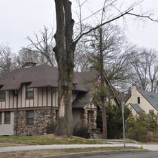
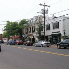
This region maintains its own community identity through local events, architectural styles, and how residents interact with their surroundings, while remaining influenced by proximity to New York City. People here preserve Connecticut traditions in their daily lives and through gatherings that keep the regional heritage alive.
The territory is well connected by transportation, with the Metro-North Railroad providing direct access to New York City and Interstate 95 offering regional mobility. Keep in mind that the region consists of several separate municipalities, so having a car or planning transit carefully helps when moving around to explore different areas.
A surprising aspect is the land swap: Connecticut received an additional land strip from New York in return, called the Oblong, which still exists today along the eastern edge of the panhandle territory. This historical 1683 land exchange remains a visible feature of the regional boundary geometry.
The community of curious travelers
AroundUs brings together thousands of curated places, local tips, and hidden gems, enriched daily by 60,000 contributors worldwide.