Enable Location

We need your location to show you interesting places around you

Discover nearby places

Find interesting locations and hidden gems around you

Precise directions

Get accurate directions and distances to places

Your location is never shared with other users. It's only used when you tap the location button.

Log in to your account

Start exploring — it's free

Trusted by 63,291 travelers worldwide

Continue with Google
Continue with Apple
or

We will send you a code to connect

By continuing, you accept our Terms and Conditions and our Privacy Policy

Check your inbox

We've sent a pincode in your inbox. Please enter the code below.

Discussion Reviews Photo
36.7k Popularity

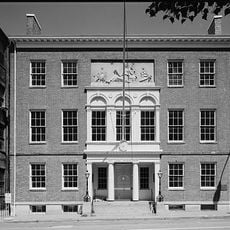
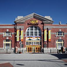
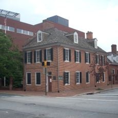
Phoenix Shot Tower, Shot tower and National Historic Landmark in Baltimore, United States

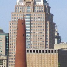
Phoenix Shot Tower rises 234 feet (71 meters) high with red brick walls measuring 4.5 feet (137 centimeters) thick at the base and tapering to 21 inches (53 centimeters) at the top. The construction uses millions of bricks assembled into a solid cylinder.

The structure was built in 1828 as the tallest building in the United States and manufactured lead shot until closing in 1892. The function then shifted from industrial production to protected monument.

The basketball team Baltimore Bullets chose their name as a reference to this structure and its former role in ammunition production for the area. The tower today shows how industrial sites transform into civic landmarks.

The site sits near Shot Tower metro station in the Jonestown neighborhood and opens for scheduled guided tours. Visitors should favor warm weather as the visit involves climbing many steps.

The building manufactured spherical ammunition by dropping molten lead from the top through a sieve into cold water below, reaching a production of 100,000 bags per year. The height allowed the falling droplets to become perfectly round during descent.

The community of curious travelers

AroundUs brings together thousands of curated places, local tips, and hidden gems, enriched daily by 60,000 contributors worldwide.

Start exploring
Location
Official opening
1828
Floors above the ground
14
GPS coordinates
39.29060,-76.60560
Latest update
December 17, 2025 10:46
Around this place
Baltimore City Hall
United States of America

Baltimore City Hall

442 m
The Peale
United States of America

The Peale

409 m
United States of America

Power Plant Live!

177 m
Port Discovery
United States of America

Port Discovery

202 m
Flag House & Star-Spangled Banner Museum
United States of America

Flag House & Star-Spangled Banner Museum

386 m
United States of America

Reginald F. Lewis Museum of Maryland African American History & Culture

375 m
Lloyd Street Synagogue
United States of America

Lloyd Street Synagogue

362 m
Carroll Mansion
United States of America

Carroll Mansion

236 m
Commerce Place
United States of America

Commerce Place

438 m
Port Discovery Children's Museum
United States of America

Port Discovery Children's Museum

180 m
Hendler Creamery
United States of America

Hendler Creamery

298 m
B'nai Israel Synagogue
United States of America

B'nai Israel Synagogue

389 m
Hutzler Brothers Palace Building
United States of America

Hutzler Brothers Palace Building

314 m
Eastern Female High School
United States of America

Eastern Female High School

540 m
Canton House
United States of America

Canton House

486 m
Garrett Building
United States of America

Garrett Building

510 m
Old Town Friends' Meetinghouse
United States of America

Old Town Friends' Meetinghouse

414 m
Chizuk Amuno Synagogue
United States of America

Chizuk Amuno Synagogue

385 m
Business and Government Historic District
United States of America

Business and Government Historic District

453 m
Chamber of Commerce Building
United States of America

Chamber of Commerce Building

424 m
Merchants' National Bank Building (1895), Baltimore
United States of America

Merchants' National Bank Building (1895), Baltimore

485 m
Reginald F. Lewis Museum
United States of America

Reginald F. Lewis Museum

378 m
House at 9 North Front Street
United States of America

House at 9 North Front Street

26 m
Old Town Savings Bank
United States of America

Old Town Savings Bank

433 m
Building at 239 North Gay Street
United States of America

Building at 239 North Gay Street

370 m
Gay Street Historic District
United States of America

Gay Street Historic District

311 m
Jewish Museum of Maryland
United States of America

Jewish Museum of Maryland

385 m
Flag House and Star-Spangled Banner Museum
United States of America

Flag House and Star-Spangled Banner Museum

396 m
Show the full map
Reviews
Share your experience

No review yet

Discussions
Start a discussion...

No discussion yet

« Phoenix Shot Tower - Shot tower and National Historic Landmark in Baltimore, United States » is provided by Around Us (aroundus.com). Images and texts are derived from Wikimedia project under a Creative Commons license. You are allowed to copy, distribute, and modify copies of this page, under the conditions set by the license, as long as this note is clearly visible.

Discover hidden gems everywhere you go!

From secret cafés to breathtaking viewpoints, skip the crowded tourist spots and find places that match your style. Our app makes it easy with voice search, smart filtering, route optimization, and insider tips from travelers worldwide. Download now for the complete mobile experience.

Around Us App Screenshot

A unique approach to discovering new places

Le Figaro

All the places worth exploring

France Info

A tailor-made excursion in just a few clicks

20 Minutes

Around Us
Travel Guide & Maps
Download

Send to your phone

QR Code
1

Open the camera app on your mobile.

2

Point at the QR code with your camera. A notification will appear.

3

Tap the notification to open the link.