Fort Brady

Log in to your account

AroundUs is a community-driven map of interesting places, built by curious explorers like you. It grows with every review, story, and photo you share.
Connect to save your favorite spots, contribute locations, and create personalized routes.
Continue with Google
Continue with Apple
Continue with X
Continue with Facebook
Continue with email
By continuing, you accept our Terms and Conditions and our Privacy Policy
Create an account
Add to collection
Map
Suggest a change
Share

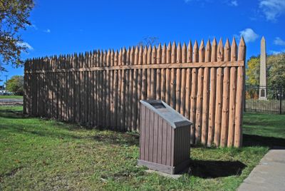
Fort Brady, Historic district in Sault Ste. Marie, United States.

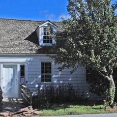
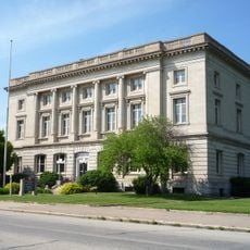
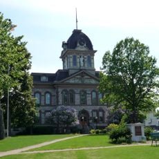
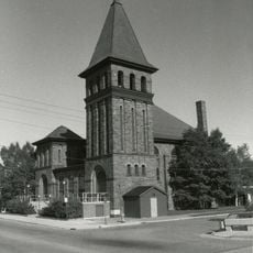
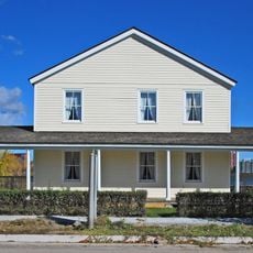
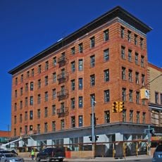
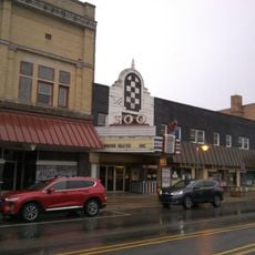
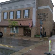
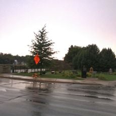
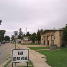
Fort Brady is a historic district in downtown Sault Ste. Marie comprising roughly 146 buildings, with over 100 listed as contributing structures to the historic designation. The buildings are concentrated along Water Street, where you will find well-preserved examples of military and civilian architecture from different eras.

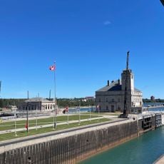
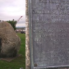
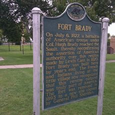
The original fort was established in 1822 to protect American interests following negotiations with the Chippewa. In 1892, the installation relocated upriver to make room for the expanding Soo Locks, which became critical for Great Lakes trade.

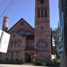
The buildings showcase different architectural styles from various periods, ranging from Italianate to Richardsonian Romanesque, that still shape the streetscape today. Walking through the area, you can observe how design preferences shifted across generations and influenced the visual character of this downtown neighborhood.

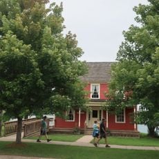
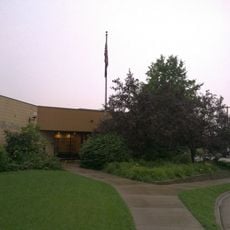
Lake Superior State University now uses the New Fort Brady site, maintaining several original officer quarters and military buildings as part of campus operations. You can walk through the neighborhood and explore the preserved structures from outside, though many serve as academic facilities.

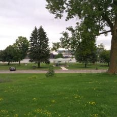
The original riverside fort was entirely relocated due to infrastructure changes, yet visitors can still trace this military past through the preserved buildings standing today. This shift reveals how economic development fundamentally reshaped the city.

Location: Sault Ste. Marie

GPS coordinates: 46.49889,-84.34250

Latest update: December 10, 2025 20:08

Photos
Around this place
Soo Locks
United States of America

Soo Locks

758 m
SS Valley Camp
United States of America

SS Valley Camp

469 m
MS Norgoma
Canada

MS Norgoma

1.2 km
Holy Name of Mary Pro-Cathedral
United States of America

Holy Name of Mary Pro-Cathedral

91 m
Tower of History
United States of America

Tower of History

171 m
John Johnston House
United States of America

John Johnston House

300 m
Old Federal Building
United States of America

Old Federal Building

62 m
Chippewa County Courthouse
United States of America

Chippewa County Courthouse

252 m
First United Presbyterian Church
United States of America

First United Presbyterian Church

551 m
Elmwood
United States of America

Elmwood

321 m
George Kemp Downtown Marina
United States of America

George Kemp Downtown Marina

403 m
Soo Lock Visitors Center
United States of America

Soo Lock Visitors Center

706 m
Adams Building
United States of America

Adams Building

423 m
Fort Chevalier de Repentigny
United States of America

Fort Chevalier de Repentigny

188 m
Poe Lock
United States of America

Poe Lock

789 m
Soo Theatre
United States of America

Soo Theatre

534 m
War Memorial Hospital
United States of America

War Memorial Hospital

602 m
Rotary Welcome Cairns
Canada

Rotary Welcome Cairns

1.3 km
Saint Mary's Pro-Cathedral Historical Marker
United States of America

Saint Mary's Pro-Cathedral Historical Marker

85 m
Ronald J. Calery Community Action Center
United States of America

Ronald J. Calery Community Action Center

499 m
Bishop Baraga House
United States of America

Bishop Baraga House

357 m
John Johnston House Historical Marker
United States of America

John Johnston House Historical Marker

363 m
Fort Brady Historical Marker
United States of America

Fort Brady Historical Marker

177 m
W.F.G. (Bud) Weber Park
United States of America

W.F.G. (Bud) Weber Park

647 m
Superior District Library
United States of America

Superior District Library

590 m
St. Marys Falls Park
United States of America

St. Marys Falls Park

309 m
Central Methodist Church Historical Marker
United States of America

Central Methodist Church Historical Marker

1.3 km
Pullar Community Building
United States of America

Pullar Community Building

345 m
Show the full map
Reviews

Visited this place? Tap the stars to rate it and share your experience / photos with the community! Try now! You can cancel it anytime.

« Fort Brady - Historic district in Sault Ste. Marie, United States » is provided by Around Us (aroundus.com). Images and texts are derived from Wikimedia project under a Creative Commons license. You are allowed to copy, distribute, and modify copies of this page, under the conditions set by the license, as long as this note is clearly visible.

Discover hidden gems everywhere you go!

From secret cafés to breathtaking viewpoints, skip the crowded tourist spots and find places that match your style. Our app makes it easy with voice search, smart filtering, route optimization, and insider tips from travelers worldwide. Download now for the complete mobile experience.

Around Us App Screenshot

A unique approach to discovering new places

Le Figaro

All the places worth exploring

France Info

A tailor-made excursion in just a few clicks

20 Minutes