Chest opened
+${chestReward.xp} XP
Explorer
NOUVEAU ×${chestReward.collectible.quantity}
tapez pour fermer
Chest locked

Open chests in the app

Around Us is built for your phone — chests unlock when you walk, explore and capture nearby places.

Enable Location

We need your location to show you interesting places around you

Discover nearby places

Find interesting locations and hidden gems around you

Precise directions

Get accurate directions and distances to places

Your location is never shared with other users. It's only used when you tap the location button.

Log in to your account

Start exploring — it's free

Trusted by 73,072 travelers worldwide

Continue with Google
Continue with Apple
or

We will send you a code to connect

By continuing, you accept our Terms and Conditions and our Privacy Policy

Check your inbox

We've sent a pincode in your inbox. Please enter the code below.

Harbor Island National Wildlife Refuge
Discussion Reviews Photo
1.9k Popularity

Harbor Island National Wildlife Refuge, National Wildlife Refuge on an island in Potagannissing Bay, Michigan

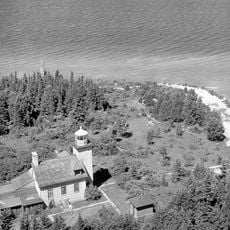
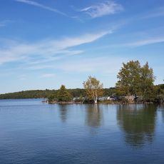
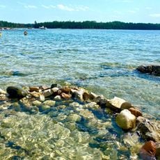
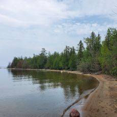
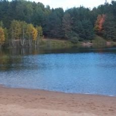
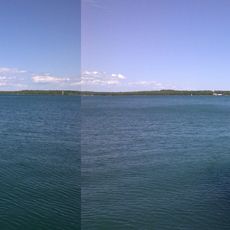
Harbor Island National Wildlife Refuge is a 695-acre protected area on a horseshoe-shaped island in Potagannissing Bay near Drummond Island. The landscape contains forests, wetlands, and natural shorelines that provide diverse habitats for wildlife.

The island was transferred from The Nature Conservancy to the U.S. Fish and Wildlife Service in 1983 to establish a protected natural area. This transition marked the start of formal management and conservation efforts to preserve the landscape and wildlife.

The refuge draws birdwatchers and nature enthusiasts who come to observe rare species like bald eagles and loons in their natural habitat. People value the island as a place where wildlife thrives without human interference.

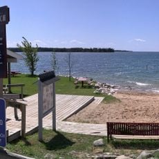
Visitors need a boat to reach the island since there are no bridges from the mainland; the nearest launch points are Drummond Island Yacht Haven and Township Park. Weather conditions can change quickly on the water, so it is wise to check forecasts and plan boat trips accordingly.

The island contains a mature white pine stand on the eastern shore and an old-growth oak forest on the north side. These distinct forest sections offer visitors examples of the different tree communities that developed naturally in northern Michigan.

The community of curious travelers

AroundUs brings together thousands of curated places, local tips, and hidden gems, enriched daily by 60,000 contributors worldwide.

Start exploring
Inception
1983
GPS coordinates
46.05440,-83.75610
Latest update
December 14, 2025 11:03
Around this place
Spectacle Reef Light
United States of America

Spectacle Reef Light

43 km
Fort St. Joseph
Canada

Fort St. Joseph

14.8 km
SS Russia
United States of America

SS Russia

24 km
Fort Drummond
United States of America

Fort Drummond

11.8 km
DeTour Reef Light
United States of America

DeTour Reef Light

16.4 km
Bois Blanc Light
United States of America

Bois Blanc Light

58.2 km
Martin Reef Light Station
United States of America

Martin Reef Light Station

34.2 km
Philetus S. Church House
United States of America

Philetus S. Church House

59.1 km
Church of Our Saviour, Friend of Children
United States of America

Church of Our Saviour, Friend of Children

61 km
Rydal Bank Church
Canada

Rydal Bank Church

34.2 km
Round Island Light
United States of America

Round Island Light

21.2 km
Lipsett Hardware Building
United States of America

Lipsett Hardware Building

48.1 km
Hessel School
United States of America

Hessel School

52.4 km
Parker Road–Charlotte River Bridge
United States of America

Parker Road–Charlotte River Bridge

53.6 km
St. Joseph's Island Migratory Bird Sanctuary
Canada

St. Joseph's Island Migratory Bird Sanctuary

13.8 km
Chippewa County Fairgrounds
United States of America

Chippewa County Fairgrounds

61.6 km
Drummond Island Historical Museum
United States of America

Drummond Island Historical Museum

3.7 km
Big Shoal Beach
United States of America

Big Shoal Beach

17.5 km
Les Cheneaux Community Library
United States of America

Les Cheneaux Community Library

47.2 km
Glen Cove Beach
United States of America

Glen Cove Beach

18 km
Dukes Lake Beach
United States of America

Dukes Lake Beach

57.5 km
Maxton Plains
United States of America

Maxton Plains

8.2 km
Les Cheneaux Maritime Museum
United States of America

Les Cheneaux Maritime Museum

46.3 km
Aldo Leopold Historical Marker
United States of America

Aldo Leopold Historical Marker

51.3 km
Detour Area School And Public Library
United States of America

Detour Area School And Public Library

13.4 km
Drummond Island Ferry
United States of America

Drummond Island Ferry

13 km
Detour Museum
United States of America

Detour Museum

13.1 km
Hessel Beach
United States of America

Hessel Beach

52.3 km
Show the full map
Reviews
Share your experience

No review yet

Discussions
Start a discussion...

No discussion yet

« Harbor Island National Wildlife Refuge - National Wildlife Refuge on an island in Potagannissing Bay, Michigan » is provided by Around Us (aroundus.com). Images and texts are derived from Wikimedia project under a Creative Commons license. You are allowed to copy, distribute, and modify copies of this page, under the conditions set by the license, as long as this note is clearly visible.

Discover hidden gems everywhere you go!

From secret cafés to breathtaking viewpoints, skip the crowded tourist spots and find places that match your style. Our app makes it easy with voice search, smart filtering, route optimization, and insider tips from travelers worldwide. Download now for the complete mobile experience.

Around Us App Screenshot

A unique approach to discovering new places

Le Figaro

All the places worth exploring

France Info

A tailor-made excursion in just a few clicks

20 Minutes

Around Us
Travel Guide & Maps
Download

Send to your phone

QR Code
1

Open the camera app on your mobile.

2

Point at the QR code with your camera. A notification will appear.

3

Tap the notification to open the link.