Lasell Neighborhood Historic District

Log in to your account

AroundUs is a community-driven map of interesting places, built by curious explorers like you. It grows with every review, story, and photo you share.
Connect to save your favorite spots, contribute locations, and create personalized routes.
Continue with Google
Continue with Apple
Continue with X
Continue with Facebook
Continue with email
By continuing, you accept our Terms and Conditions and our Privacy Policy
Create an account
Add to collection
Map
Suggest a change
Share

Lasell Neighborhood Historic District, Historic district in Newton, Massachusetts, United States.

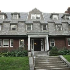
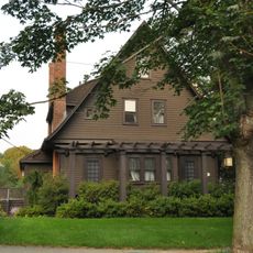
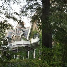
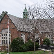
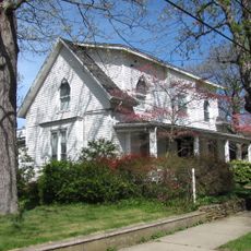
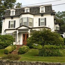
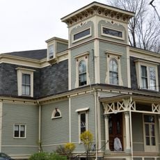
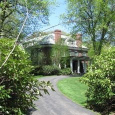
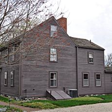
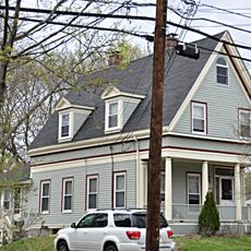
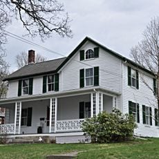
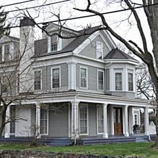
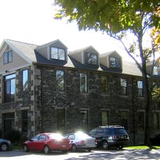
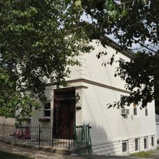
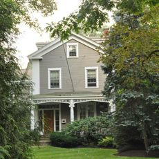
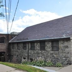
The Lasell Neighborhood Historic District is a residential area in Newton featuring buildings constructed between 1880 and 1920 that display Queen Anne and Colonial Revival design. The houses line Woodland Road, Studio Road, Aspen Avenue, Seminary Avenue, and Grove Street, forming a connected historical settlement.

The area was originally a rural zone that transformed into a residential community after the Boston and Worcester Railroad Station opened in 1851. This rail connection allowed the region to develop rapidly with housing, especially after Lasell University was established nearby.

The neighborhood took its name from Lasell University, which shaped the area and encouraged its development as a residential zone. The houses still reflect the close connection between the institution and the social fabric that formed around it.

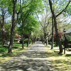
The homes are spread across several streets, so exploring all sides of the neighborhood gives you a complete view of the architectural details. The best way to experience the district is by walking slowly and observing the front facades, where most design features are most visible.

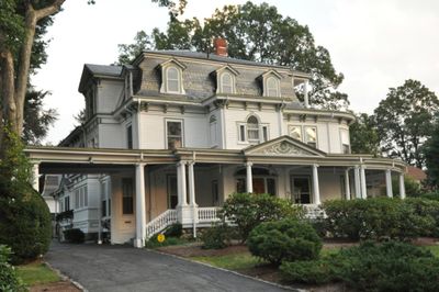
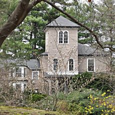
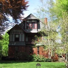
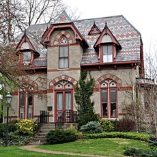
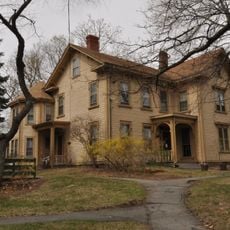
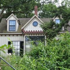
The Winslow-Haskell Mansion was built in 1870 and displays the rare Ruskinian Gothic style in residential architecture. The building still stands today and was converted into condominiums, but its distinctive features remain clearly visible from the outside.

Location: Massachusetts

GPS coordinates: 42.34056,-71.24694

Latest update: December 14, 2025 14:20

Photos
Around this place
Norumbega Park
United States of America

Norumbega Park

1.3 km
Brae Burn Country Club
United States of America

Brae Burn Country Club

1.1 km
Walker Home for Missionary Children
United States of America

Walker Home for Missionary Children

377 m
E. C. Hammond House
United States of America

E. C. Hammond House

433 m
The Eminence
United States of America

The Eminence

1.4 km
Windsor Road Historic District
United States of America

Windsor Road Historic District

1.6 km
Winslow-Haskell Mansion
United States of America

Winslow-Haskell Mansion

92 m
Plummer Memorial Library
United States of America

Plummer Memorial Library

659 m
Joseph L. Stone House
United States of America

Joseph L. Stone House

1.5 km
Myrtle Baptist Church Neighborhood Historic District
United States of America

Myrtle Baptist Church Neighborhood Historic District

1.2 km
Webster Park Historic District
United States of America

Webster Park Historic District

1.7 km
Putnam Street Historic District
United States of America

Putnam Street Historic District

1.6 km
House at 203 Islington Road
United States of America

House at 203 Islington Road

1.4 km
House at 230 Melrose Street
United States of America

House at 230 Melrose Street

931 m
Thomas A. Crimmins House
United States of America

Thomas A. Crimmins House

1.7 km
Whittemore's Tavern
United States of America

Whittemore's Tavern

743 m
House at 307 Lexington Street
United States of America

House at 307 Lexington Street

1.2 km
Old Shephard Farm
United States of America

Old Shephard Farm

689 m
House at 102 Staniford Street
United States of America

House at 102 Staniford Street

1.4 km
House at 31 Woodbine Street
United States of America

House at 31 Woodbine Street

1.7 km
Harding House-Walker Missionary Home
United States of America

Harding House-Walker Missionary Home

342 m
Eaton-Moulton Mill
United States of America

Eaton-Moulton Mill

1.8 km
Brae-Burn Historic District
United States of America

Brae-Burn Historic District

650 m
Riverside Concrete Company-Lamont's Market
United States of America

Riverside Concrete Company-Lamont's Market

830 m
Rufus Estabrook House
United States of America

Rufus Estabrook House

609 m
Ware Paper Mill
United States of America

Ware Paper Mill

1.8 km
Rev. Francis E. Clark House
United States of America

Rev. Francis E. Clark House

689 m
House at 2212 Commonwealth Avenue
United States of America

House at 2212 Commonwealth Avenue

846 m
Show the full map
Reviews

Visited this place? Tap the stars to rate it and share your experience / photos with the community! Try now! You can cancel it anytime.

« Lasell Neighborhood Historic District - Historic district in Newton, Massachusetts, United States » is provided by Around Us (aroundus.com). Images and texts are derived from Wikimedia project under a Creative Commons license. You are allowed to copy, distribute, and modify copies of this page, under the conditions set by the license, as long as this note is clearly visible.

Discover hidden gems everywhere you go!

From secret cafés to breathtaking viewpoints, skip the crowded tourist spots and find places that match your style. Our app makes it easy with voice search, smart filtering, route optimization, and insider tips from travelers worldwide. Download now for the complete mobile experience.

Around Us App Screenshot

A unique approach to discovering new places

Le Figaro

All the places worth exploring

France Info

A tailor-made excursion in just a few clicks

20 Minutes