Enable Location

We need your location to show you interesting places around you

Discover nearby places

Find interesting locations and hidden gems around you

Precise directions

Get accurate directions and distances to places

Your location is never shared with other users. It's only used when you tap the location button.

Manokin Historic District

Log in to your account

Start exploring — it's free

Trusted by 62,396 travelers worldwide

Continue with Google
Continue with Apple
or

We will send you a code to connect

By continuing, you accept our Terms and Conditions and our Privacy Policy

Check your inbox

We've sent a pincode in your inbox. Please enter the code below.

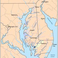
Manokin Historic District, historic district in Maryland, United States

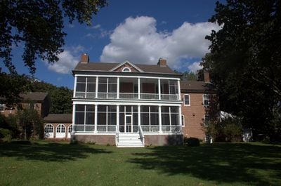
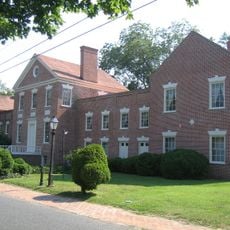
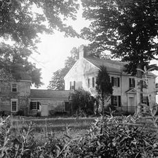
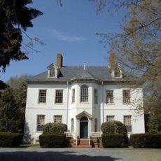
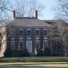
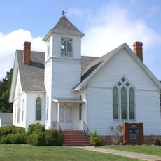
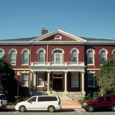
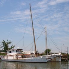
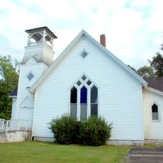
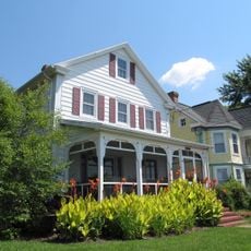
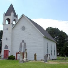
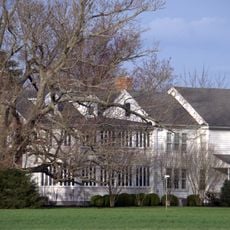
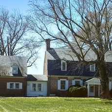
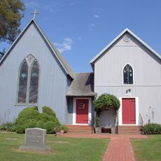
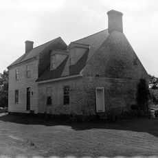
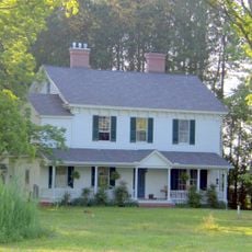
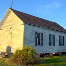
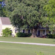
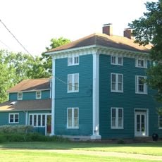
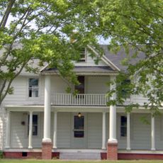
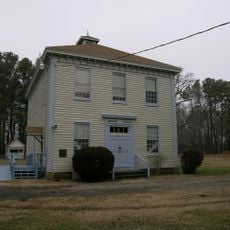
The Manokin Historic District is located at the mouth of the Manokin River near Princess Anne, Maryland, and contains numerous old buildings showing early 20th-century Georgian Revival architecture. The area includes significant houses and farms dating from the 18th and 19th centuries, among them Clifton, built around 1790, one of the region's oldest structures.

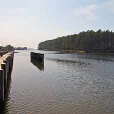
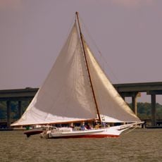
The area has served as an important location for fishing, transportation, and trade at the river mouth for centuries. It was officially added to the National Register of Historic Places on June 29, 1976, to help protect its historic buildings and landscapes.

The Manokin Historic District displays Georgian Revival architecture from the early 20th century that reflects how settlers of the 18th and 19th centuries lived. The buildings and farms remain in use today, and the traditional way of life has stayed steady across generations, connecting past to present.

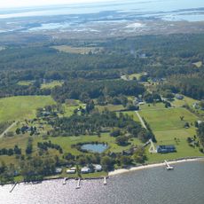
The district remains mostly rural and can be explored on quiet back roads connecting old farms and houses. The best preserved views of the historic landscape and bay can be seen from various locations throughout the area.

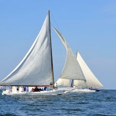
The Manokin River was the last to be added in 2019 to a major restoration program for native oysters in the Chesapeake Bay. So far, about 96 acres of oyster reefs have been created, providing habitat for local fish and oyster populations and improving water quality.

The community of curious travelers

AroundUs brings together thousands of curated places, local tips, and hidden gems, enriched daily by 60,000 contributors worldwide.

Start exploring
Location
GPS coordinates
38.15444,-75.78944
Latest update
February 9, 2026 07:42
Around this place
Janes Island State Park
United States of America

Janes Island State Park

16.5 km
Teackle Mansion
United States of America

Teackle Mansion

9.4 km
Deal Island Wildlife Management Area
United States of America

Deal Island Wildlife Management Area

7.4 km
Kingston Hall
United States of America

Kingston Hall

9.8 km
Ida May
United States of America

Ida May

13.9 km
Beverly
United States of America

Beverly

8.8 km
Fannie L. Daugherty
United States of America

Fannie L. Daugherty

14.2 km
Waterloo
United States of America

Waterloo

8.6 km
Beckford
United States of America

Beckford

9.4 km
Quindocqua United Methodist Church
United States of America

Quindocqua United Methodist Church

15.7 km
Princess Anne Historic District
United States of America

Princess Anne Historic District

10 km
All Saints Church at Monie
United States of America

All Saints Church at Monie

4.8 km
Thomas W. Clyde
United States of America

Thomas W. Clyde

14.2 km
Mount Zion Memorial Church
United States of America

Mount Zion Memorial Church

12.4 km
Whitehaven Historic District
United States of America

Whitehaven Historic District

12.7 km
St. Peter's Methodist Episcopal Church
United States of America

St. Peter's Methodist Episcopal Church

15.5 km
Great Shoals Light
United States of America

Great Shoals Light

10.3 km
White Hall
United States of America

White Hall

13.7 km
Bennett's Adventure
United States of America

Bennett's Adventure

15.2 km
St. Paul's Protestant Episcopal Church
United States of America

St. Paul's Protestant Episcopal Church

15.5 km
Sudler's Conclusion
United States of America

Sudler's Conclusion

3.9 km
Catalpa Farm
United States of America

Catalpa Farm

10.2 km
William T. Tull House
United States of America

William T. Tull House

8 km
St. Mark's Episcopal Church
United States of America

St. Mark's Episcopal Church

11.5 km
Jeptha Hayman House
United States of America

Jeptha Hayman House

11.9 km
Upper Fairmount Historic District
United States of America

Upper Fairmount Historic District

5.4 km
Cullen Homestead Historic District
United States of America

Cullen Homestead Historic District

16.5 km
Academy Grove Historic District
United States of America

Academy Grove Historic District

6.4 km
Show the full map
« Manokin Historic District - historic district in Maryland, United States » is provided by Around Us (aroundus.com). Images and texts are derived from Wikimedia project under a Creative Commons license. You are allowed to copy, distribute, and modify copies of this page, under the conditions set by the license, as long as this note is clearly visible.

Discover hidden gems everywhere you go!

From secret cafés to breathtaking viewpoints, skip the crowded tourist spots and find places that match your style. Our app makes it easy with voice search, smart filtering, route optimization, and insider tips from travelers worldwide. Download now for the complete mobile experience.

Around Us App Screenshot

A unique approach to discovering new places

Le Figaro

All the places worth exploring

France Info

A tailor-made excursion in just a few clicks

20 Minutes

Around Us
Travel Guide & Maps
Download

Send to your phone

QR Code
1

Open the camera app on your mobile.

2

Point at the QR code with your camera. A notification will appear.

3

Tap the notification to open the link.