Chest opened
+${chestReward.xp} XP
Explorer
NOUVEAU ×${chestReward.collectible.quantity}
tapez pour fermer
Chest locked

Open chests in the app

Around Us is built for your phone — chests unlock when you walk, explore and capture nearby places.

Enable Location

We need your location to show you interesting places around you

Discover nearby places

Find interesting locations and hidden gems around you

Precise directions

Get accurate directions and distances to places

Your location is never shared with other users. It's only used when you tap the location button.

Mount Nebo

Log in to your account

Start exploring — it's free

Trusted by 72,878 travelers worldwide

Continue with Google
Continue with Apple
or

We will send you a code to connect

By continuing, you accept our Terms and Conditions and our Privacy Policy

Check your inbox

We've sent a pincode in your inbox. Please enter the code below.

Mount Nebo
Discussion Reviews 1 Photos
6.9k Popularity

Mount Nebo, Mountain peak in Arkansas River Valley, United States.

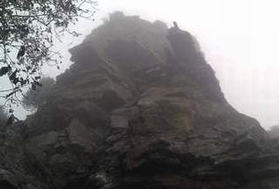
Mount Nebo is a flat-topped mountain in the Arkansas River Valley in the state of Arkansas, rising to about 1,755 feet (535 m) above sea level. From the summit, visitors look out over Lake Dardanelle and the Arkansas River winding through the valley below.

In the 1860s, a settler named Mrs. Louis White gave the mountain its biblical name, connecting the landscape to a wider religious tradition. A century later, the Civilian Conservation Corps built the roads, trails, and cabins that still define the site today.

The name comes from the Bible, referring to the mountain where Moses looked out over the Promised Land. Standing at the top and looking down over the valley and the river below, it is easy to see why the name felt right to early settlers.

The road to the top is steep and winding, so large vehicles with trailers may find it difficult. Once there, rental cabins, campsites, and trails of different lengths and difficulty levels give visitors plenty of ways to spend time on the mountain.

A 100-room hotel once operated at the summit, drawing guests from across the region during the late 1800s. It burned down in 1918 and left almost no visible trace of what had been a busy resort on top of the mountain.

The community of curious travelers

AroundUs brings together thousands of curated places, local tips, and hidden gems, enriched daily by 60,000 contributors worldwide.

Start exploring
Location
GPS coordinates
35.21670,-93.25190
Latest update
March 3, 2026 08:18
Around this place
Dardanelle Agriculture and Post Office
United States of America

Dardanelle Agriculture and Post Office

9.5 km
Russellville Downtown Historic District
United States of America

Russellville Downtown Historic District

12.7 km
Russellville Public Library
United States of America

Russellville Public Library

12.6 km
Brearley Cemetery
United States of America

Brearley Cemetery

7.4 km
Yell County Courthouse
United States of America

Yell County Courthouse

8.7 km
Latimore Tourist Home
United States of America

Latimore Tourist Home

12.1 km
Norristown Cemetery
United States of America

Norristown Cemetery

9.7 km
Russellville Masonic Temple
United States of America

Russellville Masonic Temple

12.6 km
Steamboat House
United States of America

Steamboat House

8.7 km
Sulphur Springs Cemetery
United States of America

Sulphur Springs Cemetery

7.2 km
Riggs-Hamilton American Legion Post No. 20
United States of America

Riggs-Hamilton American Legion Post No. 20

12.7 km
First Presbyterian Church
United States of America

First Presbyterian Church

8.9 km
John W. White House
United States of America

John W. White House

12 km
First United Methodist Church
United States of America

First United Methodist Church

8.9 km
Kimball House
United States of America

Kimball House

12.4 km
Thomas James Cotton House
United States of America

Thomas James Cotton House

8.7 km
W.J. White House
United States of America

W.J. White House

11.9 km
Henry R. Koen Forest Service Building
United States of America

Henry R. Koen Forest Service Building

12.4 km
Berry House
United States of America

Berry House

8.9 km
Mountain View School
United States of America

Mountain View School

9.9 km
United States of America

Kaleidoclasm The Gallery

12.7 km

Lemley House Art Guild

12.7 km
United States of America

Sunset Point

1.6 km
United States of America

Sunrise Point

298 m
United States of America

Scenic viewpoint

2.8 km
United States of America

Scenic viewpoint

1.3 km
United States of America

Scenic viewpoint

1.7 km
United States of America

Scenic viewpoint

2.5 km
Show the full map
Reviews
Share your experience

No review yet

Discussions
Start a discussion...

No discussion yet

« Mount Nebo - Mountain peak in Arkansas River Valley, United States » is provided by Around Us (aroundus.com). Images and texts are derived from Wikimedia project under a Creative Commons license. You are allowed to copy, distribute, and modify copies of this page, under the conditions set by the license, as long as this note is clearly visible.

Discover hidden gems everywhere you go!

From secret cafés to breathtaking viewpoints, skip the crowded tourist spots and find places that match your style. Our app makes it easy with voice search, smart filtering, route optimization, and insider tips from travelers worldwide. Download now for the complete mobile experience.

Around Us App Screenshot

A unique approach to discovering new places

Le Figaro

All the places worth exploring

France Info

A tailor-made excursion in just a few clicks

20 Minutes

Around Us
Travel Guide & Maps
Download

Send to your phone

QR Code
1

Open the camera app on your mobile.

2

Point at the QR code with your camera. A notification will appear.

3

Tap the notification to open the link.