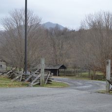
Panther Wildlife Management Area, Wildlife management area in McDowell County, West Virginia, United States
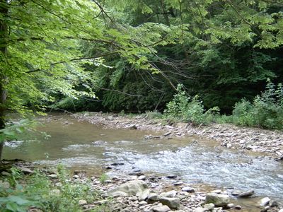
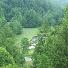
Panther Wildlife Management Area is a protected zone in McDowell County that spreads across forested hills and creek valleys with trails for walking and wildlife observation. The landscape includes woodland edges, open fields, and water areas where visitors might encounter deer, wild boar, and various bird species.
The name comes from Panther Creek, where early settlers recorded the presence of mountain lions in the area. The zone was established as a protected space to preserve these natural habitats from further damage.
The establishment of this protected zone reflects West Virginia's commitment to maintaining natural habitats while providing educational opportunities about local wildlife.
The terrain is rough and requires good hiking boots and a higher fitness level for longer trips. Visitors should prepare for mountain weather conditions and learn about available routes before arriving.
The region was a bustling hunting ground for fur traders and hunters during colonial times because of the rich wildlife population. This tradition of wilderness use shapes how the area is visited today during hunting seasons.
Location: West Virginia
Website: https://wvstateparks.com/park/panther-state-forest
GPS coordinates: 37.42330,-81.87640
Latest update: December 14, 2025 11:43
Breaks Interstate Park
39.8 km
Coal House
45 km
Twin Falls Resort State Park
43.1 km
U.S. Coal and Coke Company Store
30.2 km
Elkhorn City Railroad Museum
43.2 km
McDowell County Courthouse
25.9 km
Itmann Company Store and Office
43.8 km
World War Memorial
32.7 km
Maiden Spring
45.7 km
Pocahontas Fuel Company Store and Office Buildings
42.7 km
Ashland Company Store
46.2 km
Buchanan County Courthouse
25.5 km
Big Crab Orchard Site
43.1 km
Page Coal and Coke Company Store
37.3 km
Welch Commercial Historic District
25.7 km
Chimney Rock Farm
45.2 km
Tazewell Historic District
46.4 km
Capt. James Moore Homestead
46 km
Richlands Historic District
37.1 km
Williams House
37.4 km
Clinch Valley Roller Mills
38.5 km
Old Kentucky Turnpike Historic District
38.5 km
Little Laurel Branch
41.8 km
Tazewell Avenue Historic District
37 km
Williamson Historic District
45 km
Matewan Depot Replica Welcome Center and Museum
34 km
James Ellwood Jones House
44.9 km
Matewan Historic District
33.8 kmVisited this place? Tap the stars to rate it and share your experience / photos with the community! Try now! You can cancel it anytime.
Discover hidden gems everywhere you go!
From secret cafés to breathtaking viewpoints, skip the crowded tourist spots and find places that match your style. Our app makes it easy with voice search, smart filtering, route optimization, and insider tips from travelers worldwide. Download now for the complete mobile experience.
A unique approach to discovering new places❞
— Le Figaro
All the places worth exploring❞
— France Info
A tailor-made excursion in just a few clicks❞
— 20 Minutes