Enable Location

We need your location to show you interesting places around you

Discover nearby places

Find interesting locations and hidden gems around you

Precise directions

Get accurate directions and distances to places

Your location is never shared with other users. It's only used when you tap the location button.

Level Loop

Log in to your account

Start exploring — it's free

Trusted by 62,563 travelers worldwide

Continue with Google
Continue with Apple
or

We will send you a code to connect

By continuing, you accept our Terms and Conditions and our Privacy Policy

Check your inbox

We've sent a pincode in your inbox. Please enter the code below.

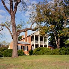
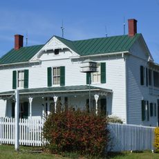
Level Loop, historic house in Virginia, United States

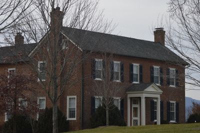
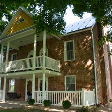
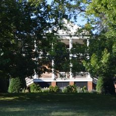
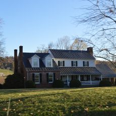
Level Loop is a historic brick house built around 1819 in Virginia for William Houston. The two-story building with five bays features Federal-style architecture, including fine woodwork and a carved mantel in the dining room that displays regional design elements.

The house was built in 1819 for William Houston, a relative of Texas pioneer Sam Houston from Rockbridge County. It was added to the National Register of Historic Places in 1993 in recognition of its importance as an example of early Federal-style architecture and rural life after the American Revolution.

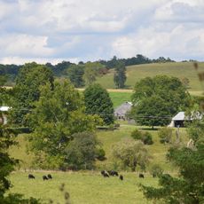
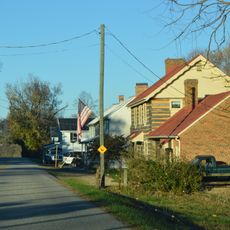
The property takes its name from a flat area of land shaped by nearby Hayes Creek. The surrounding landscape continues to reflect how natural features influenced settlement patterns and farm life in this region.

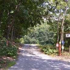
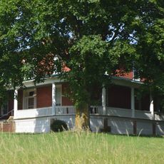
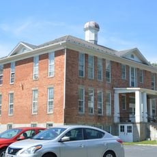
This is a privately owned residence and is not open for public tours. Visitors can view and photograph the property from public roads while respecting the privacy of the residents.

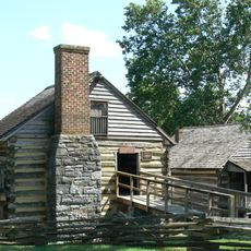
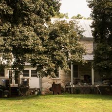
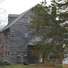
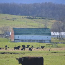
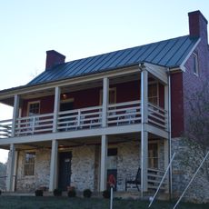
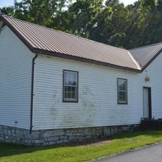
The property includes several 19th-century outbuildings, including a wooden smokehouse with a small cupola and an early outdoor kitchen, whose stone chimney remains visible today. These structures offer rare glimpses into the everyday farm infrastructure of that era.

The community of curious travelers

AroundUs brings together thousands of curated places, local tips, and hidden gems, enriched daily by 60,000 contributors worldwide.

Start exploring
Location
GPS coordinates
37.93250,-79.33500
Latest update
February 9, 2026 11:06
Around this place
Cyrus McCormick Farm
United States of America

Cyrus McCormick Farm

10.3 km
George C. Marshall Foundation
United States of America

George C. Marshall Foundation

18.1 km
Saint Mary's Wilderness
United States of America

Saint Mary's Wilderness

17.6 km
Hull's Drive In
United States of America

Hull's Drive In

12.2 km
Timber Ridge Presbyterian Church
United States of America

Timber Ridge Presbyterian Church

10.2 km
Stono
United States of America

Stono

17.9 km
Maple Hall
United States of America

Maple Hall

10.1 km
Old Providence Stone Church
United States of America

Old Providence Stone Church

10 km
New Providence Presbyterian Church
United States of America

New Providence Presbyterian Church

3.5 km
Goshen Land Company Bridge
United States of America

Goshen Land Company Bridge

15.2 km
Lylburn Downing School
United States of America

Lylburn Downing School

18.1 km
James Alexander House
United States of America

James Alexander House

12.1 km
William Mackey House
United States of America

William Mackey House

10.7 km
Oak Spring Farm
United States of America

Oak Spring Farm

9.4 km
Clover Mount
United States of America

Clover Mount

13.7 km
Clifton
United States of America

Clifton

17.3 km
Mountain View Farm
United States of America

Mountain View Farm

15.1 km
Middlebrook Historic District
United States of America

Middlebrook Historic District

17 km
Hays Creek Mill
United States of America

Hays Creek Mill

851 m
Brownsburg Historic District
United States of America

Brownsburg Historic District

1.5 km
Henry Mish Barn
United States of America

Henry Mish Barn

17.7 km
Maple Front Farm
United States of America

Maple Front Farm

16.4 km
A. J. Miller House
United States of America

A. J. Miller House

13.6 km
Craigsville School
United States of America

Craigsville School

16.8 km
Mulberry Grove
United States of America

Mulberry Grove

2.7 km
Jordan's Point Historic District
United States of America

Jordan's Point Historic District

17.7 km
Moffett's Creek Schoolhouse
United States of America

Moffett's Creek Schoolhouse

8.1 km
Kennedy-Wade Mill
United States of America

Kennedy-Wade Mill

4.7 km
Show the full map
« Level Loop - historic house in Virginia, United States » is provided by Around Us (aroundus.com). Images and texts are derived from Wikimedia project under a Creative Commons license. You are allowed to copy, distribute, and modify copies of this page, under the conditions set by the license, as long as this note is clearly visible.

Discover hidden gems everywhere you go!

From secret cafés to breathtaking viewpoints, skip the crowded tourist spots and find places that match your style. Our app makes it easy with voice search, smart filtering, route optimization, and insider tips from travelers worldwide. Download now for the complete mobile experience.

Around Us App Screenshot

A unique approach to discovering new places

Le Figaro

All the places worth exploring

France Info

A tailor-made excursion in just a few clicks

20 Minutes

Around Us
Travel Guide & Maps
Download

Send to your phone

QR Code
1

Open the camera app on your mobile.

2

Point at the QR code with your camera. A notification will appear.

3

Tap the notification to open the link.