Chest opened
+${chestReward.xp} XP
Explorer
NOUVEAU ×${chestReward.collectible.quantity}
tapez pour fermer
Chest locked

Open chests in the app

Around Us is built for your phone — chests unlock when you walk, explore and capture nearby places.

Enable Location

We need your location to show you interesting places around you

Discover nearby places

Find interesting locations and hidden gems around you

Precise directions

Get accurate directions and distances to places

Your location is never shared with other users. It's only used when you tap the location button.

Log in to your account

Start exploring — it's free

Trusted by 72,982 travelers worldwide

Continue with Google
Continue with Apple
or

We will send you a code to connect

By continuing, you accept our Terms and Conditions and our Privacy Policy

Check your inbox

We've sent a pincode in your inbox. Please enter the code below.

Camp Cameron
Discussion Reviews Photo
1.5k Popularity

Camp Cameron, Civil War training camp in North Cambridge, Massachusetts, United States.

Camp Cameron was a military installation in North Cambridge that served as a training ground for Union soldiers from June 1861 to January 1863. The camp occupied around 140 acres of farmland with thirty wooden structures, including fifteen barracks each designed to house about one hundred soldiers.

The camp was established in 1861 and used land donated by Gardner Green Hubbard and the Union Horse Railroad. This facility played a key role in preparing thousands of soldiers for deployment to Civil War battlefields.

The camp's name lives on in local street names such as Cameron Avenue and Camp Street, which mark the footprint of this military installation. These names help visitors today understand where the encampment once extended across the landscape.

The former camp site sits at the border between Somerville and Cambridge and is now part of the modern urban landscape. Visitors can use street names like Cameron Avenue to trace the camp's former extent and understand its historical boundaries.

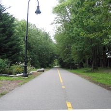
A brook that originally flowed through the camp grounds was redirected underground in 1896 and became part of the modern drainage system. This hidden transformation shows how the city repurposed and reshaped the land after the war.

The community of curious travelers

AroundUs brings together thousands of curated places, local tips, and hidden gems, enriched daily by 60,000 contributors worldwide.

Start exploring
Location
GPS coordinates
42.39930,-71.12860
Latest update
December 14, 2025 14:21
Around this place
Somerville Community Path
United States of America

Somerville Community Path

608 m
Somerville Theatre
United States of America

Somerville Theatre

549 m
Davis Square statues
United States of America

Davis Square statues

584 m
Almshouse
United States of America

Almshouse

452 m
Abraham Watson House
United States of America

Abraham Watson House

840 m
The End of the Red Line
United States of America

The End of the Red Line

1.1 km
Butterfield-Whittemore House
United States of America

Butterfield-Whittemore House

842 m
West Somerville Branch Library
United States of America

West Somerville Branch Library

596 m
Alpheus Mead House
United States of America

Alpheus Mead House

742 m
Henderson Carriage Repository
United States of America

Henderson Carriage Repository

975 m
Z. E. Cliff House
United States of America

Z. E. Cliff House

986 m
Thomas Cook House
United States of America

Thomas Cook House

1.1 km
Greek Revival Cottage
United States of America

Greek Revival Cottage

556 m
Chester Kingsley House
United States of America

Chester Kingsley House

742 m
Clifton Bacon House
United States of America

Clifton Bacon House

683 m
R.H. Farwell House
United States of America

R.H. Farwell House

679 m
Philemon Russell House
United States of America

Philemon Russell House

874 m
Sculpture with a D
United States of America

Sculpture with a D

527 m
Charles H. Lockhardt House
United States of America

Charles H. Lockhardt House

733 m
Frederick Billings House
United States of America

Frederick Billings House

1.1 km
Lawrence Soule House
United States of America

Lawrence Soule House

879 m
Isaac McLean House
United States of America

Isaac McLean House

697 m
John F. Nichols House
United States of America

John F. Nichols House

738 m
Patrick Slowey House
United States of America

Patrick Slowey House

1 km
R. A. Knight-Eugene Lacount House
United States of America

R. A. Knight-Eugene Lacount House

593 m
Wyeth Brickyard Superintendent's House
United States of America

Wyeth Brickyard Superintendent's House

988 m
House at 197 Morrison Avenue
United States of America

House at 197 Morrison Avenue

788 m
Alfred E. Robindreau House
United States of America

Alfred E. Robindreau House

863 m
Show the full map
Reviews
Share your experience

No review yet

Discussions
Start a discussion...

No discussion yet

« Camp Cameron - Civil War training camp in North Cambridge, Massachusetts, United States » is provided by Around Us (aroundus.com). Images and texts are derived from Wikimedia project under a Creative Commons license. You are allowed to copy, distribute, and modify copies of this page, under the conditions set by the license, as long as this note is clearly visible.

Discover hidden gems everywhere you go!

From secret cafés to breathtaking viewpoints, skip the crowded tourist spots and find places that match your style. Our app makes it easy with voice search, smart filtering, route optimization, and insider tips from travelers worldwide. Download now for the complete mobile experience.

Around Us App Screenshot

A unique approach to discovering new places

Le Figaro

All the places worth exploring

France Info

A tailor-made excursion in just a few clicks

20 Minutes

Around Us
Travel Guide & Maps
Download

Send to your phone

QR Code
1

Open the camera app on your mobile.

2

Point at the QR code with your camera. A notification will appear.

3

Tap the notification to open the link.