Meda, locality in Derby-West Kimberley, Western Australia, Australia
Location: Shire of Derby-West Kimberley
Location: Western Australia
GPS coordinates: -17.39449,123.98559
Latest update: October 26, 2025 12:50
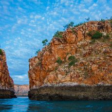
Horizontal Falls
113 km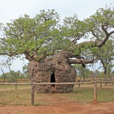
Boab Prison Tree, Derby
33.9 km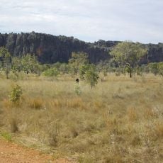
Windjana Gorge
103.3 km
Curtin Immigration Reception and Processing Centre
29.2 km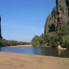
Windjana Gorge National Park
106.4 km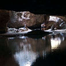
Tunnel Creek National Park
125.3 km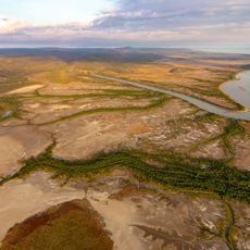
Walcott Inlet
129.4 km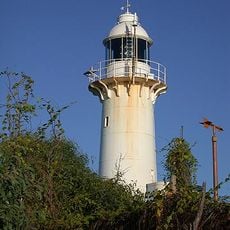
Cape Leveque Lighthouse
158.3 km
Bell Creek Gorge
137.1 km
Windjana Gorge
102.2 km
Horizontal Waterfalls
109.6 km
Trochus Hatchery and Aquaculture Centre
144 km
Cygnet Bay Pearl Farm
147.5 km
Church of the Sacred Heart
147.7 km
Gefängnisbaum
33.9 km
Horizontal Waterfall
112.6 km
Mowanjum Art and Culture Center
30.9 km
Tunnel Creek
125.4 km
The Dinner Tree
38.1 km
Dolerite Gorge
120.4 km
Joonjoo Botanical trail
34.5 km
Norval Gallery
37.1 km
Visitors' Beach Lookout
143.8 km
Horizontal Falls
113.1 km
Sandy Beach Sunset point
102.1 km
Scenic viewpoint
130.3 km
Lennard River Gorge
131.4 km
Scenic viewpoint
117 kmReviews
Visited this place? Tap the stars to rate it and share your experience / photos with the community! Try now! You can cancel it anytime.
Discover hidden gems everywhere you go!
From secret cafés to breathtaking viewpoints, skip the crowded tourist spots and find places that match your style. Our app makes it easy with voice search, smart filtering, route optimization, and insider tips from travelers worldwide. Download now for the complete mobile experience.

A unique approach to discovering new places❞
— Le Figaro
All the places worth exploring❞
— France Info
A tailor-made excursion in just a few clicks❞
— 20 Minutes