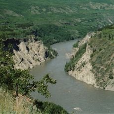
Zwerger Cascade, waterfall in British Columbia, Canada
Location: British Columbia
GPS coordinates: 58.65472,-128.12833
Latest update: November 24, 2023 23:42
Stikine River Provincial Park
95.1 km
Tā Ch’ilā Provincial Park
97.8 km
Denetiah Provincial Park
44.7 km
Dall River Old Growth Provincial Park
24.8 km
Horneline Creek Provincial Park
63.6 km
Chickens Neck Mountain Ecological Reserve
108.3 km
Dune Za Keyih Provincial Park
110 km
Denetiah Corridor Protected Area
60.7 km
Pitman River Protected Area
69.7 km
Ne'āh' Conservancy
87.2 km
Stone Island Rapids
83.9 km
Jewel Rapids
89.9 km
Klappan River
118.8 km
Pine Rapids
103.5 km
Cottonwood Rapids
100.7 km
Cold Fish Lake
116.9 km
Cassiar Mountains
109.5 km
Waterfall
72.9 km
Waterfall
99.2 km
Waterfall
97.4 km
Waterfall
97.4 km
Waterfall
103.7 km
Waterfall
104.2 km
Waterfall
106.7 km
Viewpoint Beaver dam
96.9 km
Waterfall
96.5 km
Waterfall
94.2 km
Waterfall
78.2 kmReviews
Visited this place? Tap the stars to rate it and share your experience / photos with the community! Try now! You can cancel it anytime.
Discover hidden gems everywhere you go!
From secret cafés to breathtaking viewpoints, skip the crowded tourist spots and find places that match your style. Our app makes it easy with voice search, smart filtering, route optimization, and insider tips from travelers worldwide. Download now for the complete mobile experience.

A unique approach to discovering new places❞
— Le Figaro
All the places worth exploring❞
— France Info
A tailor-made excursion in just a few clicks❞
— 20 Minutes